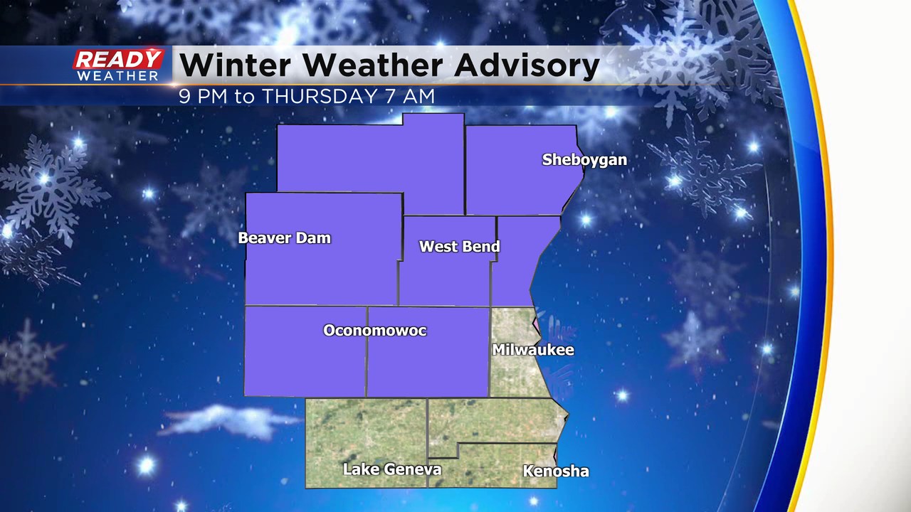
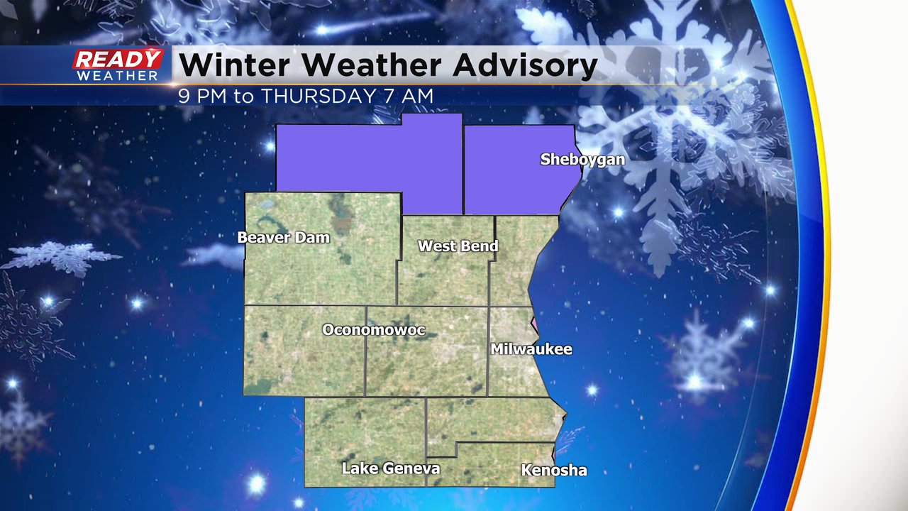
Winter Advisory begins at 9 PM. Rain to snow remains on track for overnight


Updated: 8:30 p.m. Dec. 14, 2022
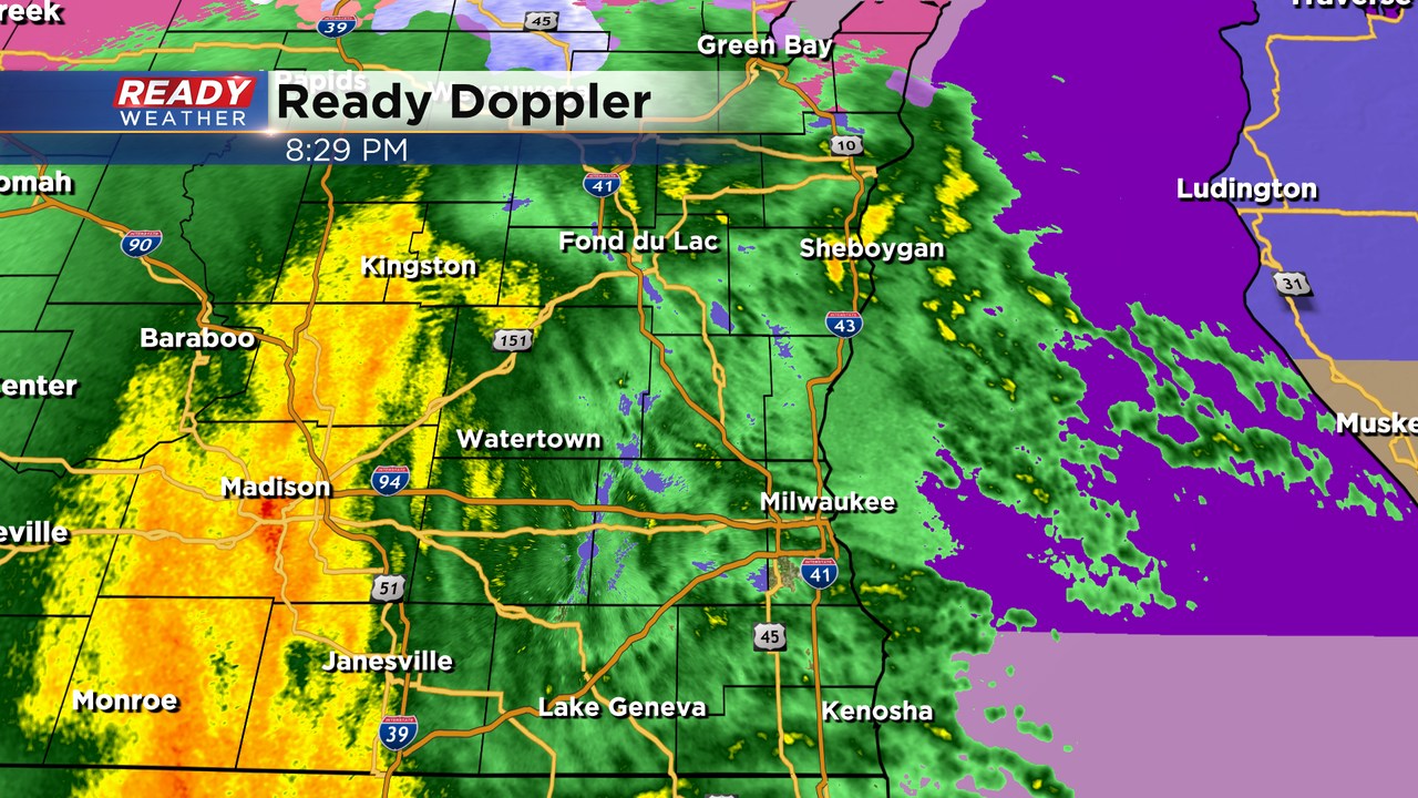
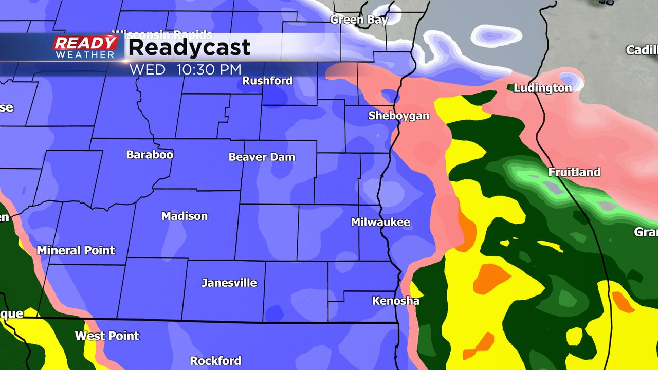
So far all of the precipitation that is falling is just rain. Between 10 pm and Midnight we should expect a switch over to wet snow.
The winter weather advisory starts at 9 pm and goes until 7 am.
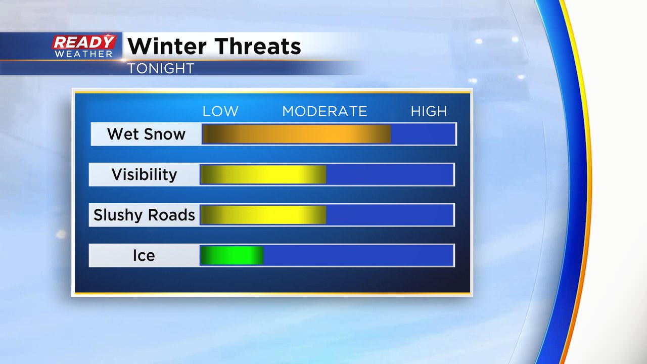
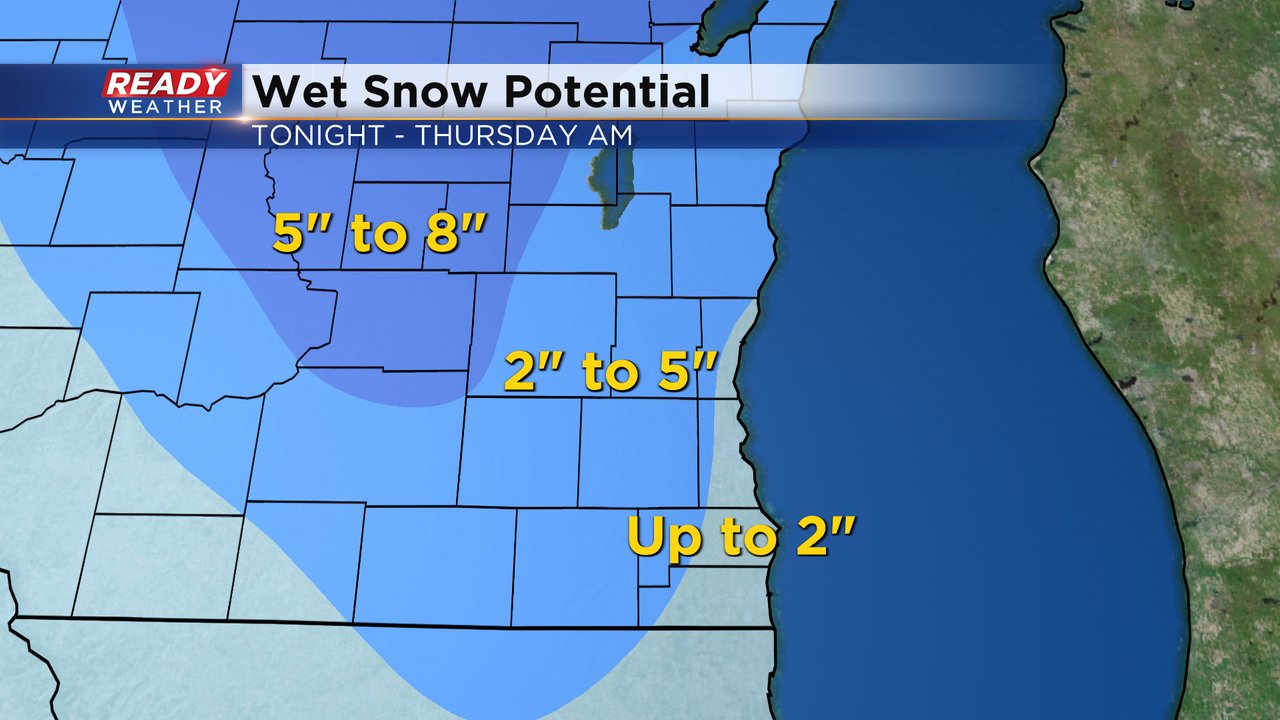
Counties in the advisory will have the best chance to pickup 2" to 4" of snow with some locally higher amounts. This will be a very wet, and heavy snow, and will cause slushy roads overnight into Thursday morning.
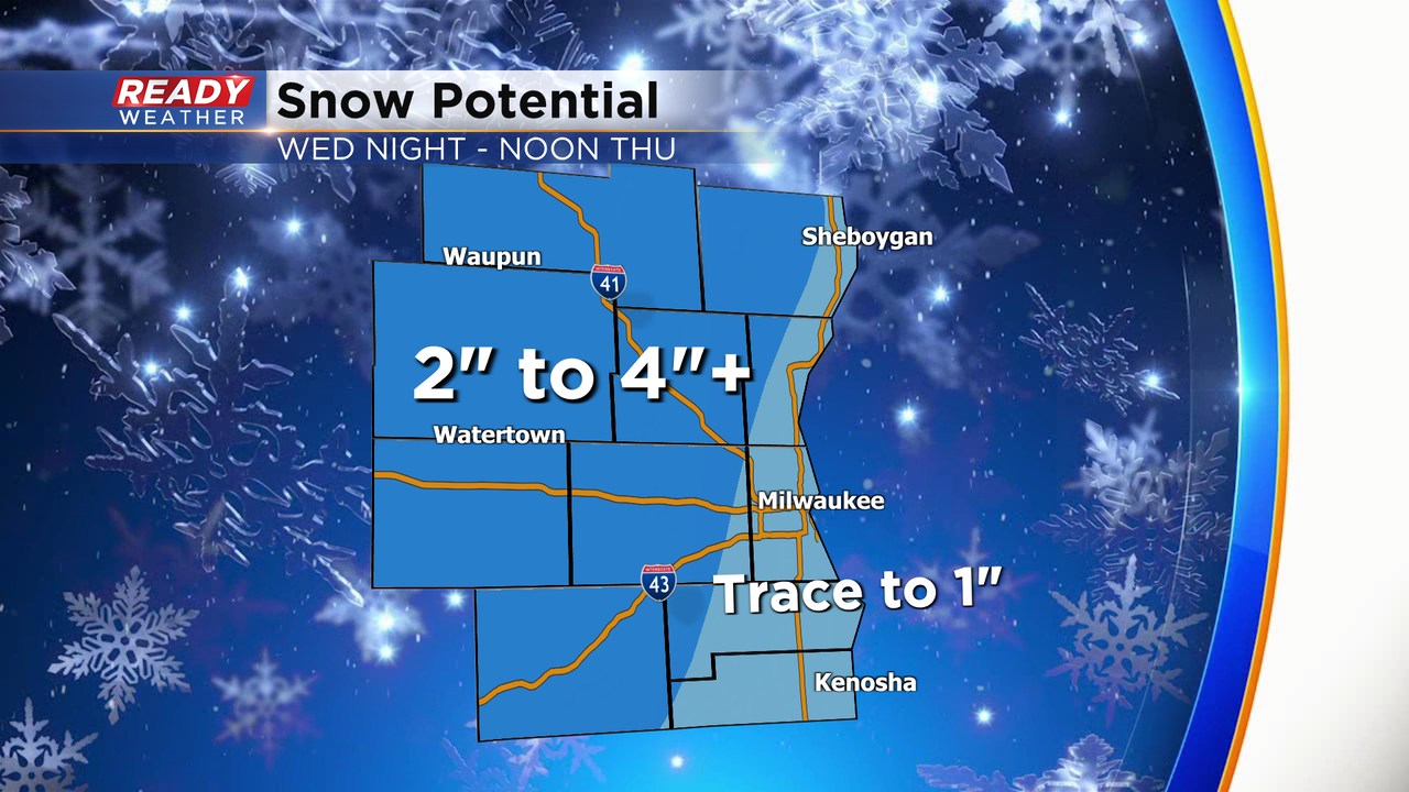
A break from the snow will occur for the morning commute, with additional snow showers picking up during the afternoon. Any accumulation during the afternoon and evening will be light and less than an inch.
________________________________________________________________________________________________
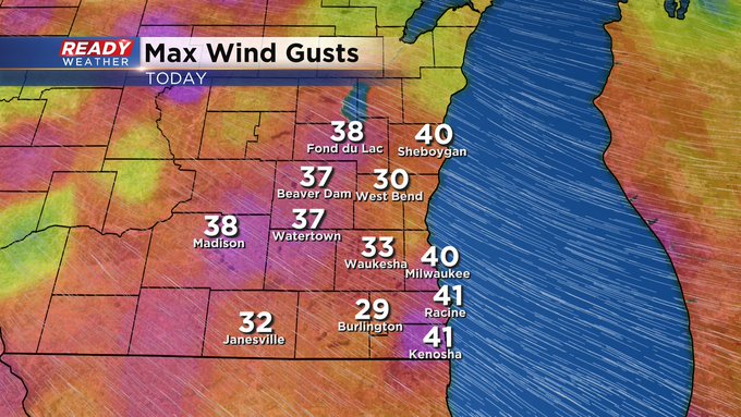
Updated: 12:00 p.m. Dec. 14, 2022
On radar it appears as though we're seeing a lull in the rain. However, there's plenty of heavy mist being whipped around on strong southeast wind. Check out the peak gusts so far today:
Updated: 9:07 a.m. Dec. 14, 2022
The steady rain from the overnight hours wrapped up but some light showers and drizzle will continue off and on throughout the morning and afternoon. Another round of steady and heavy rain will likely arrive around dinner time that impacts the evening commute. Shortly after that steady/heavy rain we see a switch to snow with heavy wet snow still expected for at least a few hours tonight.
In addition to the rain and snow, the wind will continue to see gusts to 40 mph most of Wednesday. Check out some of the wind gusts around 9 AM.
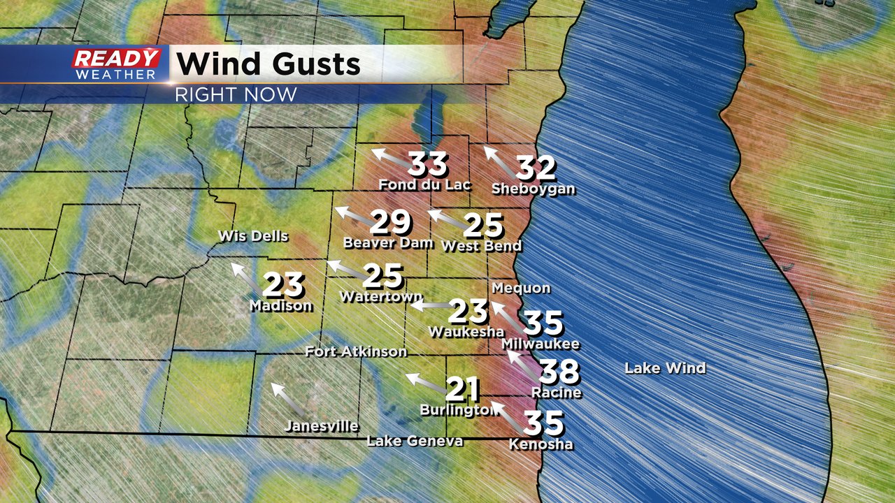
------
Posted: 6:04 a.m. Dec. 14, 2022
We are in the thick of some wet and windy weather for Wednesday. Rain started light Tuesday evening then picked up after midnight Wednesday morning. The rain is expected to last all day. There may be some breaks here and there but most of southeast Wisconsin will see light to moderate pockets of rain throughout the day.
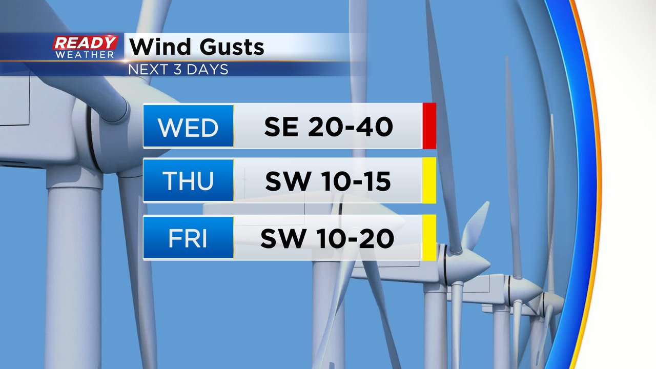
In addition to the rain, the wind is very strong. Wind gusts are out of the southeast gusting between 20-40 mph. The wind will stay strong all day on Wednesday then die down a bit Wednesday night with only a touch of a breeze Thursday and Friday.
Around 9 PM or 10 PM we see the rain mix and switch over to some wet snow. A batch of very heavy wet snow with drastically reduced visibility is likely from 11 PM through 5 AM. Thankfully the wet snow should be wrapping up just before the Thursday morning commute with improving road conditions but if you have to drive at night expect difficult driving conditions.
Accumulating wet snow is likely for all of southeast Wisconsin. 1-2" of snow is expected lakeside and in southern counties with 2-5" for many of our inland and northern counties. Central Wisconsin will see more snow with 5-8" there which could even include western parts of Dodge and Fond du Lac Counties in our local area. Northern Wisconsin gets 6-12" of snow with this storm.
A winter weather advisory has already been issued for Fond du Lac and Sheboygan Counties for the snowfall from 9 PM Wednesday evening through 7 AM Thursday morning. A few more local counties could be added to the advisory as well.
Download the CBS 58 Ready Weather app to track the rain, wind and snow.