Monday Morning Update: Severe storms have left southeast Wisconsin


Updated: 5:09 a.m. Sep. 13, 2021
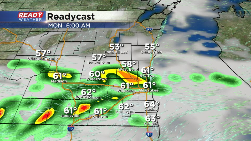
Any severe thunderstorm warnings expired by 4 AM as storms moved over Lake Michigan. A few showers and storms will be possible during the rest of the morning with a chance for stronger thunderstorms returning a few hours after sunrise. Rain and storm chances on Monday look best during the morning but an isolated shower or storm will be possible in the afternoon and evening. Overnight storms going into Tuesday morning will also be possible.
------
Updated: 3:46 a.m. Sep. 13, 2021
A severe thunderstorm warning has been issued for Waukesha and Milwaukee Counties until 4:15 AM. Hail is the main threat up to a quarter sized. The storms are moving east and should hit the lakefront from Whitefish Bay down to Oak Creek a little after 4 AM.
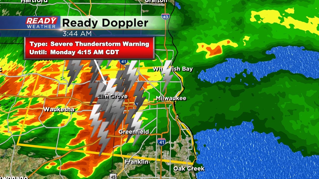
After this severe storm there is some more strong storms stretching out to the Oconomowoc area so some stronger thunderstorms with small hail will be possible through 5 AM.
------
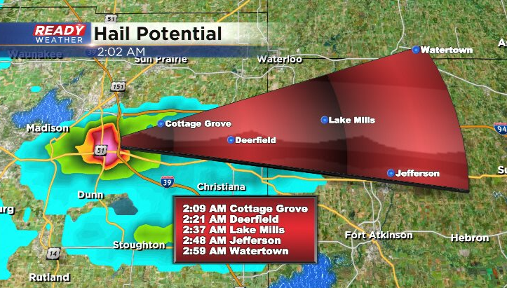
Updated: 2:05 am Monday September 13th:
A Severe Thunderstorm Warning has been issued for western Jefferson county until 2:45 am for quarter sized hail.
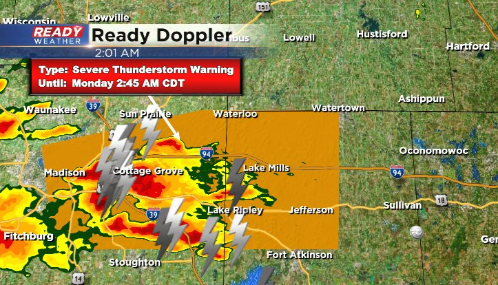
The hail core is currently over the east side of Madison and is tracking east at 30 mph.
-------------------------------------------------------------------------
Updated: 4:45 pm Sunday September 12th:
The severe storm has pushed out over the lake, so the Severe Thunderstorm Warning has been cancelled.
Few reports of dime to penny sized hail from Germantown to Bayside as the storm moved through. Any isolated storms that pop this evening into tonight will have the potential to produce hail.
-----------------------------------------------------------------------------------
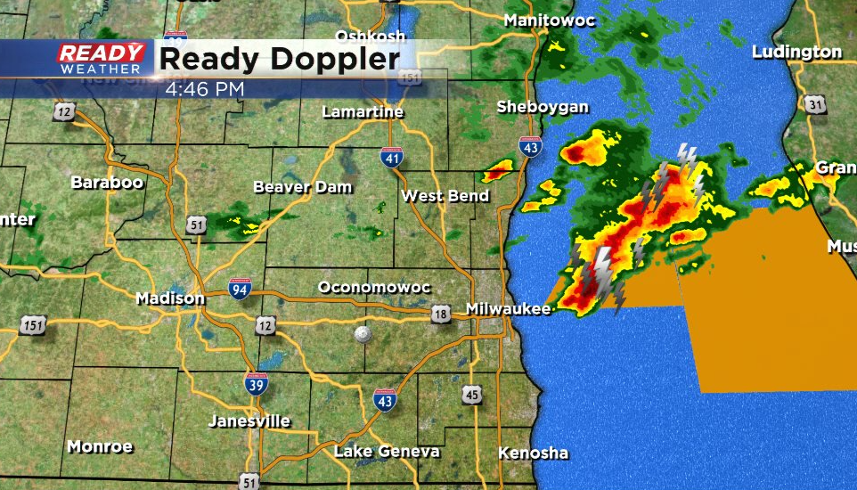
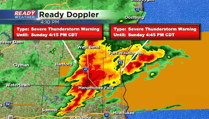
Updated: 4:10 pm Sunday September 12, 2021:
A cluster of storms racing east at 55 mph has the potential to produce large hail. Severe Thunderstorm Warning is in effect for Washington and Waukesha counties until 4:15 pm and for Ozaukee and Milwaukee counties until 4:45 pm.
-------------------------------------------------------------------------------
The cold front that was dropping into southeast Wisconsin Saturday evening stalled across the area today with isolated showers and storms from time to time north of the front.
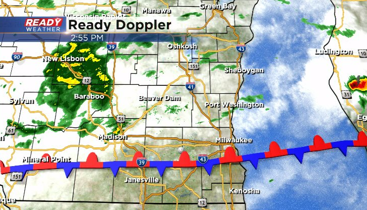
The front will continue to drop just south of the Wisconsin/Illinois border this evening and stall there overnight, putting the focus for scattered showers and isolated storms across southeast Wisconsin. Showers look to become more numerous this evening into Monday morning with a couple of isolated storms possible as well.
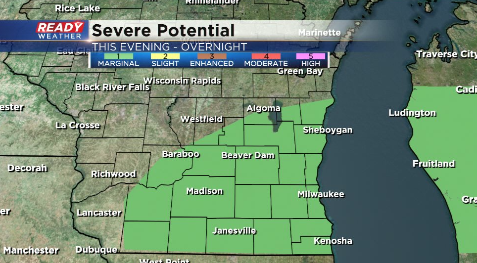
If we're able to get a few storms to pop this evening into tonight, they could be on the stronger side and produce gusty winds or hail. All of southeast Wisconsin is under a Marginal Risk (level 1 of 5) for this isolated strong storm threat.
Scattered showers and isolated stronger storms will be possible through Monday morning before becoming more isolated in the afternoon. The stalled front will slowly lift northward through the area later Monday afternoon and evening, pushing any showers and storms into the northern part of the state for Monday night.
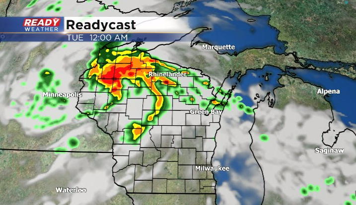
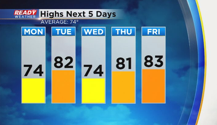
A weakening line of showers and storms head of the cold front will dissipate as it moves into SE WI around sunrise Tuesday morning, but the actual cold front won't move through into the afternoon. Behind the front, temps will drop back to normal for a day on Wednesday before 80s return for the second half of the week.
Download the CBS 58 Ready Weather App to get any severe warnings sent to your phone.