7 AM UPDATE: Messy morning, then turning cold this weekend


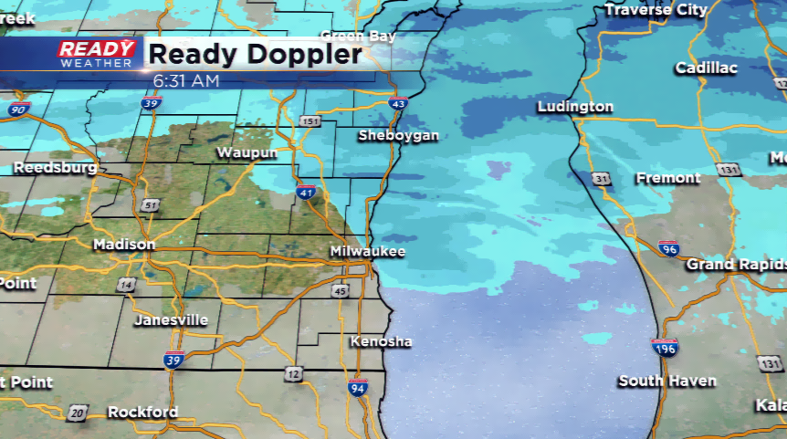
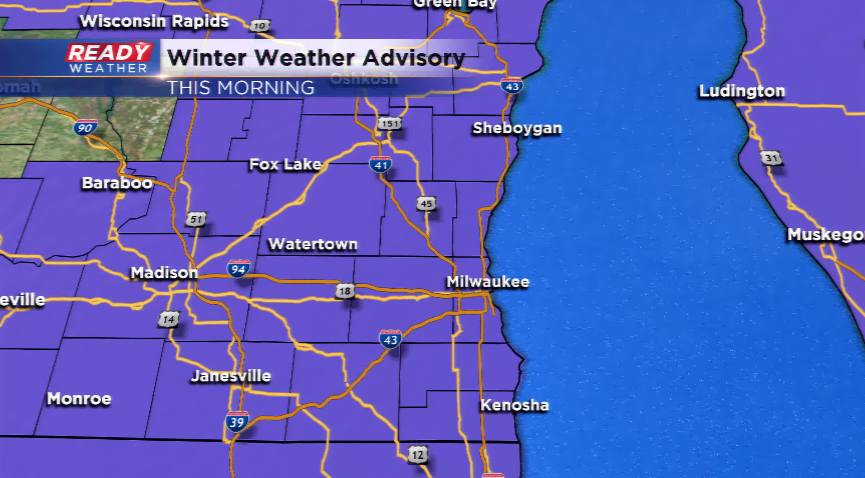
7 AM UPDATE - We are experiencing light snowfall in the northern sections of the metro and our northern counties, as well. The rest of the viewing area is seeing a light freezing drizzle mix. If you're heading out this morning, expect delays and slick roads!
------------------------------------------------------------------------------------------------------------------------------------------------------------------------------------
A light wintry mix with occasional snow showers will come to an end later this morning. It has been snowing on and off since yesterday in southeastern Wisconsin. Most areas received 1”-3” with higher amounts north in the 4”-4.5” range in Sheboygan County. Many roads are either snow covered or slick this morning; make sure to take caution.
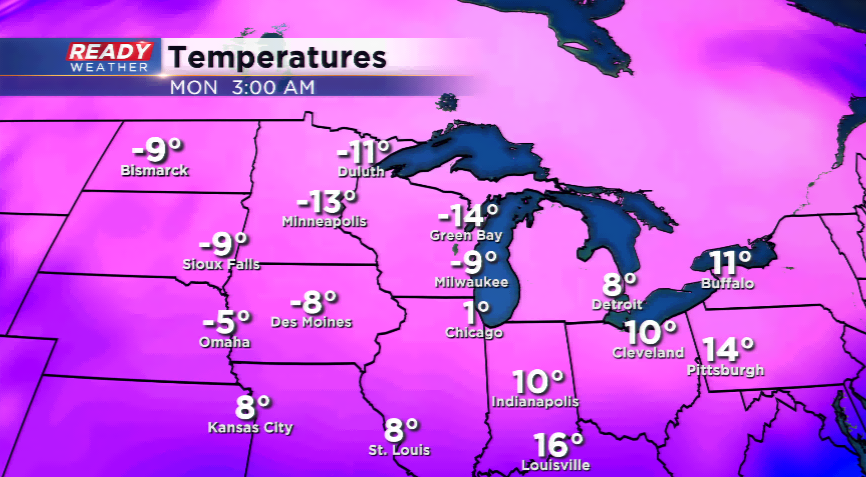
The precipitation takes east the rest of the morning allowing for clouds to take over. There could be partial clearing with drier air rolling in. Quiet and cold conditions will be the story heading into tonight. Lows will drop into the single digits and lower teens.
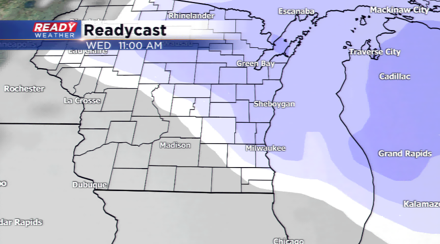
Our forecast will bring slight chances of light snow showers on Thursday and Friday. However, the best chances for another snow maker will be on Friday night and early Saturday. Then the story will be the major cold that arrives. The influence of high pressure and recent snow pack will make this cold snap even worse. There will very likely be advisories posted for dangerous temperatures and wind chills over the weekend and early next week. We’ll follow this closely!