Watching lake effect and return of dangerous cold New Year's Eve
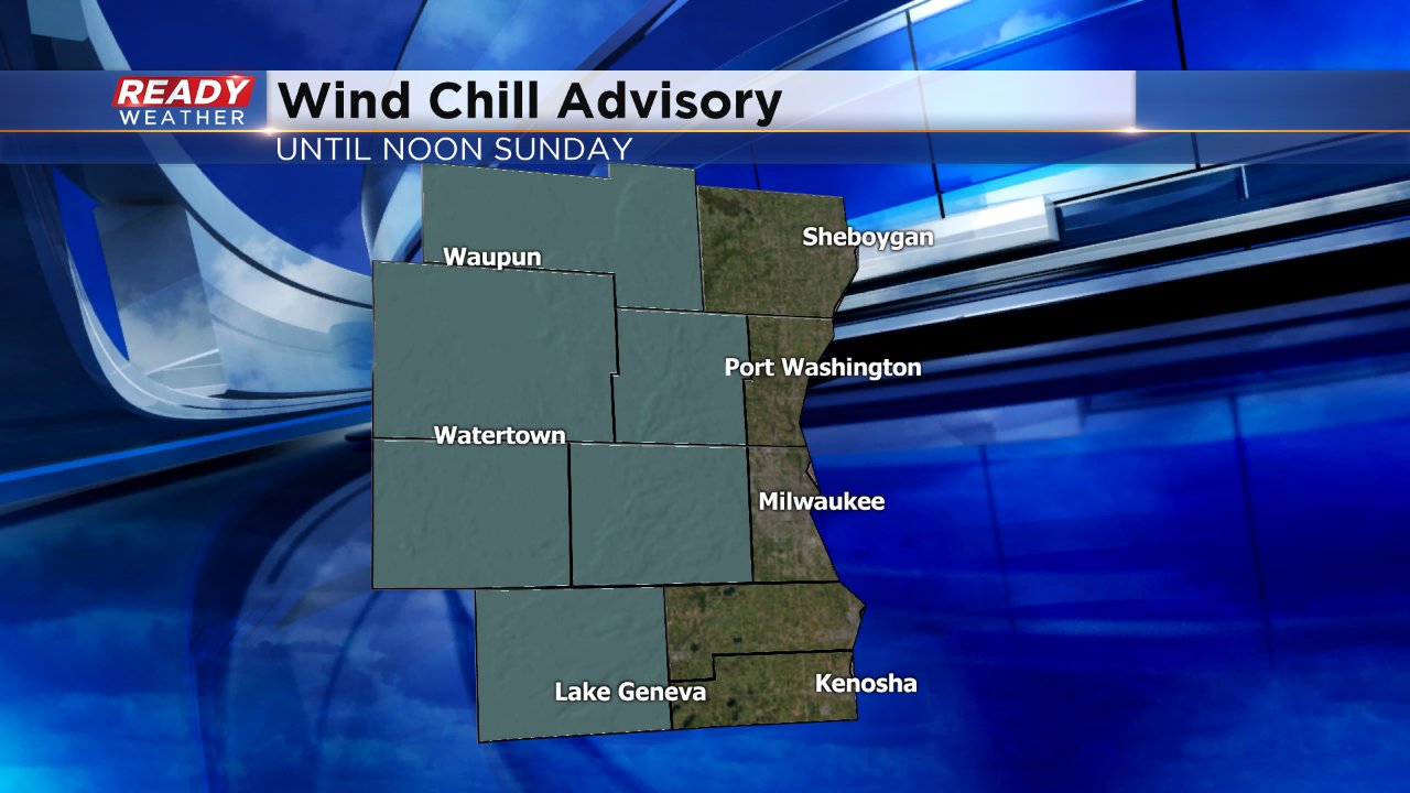
Friday was the warmest day of the week with a high of 15°, but now temperatures are going back down. Wind chills Saturday night are once again expected to reach the teens and 20s below-zero with a wind chill advisory in effect for some western counties until noon on Sunday.
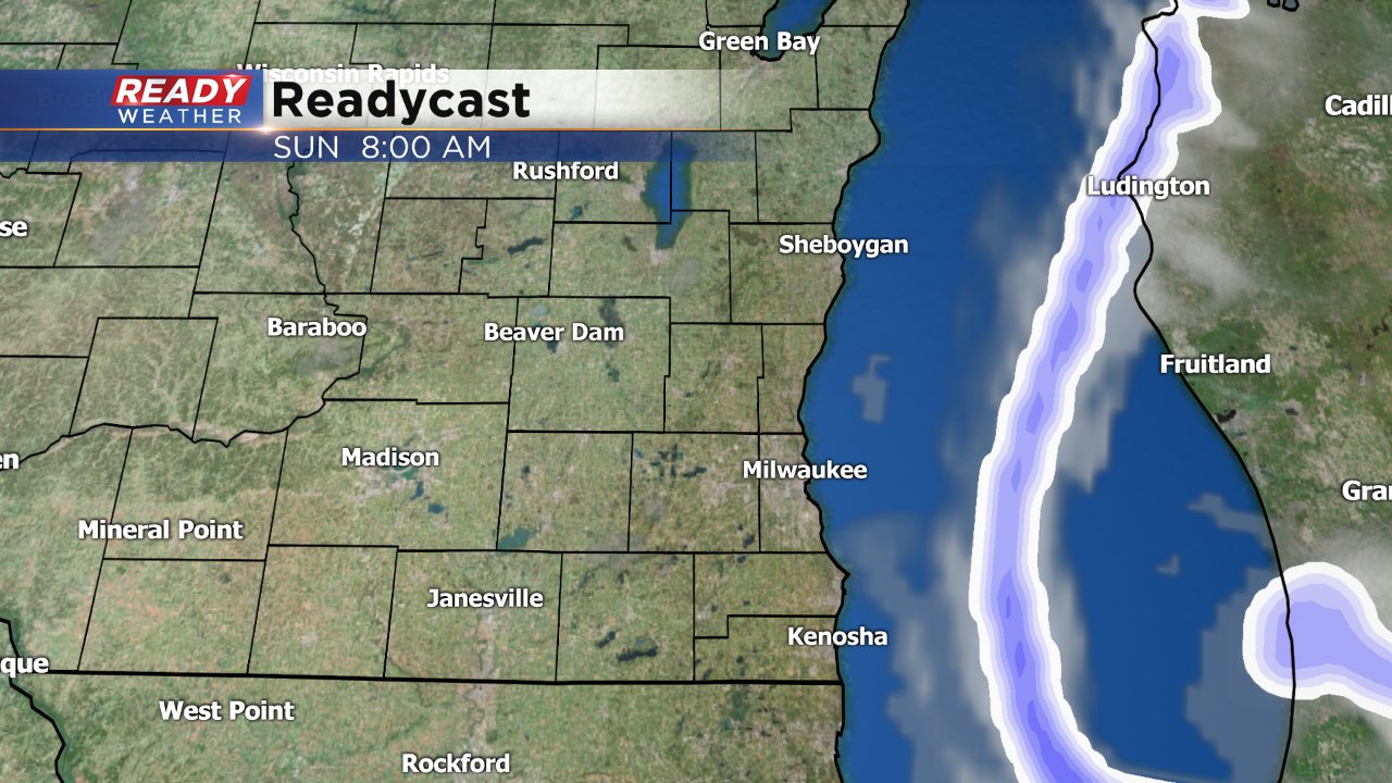
In addition to the cold air, we will watch a lake effect snow band that is expected to develop Sunday very closely. The majority of our weather models keep the lake effect band over the lake, but if it shifts a little west some lakeside communities could see some quick accumulation. Milwaukee, Racine and Kenosha have the best chance to see the lake effect.
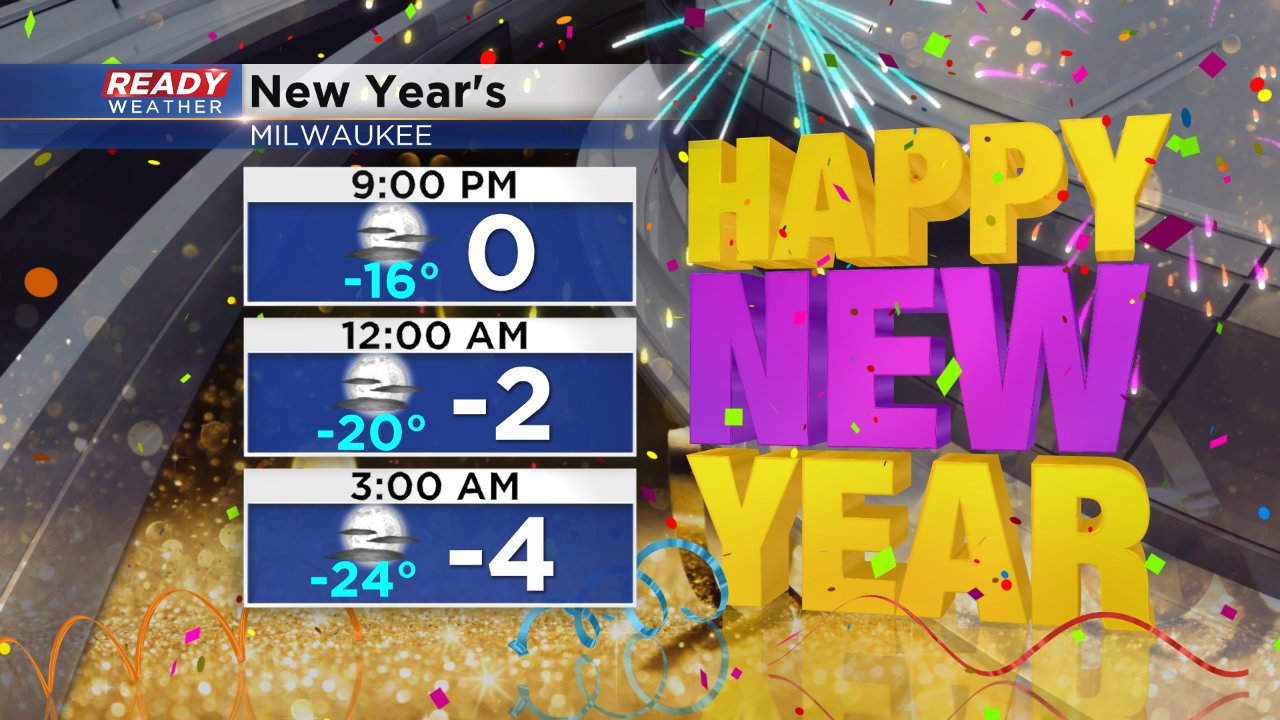
If you're going out on New Year's Eve make sure you dress in layers. At least three on top and two on bottom if you are going to be outside. Wind chill values at midnight are expected to stay in the 20s below-zero. A wind chill advisory is likely both Sunday night and Monday night with wind chills as cold as -30°.
Download the CBS 58 Ready Weather App to track Sunday's lake effect snow band and track the temperature and wind chill right where you live.
