Monday Evening Snow
Another fast moving shortwave is moving across the Midwest tonight. There's not a lot of moisture to work with, but there is enough to lift to squeeze out some light snow showers this evening and overnight. Take a look below...the radar is already showing light snow overcoming a dry atmosphere.
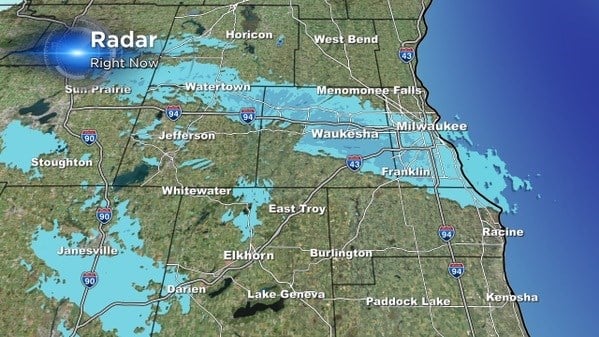
Light snow showers are possible from now until 2 am. Like I said, the atmosphere is relatively dry, so we aren't expecting major snow to cover the area. Around an inch of snow is possible across southeastern Wisconsin; however, some spots could see up to 1.5" or so with a 20:1 snow ratios. With temperatures in the single digits and teens this evening, just a little snow could cause slick spots on the roads.

After the snow clears another reinforcing shot of very cold air arrives out of the northwest! This shot of cold air will keep highs in the lower teens on Tuesday with lows below zero on Wednesday morning. We average 12 days with below zero temps for the year!
