Bit warmer with increasing humidity and a chance for storms Tuesday


Monday was a nice dry day with low humidity and a bit cooler, especially lakeside, with a lake breeze. On Tuesday all of that changes with some showers and storms returning to southeast Wisconsin. We already have some rain and downpours out there Tuesday morning but not many storms.
Here is a current radar image that will update with time:

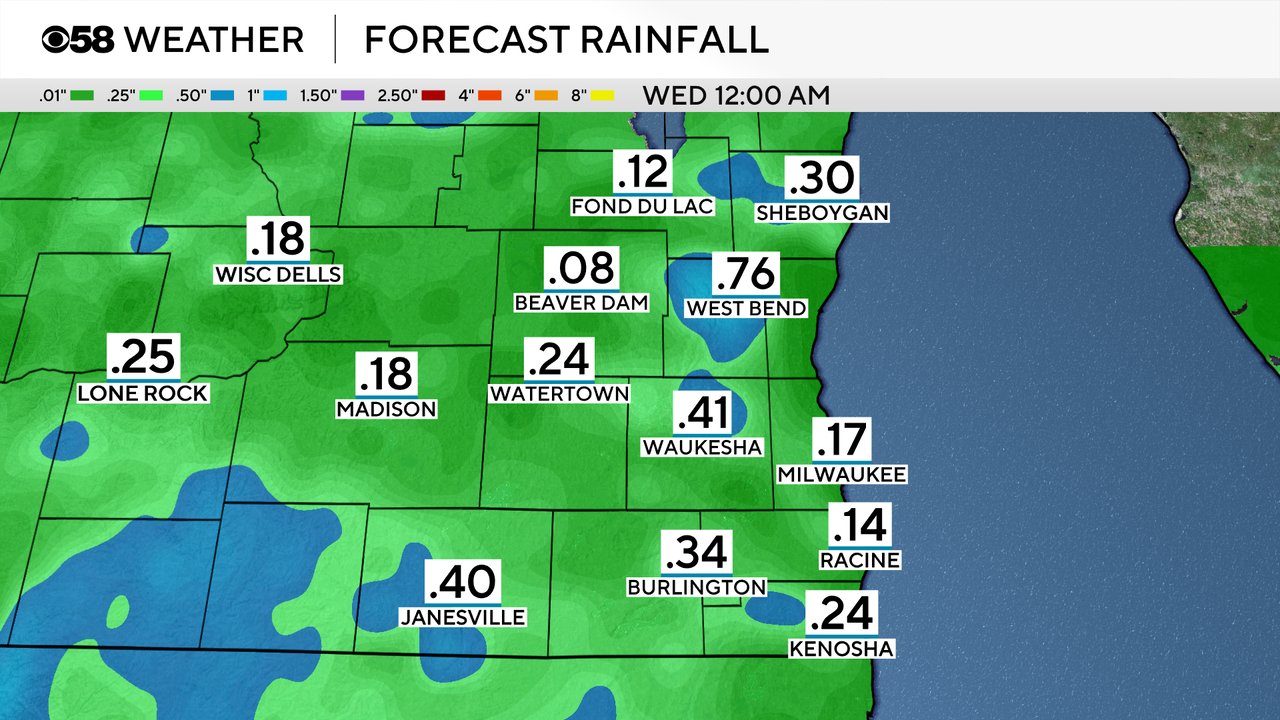
The rain chance for Tuesday will continue off and on through most of the day but between the periods of rain we will get some decent dry spells. No severe storms are expected and we are not under any risk for severe weather but an isolated stronger storm can't be ruled out if we see it this afternoon or evening.

Rain totals for most of southeast Wisconsin during the day Tuesday will range from 0.10-0.25" but those that see a few rounds of downpours or a few storms could get as much as around a half inch or even more.
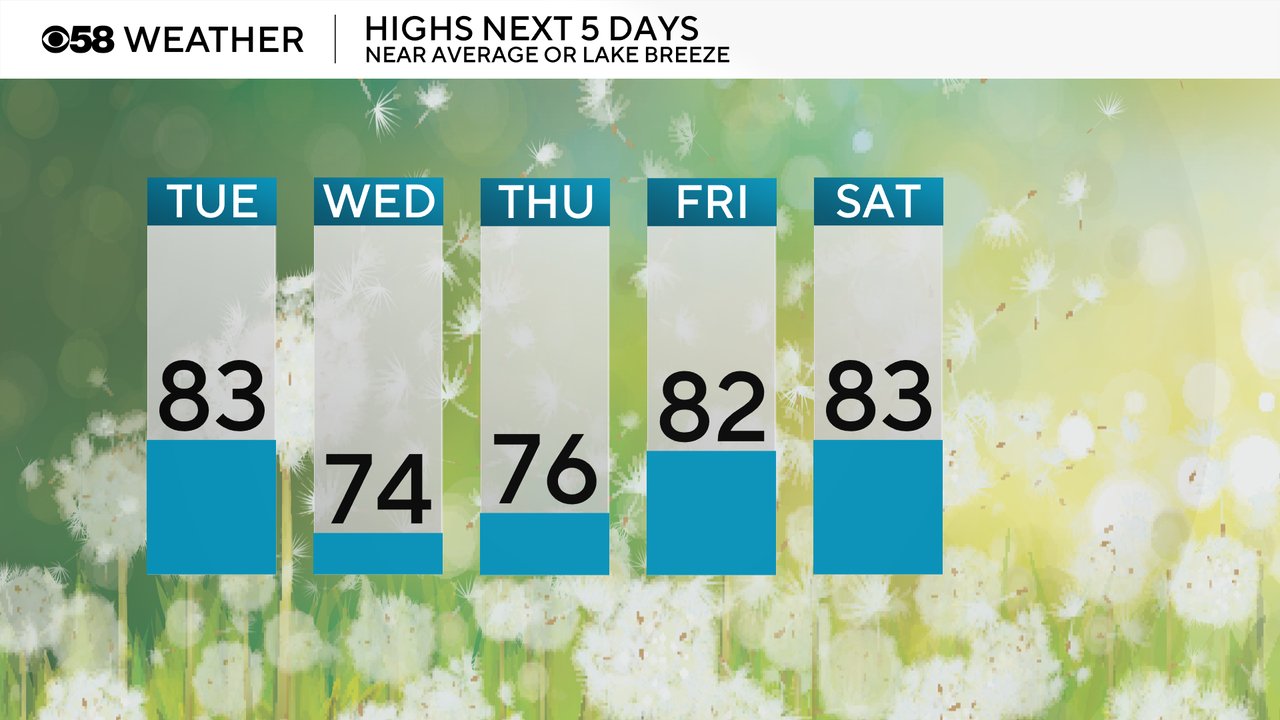
The lake breeze will go away Tuesday with a southeast wind pushing temps into the 80s for everyone. That lake breeze will kick back in for Wednesday and Thursday with highs only in the 70s lakeside but then the warmth returns for the weekend back into the 80s.
Humidity levels for most of Tuesday won't be so bad in the low 60s but by the evening it becomes more muggy with dew points reaching the upper half of the 60s. Those dew points stay in that range for Wednesday but then drops a bit on Thursday into the lower 60s.

Download the CBS 58 Weather app to track the rain for Tuesday and the expected temps and humidity levels.