Temps and humidity increase to start the new work week but rain chances stay away for now


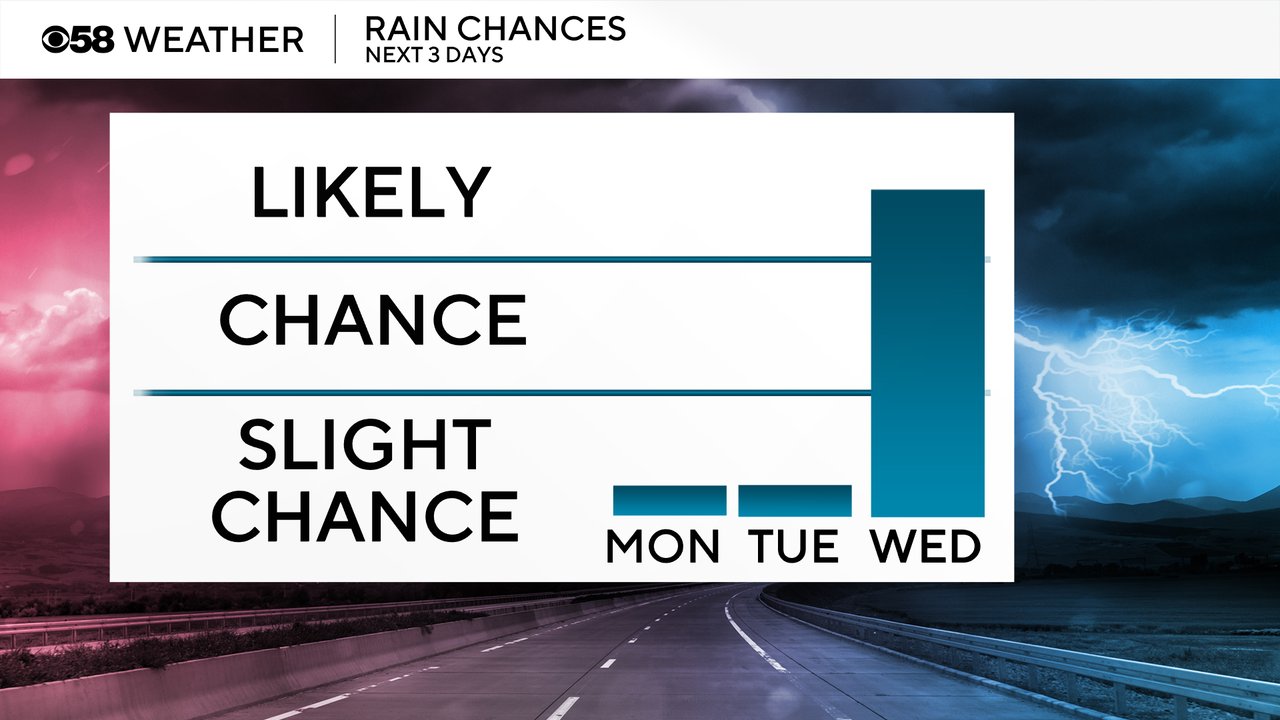
Since the strong and severe storms Friday evening, most of southeast Wisconsin has been pretty dry the last few days. That is a trend that will continue for the start of the new work week with only a 10% chance for a passing shower Monday and Tuesday. That low chance looks best, if it happens at all, in northern counties on Monday, and at night on Tuesday. But Wednesday already looks likely for some scattered showers and storms during the afternoon and evening.
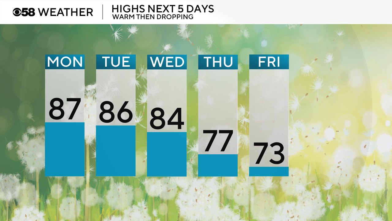
While the sky stays dry the temperatures and humidity levels will increase. Highs on Monday reach the middle to upper 80s and stay in that range through Wednesday. A cold front Wednesday night will drop us into the 70s for the end of the week.
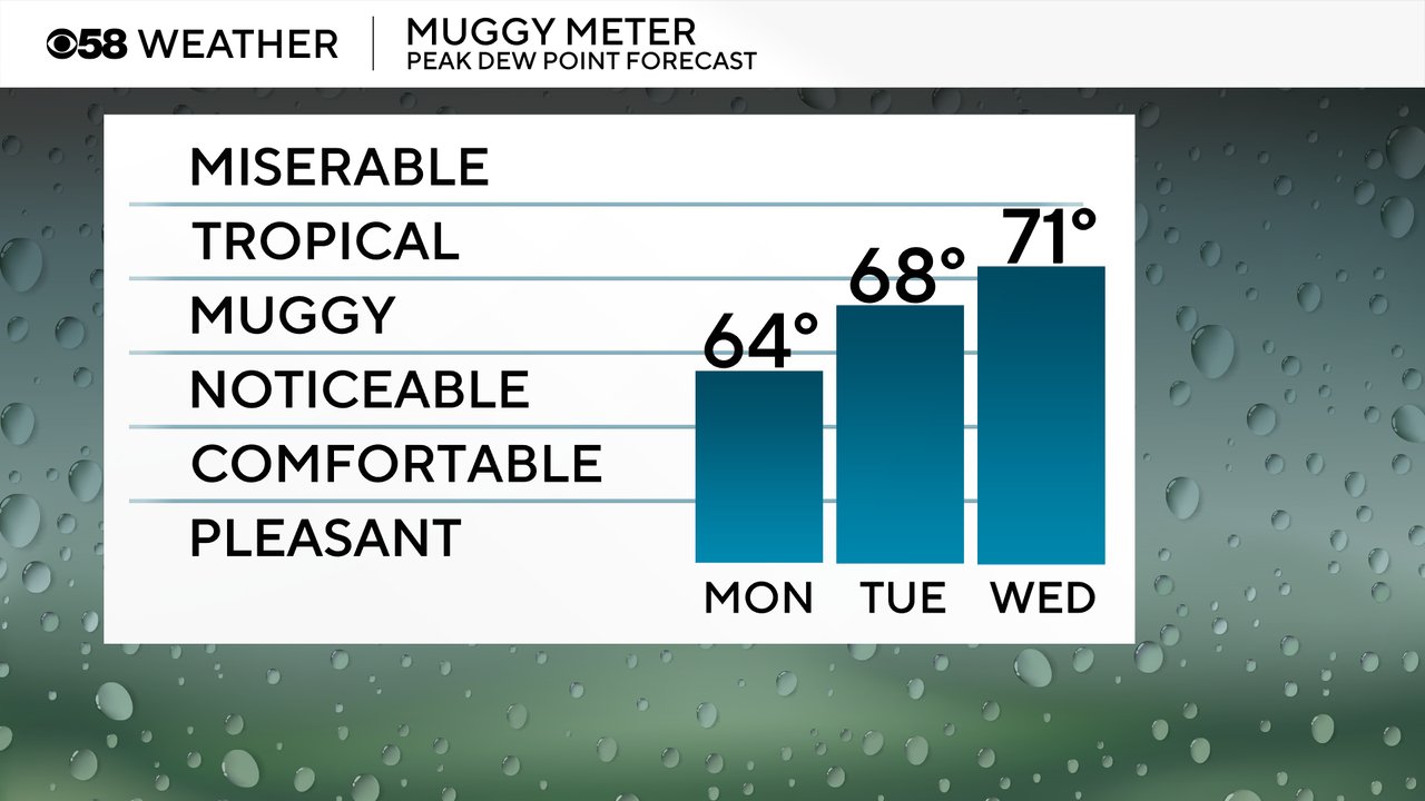
Dew points will not be overly humid on Monday, but you're still going to notice it. More of the muggies return on Tuesday with tropical level humidity returning for Wednesday with the approaching chance for rain.
Download the CBS 58 Weather app to track the temps and humidity levels.