


We had another round of light snow showers and flurries early Tuesday morning. Those made the roads a bit slick in some areas with a quick dusting in some spots. But the cold air remains the bigger story. We briefly saw the wind chill in Milwaukee get to 1 degree ABOVE-zero around 5 AM Tuesday morning which ended our streak of consecutive hours with wind chills below-zero. That streak started Thursday evening and came to an end after 107 hours.

Wind chills the rest of Tuesday will stay cold from -15 to -5. Similar wind chills are expected both Wednesday and Thursday morning with morning wind chills around -15 then warming to around 0 in the afternoon hours.

High temperatures will stay cold. Tuesday's temp stays pretty steady around 10 most of the day with highs reaching the low teens both Wednesday and Thursday. Friday is a touch warmer but Saturday will start the nice warm up with highs in the 20s feeling so nice after all of this cold.

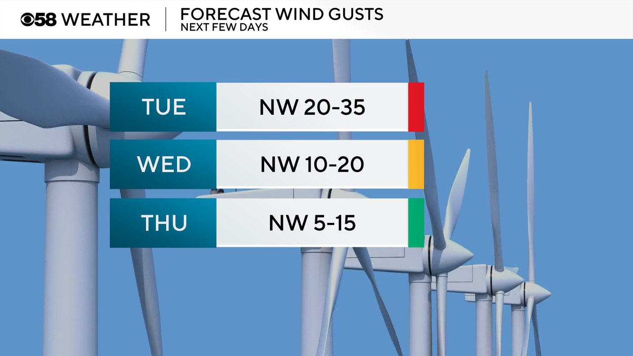
Wind gusts will stay blustery Tuesday with gusts up to 35 mph. The breeze will remain on Wednesday from 10-20 mph then finally getting into a light wind on Thursday from 5-15 mph. The wind direction stays all out of the NW bringing in the consistent cold air.
Download the CBS 58 Weather app to continue tracking the cold air.