


Temperatures have been pretty wonky over the last 24 hours. Most of Friday afternoon temps hung out in the 40s then we warmed to the low 50s around 10 PM. That goes down as the high temperature in Milwaukee and most of southeast Wisconsin reached the 50s as well with some getting into the mid 50s. Racine was the only location that stayed in the 40s.

The high of 52 in Milwaukee falls short of the record for Thursday's date (1/8) of 57 degrees set in 1965. But then the temperature kept warming into early Friday with a high of 59 degrees around 1:30 AM. That 59 shatters the old record high for Friday's date (1/9) of 54 set back in 2018.

Temperatures through the rest of Friday will hang out around 40 and warm a bit into the low to mid 40s Friday afternoon then we see some colder air arrive for the weekend with highs both Saturday and Sunday in the 30s.
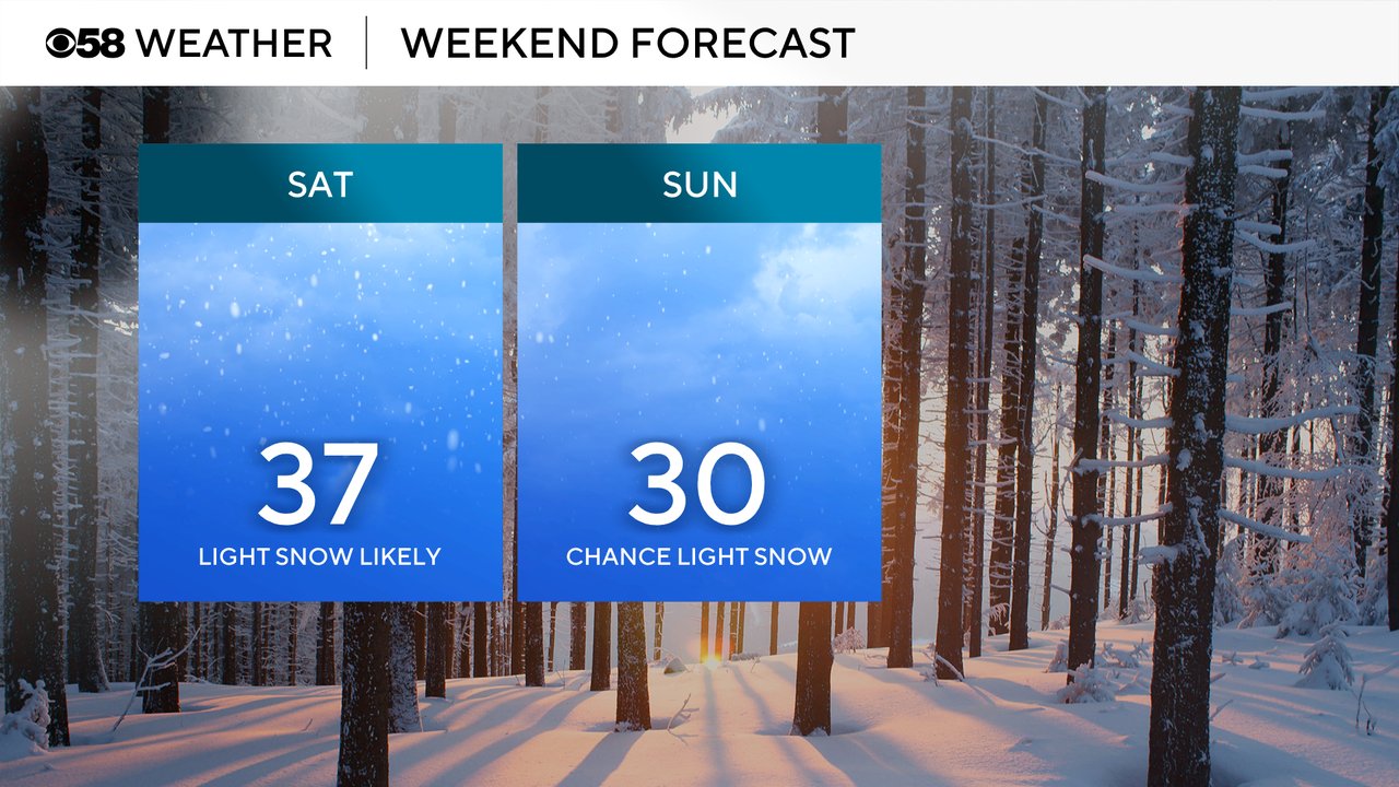
Friday morning is also featuring some lingering rain and mix showers but the sunshine returns Friday afternoon. By Saturday the clouds have increased and our next chance for snow arrives. Snow is likely already falling when most of us wake up Saturday morning and could stay steady most of the morning through the early afternoon. Some lingering snow showers will be possible going into Sunday.

Snow totals look relatively light with 1-2" of snow expected for most of southeast Wisconsin. There are a few weather models that have come in higher on totals so don't be surprised if there are some adjustments to the snow map before the snow starts falling.

Download the CBS 58 Weather app to track the temps and snow chances for the weekend.