Rainy April Continues into Easter Weekend
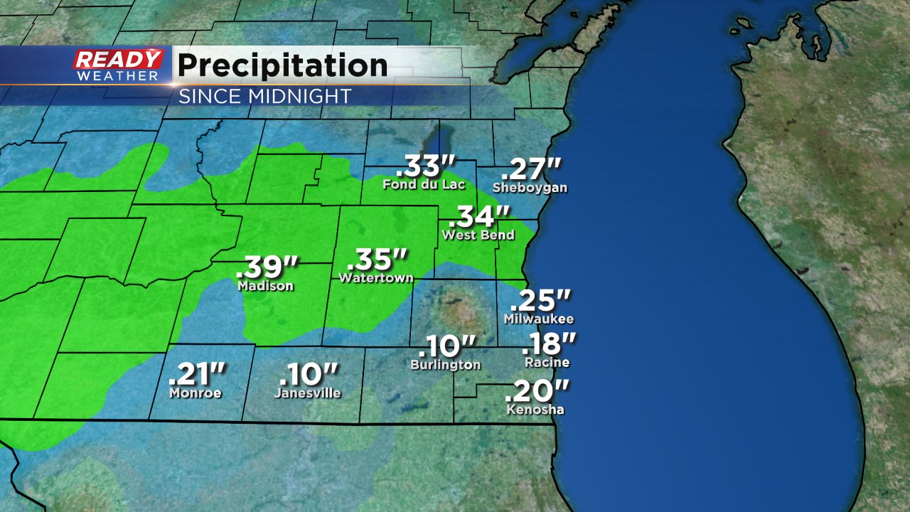
Rain showers started shortly after midnight early Thursday morning. The rain came down fairly steady for most at a light rate but a few moderate areas of rain were observed as well. No thunderstorms Thursday morning but there is a better chance for those on Friday and Saturday. Since midnight on Thursday most of southeast Wisconsin picked up around a quarter inch of rain.
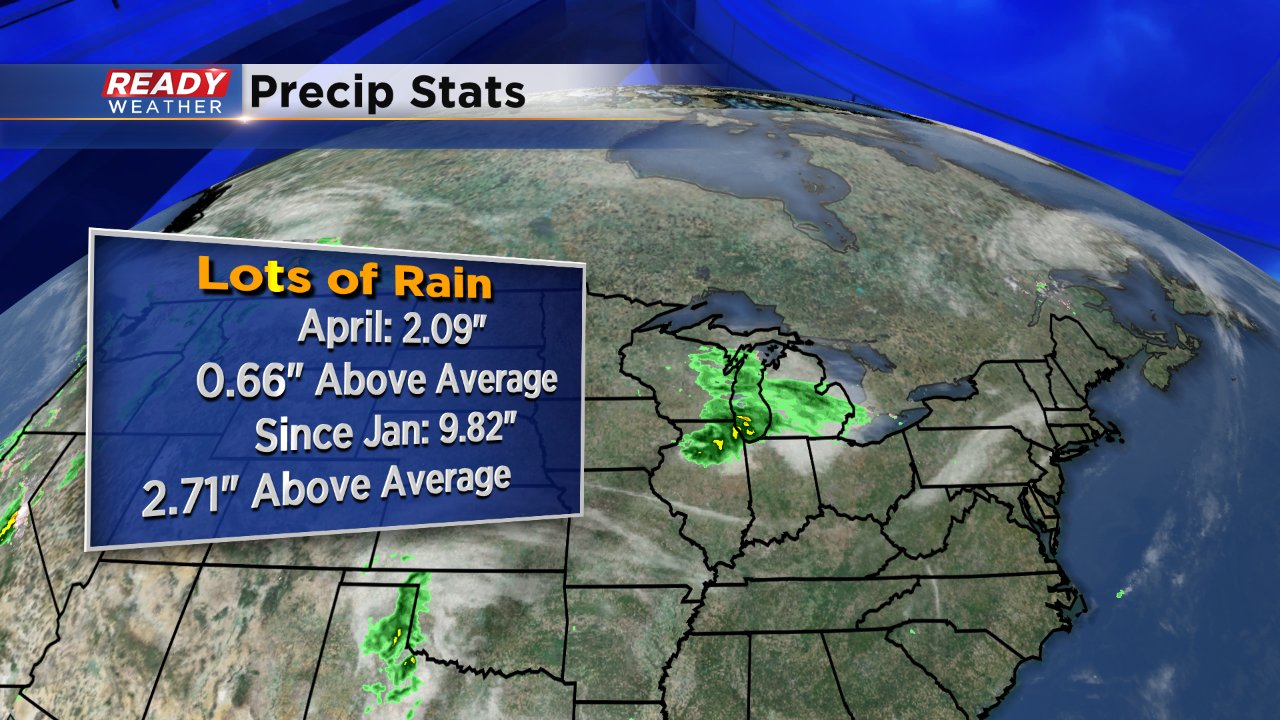
Thursday is only the 13th day of April and we've already seen over 2" of rain. April continues a trend of wet, but not very snowy, months. Since January we've picked up nearly 10" of precipitation including rain and melted snow which is almost 3" above-average.
Enjoy the brief break in the rain because more showers and storms will be possible Friday evening as a warm front pushes through and again Saturday night as a cold front moves in.
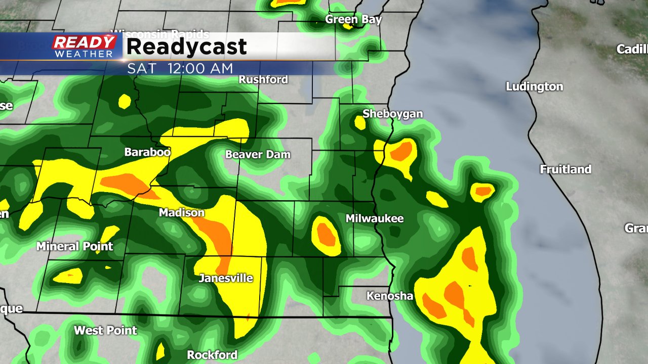
Saturday night's storms will have to be watched for the potential to become strong to severe. Temperatures will rise into the 70s and 80s aren't out of the question. All of that heat combined with a little humidity will create enough instability to pop some strong thunderstorms where large hail and some wind will be the main threats. Right now southeast Wisconsin is included in the marginal risk for severe weather because of that chance for wind and hail.

Download the CBS 58 Ready Weather app to track the incoming showers and storms.
