


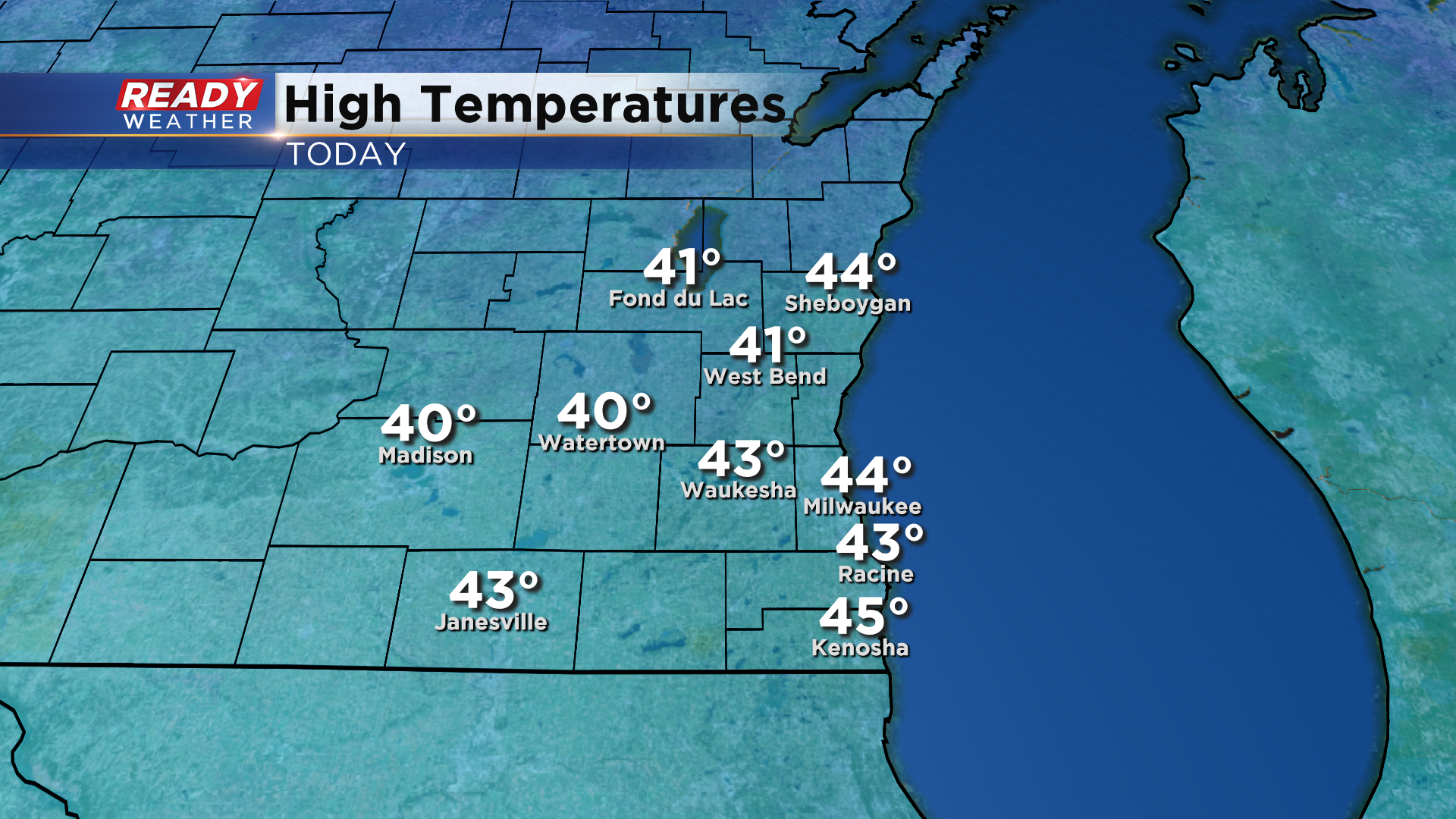
It was a spectacular Saturday across southeast Wisconsin with abundant sunshine, light winds, and temperatures in the low to mid 40s.
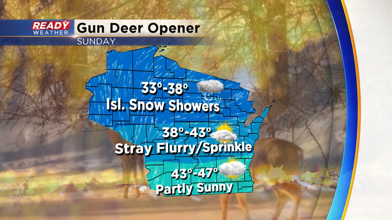
We'll have more clouds in the area on Sunday as a wave of low pressure moves through the state. This wave will generate isolated rain/snow showers across northern Wisconsin, but most of southeast Wisconsin will remain dry. If anything, there may be a stray sprinkle.
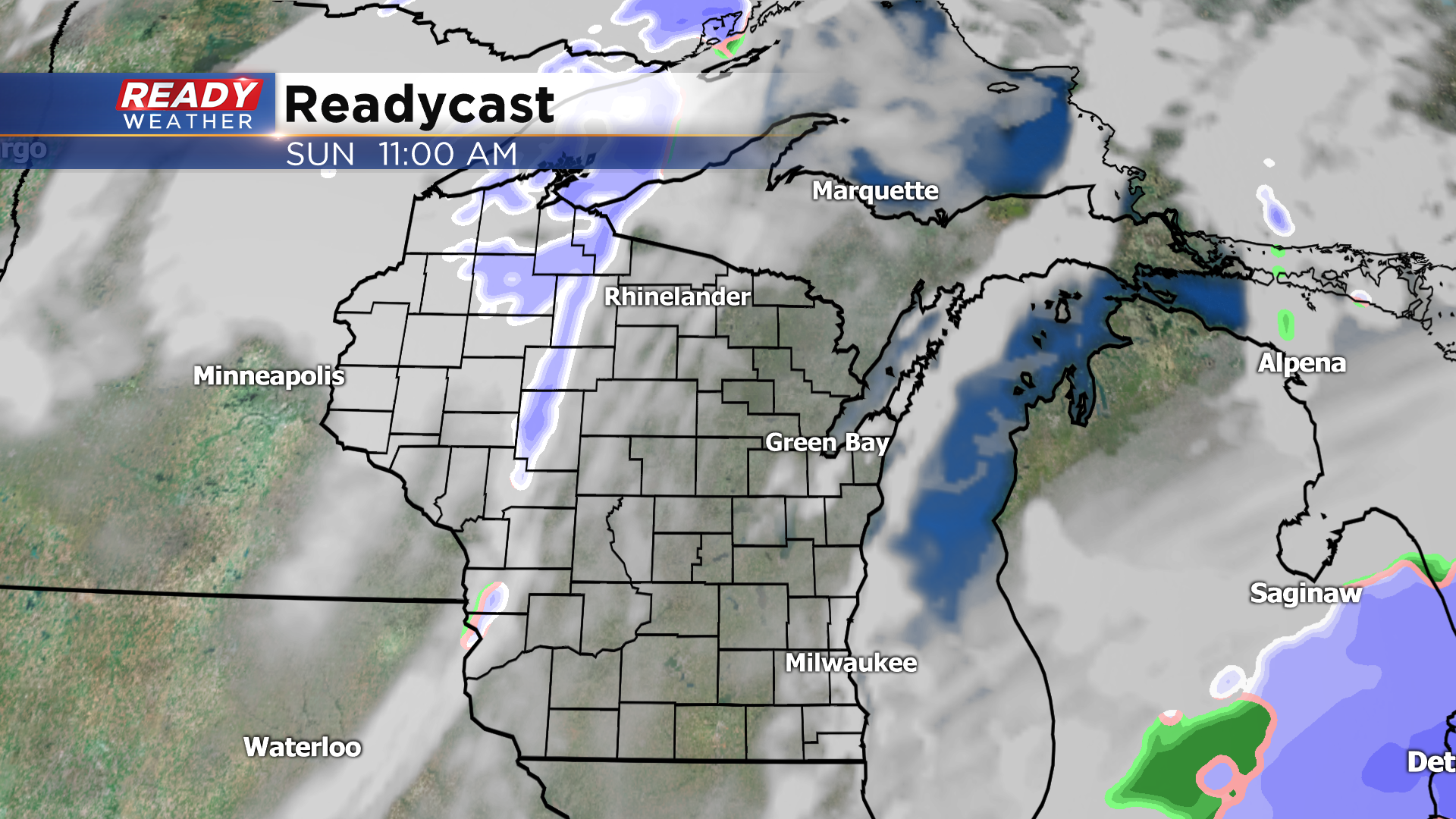
Good news is winds will remain light and temperatures will be a few degrees warmer with highs in the mid 40s. If you're heading up north to hunt, expect more clouds and slightly cooler temps.
More sunshine is expected for Monday, but Tuesday is looking quite unsettled as a low pressure system moves into the region. This system will bring an area of wet snow into southeast Wisconsin Tuesday morning, changing over to rain from south to north heading into the afternoon.
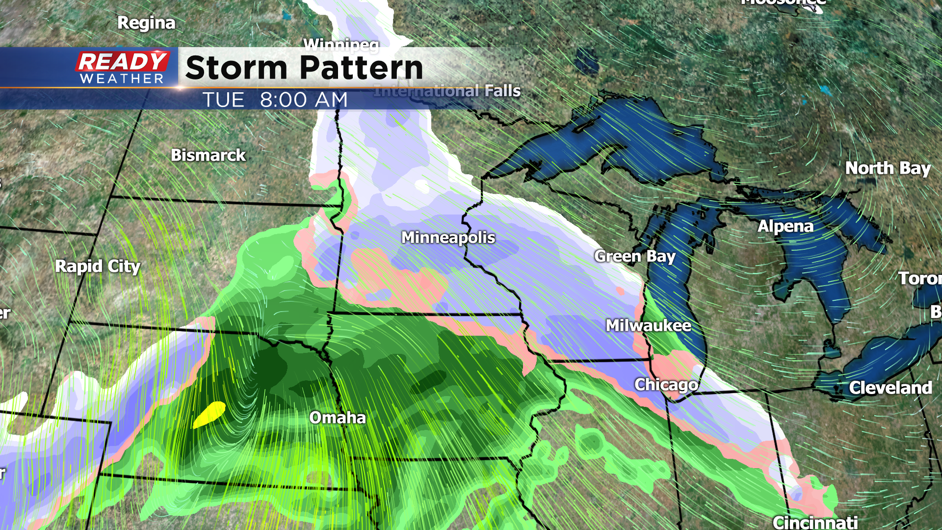
Minor, slushy accumulation is possible Tuesday morning, especially away from the lake. This could be our first real snowfall of the season, and with it occurring during the morning commute expect slower travel and reduced visibility.
Rain showers with this system could linger into Wednesday, but high pressure will bring dry weather and more sunshine into the state for Thanksgiving. Download the CBS 58 Ready Weather app to see how warm it may be.