


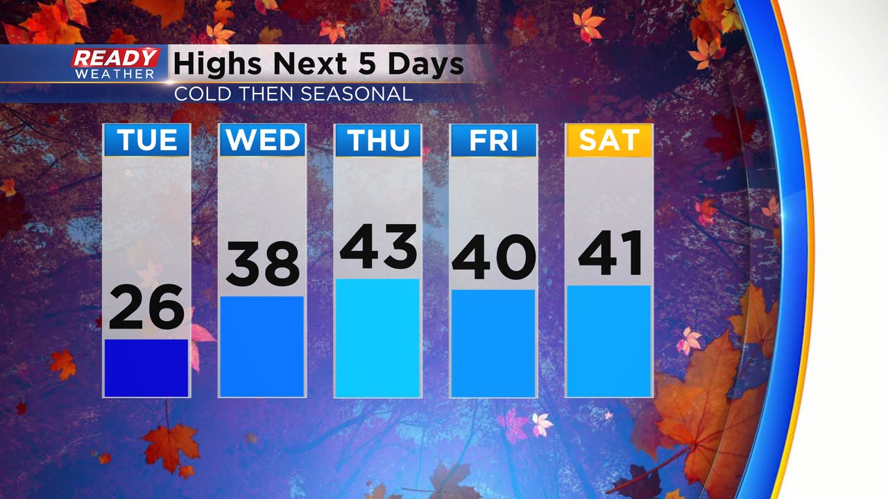
Tuesday morning was the coldest morning of the season so far with lows dropping to around 10 degrees or in the teens. It's the coldest temps we've felt since the middle of March last winter!

Just like Monday, afternoon temps on Tuesday will stay in the 20s but then we start to warm up. The average high Tuesday is 42* so we get into the upper 30s and low 40s, right around average, for the rest of the week.
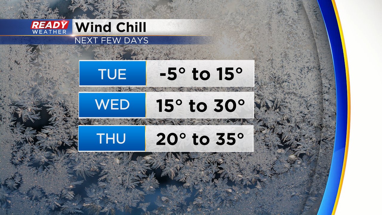
Wind chills stay cold all day Tuesday only warming into the teens during the afternoon. The good news is we don't cool much Tuesday night so wind chills stay in the teens Wednesday morning then rise to around 30 by Wednesday afternoon. Thursday gets back to more typical wind chills for this time of year around 20 in the morning then 30s in the afternoon.
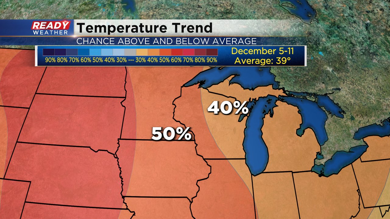
But even though it's cold now, as we turn the calendar into December, it looks like some warmth will return or at least slightly above average. The temperature trend through December 10 gives us a 40-50% chance for above average highs. Fingers crossed for 40s instead of 30s.
Download the CBS 58 Ready Weather app to track the temps and wind chills.