


The heavy rain and wet snow stayed across northern Illinois last night, and it tracked far enough south to give us a lot of sunshine today! The onshore wind has kept most of the area fairly stable and cloud-free, but there are some cumulus clouds well inland and a few isolated sprinkles near the Fox Valley.
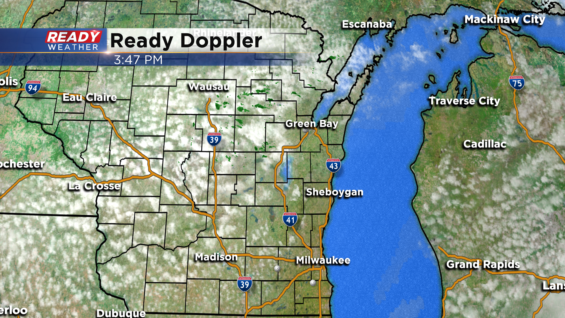
These sprinkles are struggling to reach the ground, but a few may sneak into Fond du Lac and Dodge counties this evening before falling apart.
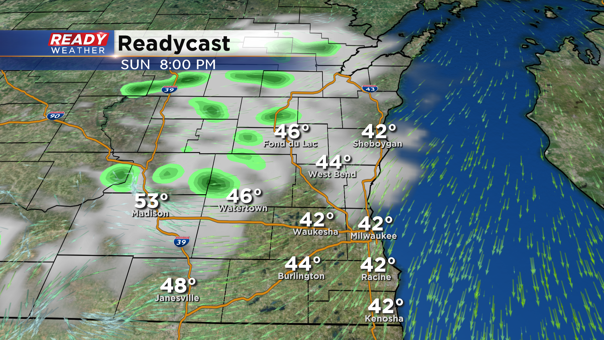
Another wave will track along the WI/IL border early Monday morning, which may trigger a few more isolated, light showers. However, dry air should win a good chunk of the battle, so whatever rain reaches the ground will be very light.
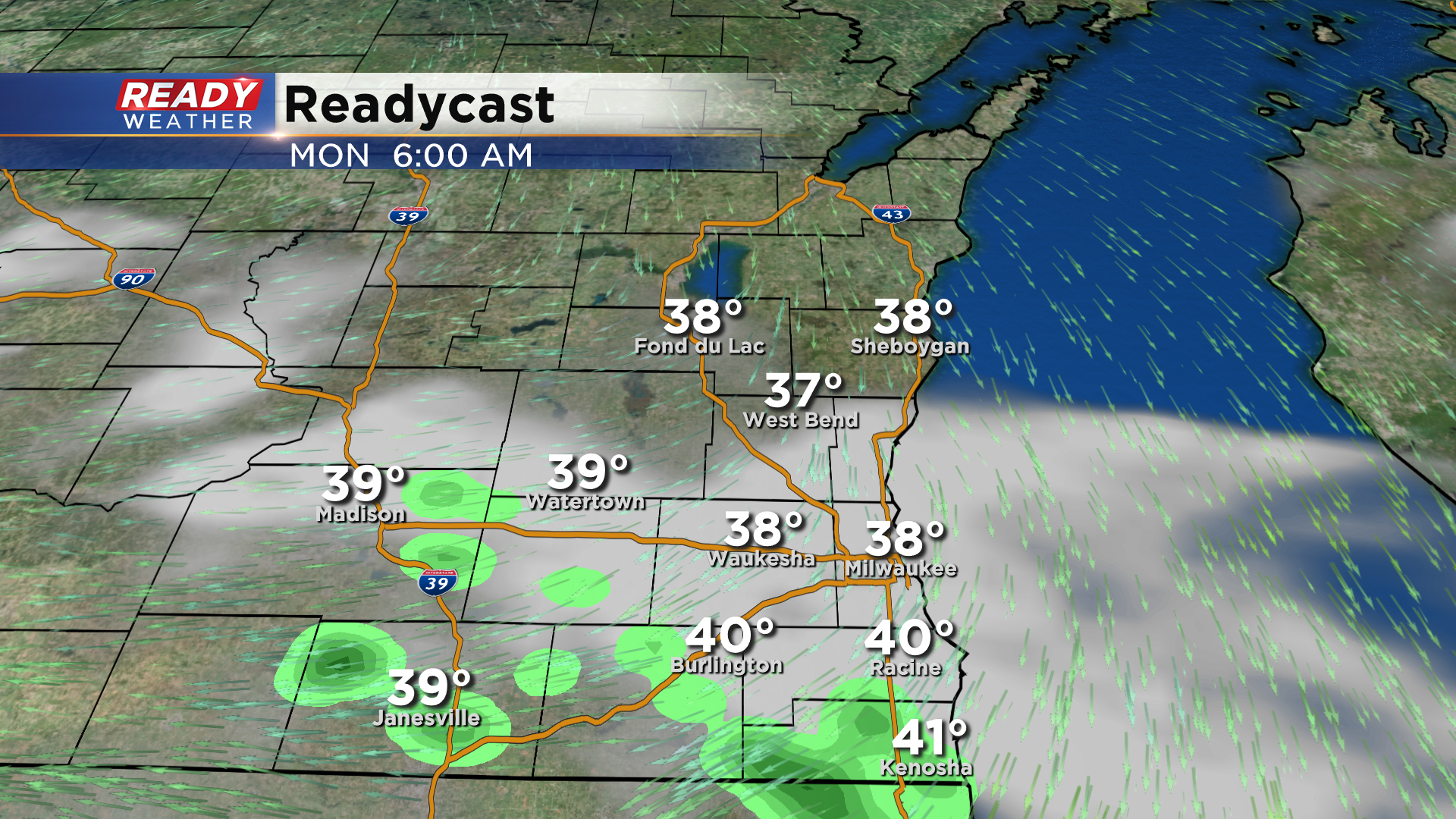
Once those showers pass, we'll see mostly dry conditions besides a small pop up shower chance in the far north late in the afternoon. However, the higher chance for spotty afternoon showers will be across central Wisconsin and the Fox Valley.
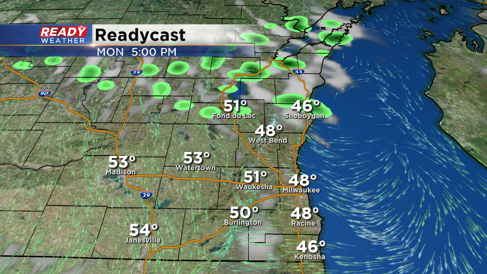
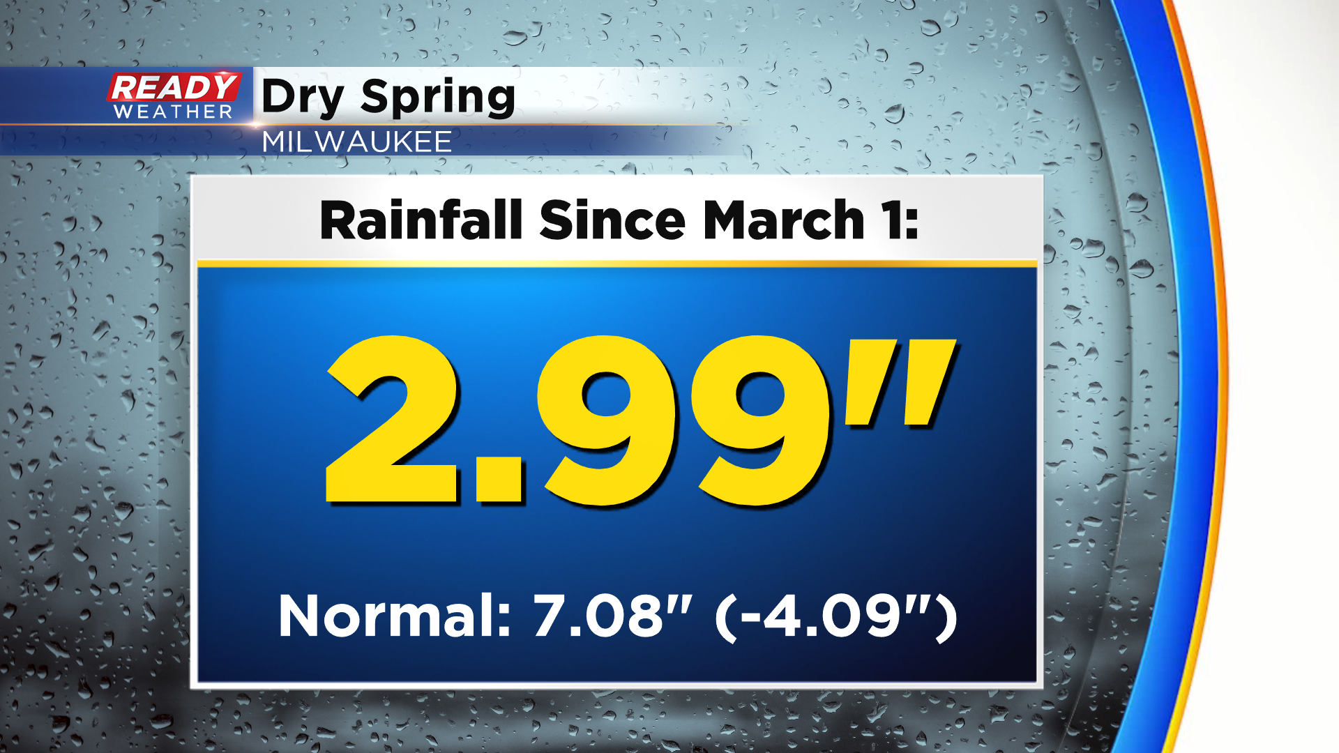
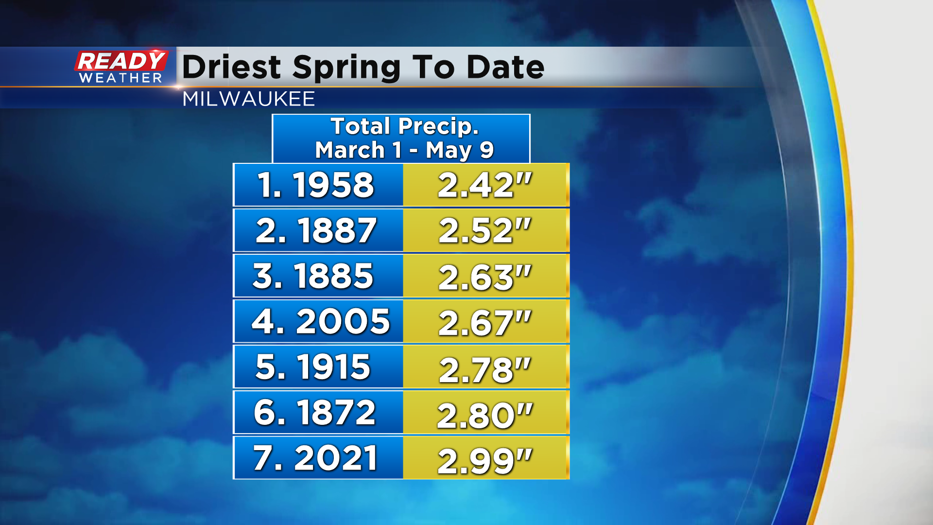
That will be our best shower chance through the work week as high pressure takes control, which is not good news for the ongoing drought in southeast Wisconsin. Milwaukee is running over 4" below normal for precipitation this spring having only picked up 2.99" since March 1st.
This has been Milwaukee's 7th driest spring to date.
Temperatures will be cool in the 50s to start the week, but will be on a gradual warming trend back into the 60s by the end of the week. See how warm temps may be by next weekend by downloading the CBS 58 Ready Weather App.