


Over the last six months or so we've seen a lot of precipitation. Up until our last few storms which dropped really good snowfall most of those precipitation events were of the rain or sleet variety. Going into the fourth week of March we are sitting just a touch below-average on overall snowfall and well above-average on total precipitation.

Tuesday's rain chance has all but gone away with just a 10% chance for an isolated shower. We could see an isolated shower Tuesday night then we will watch two passing waves on Wednesday. The first mostly stays north in the morning and the second mostly stays south in the evening. Thursday, especially in the morning, might be our best chance to see some rain and snow.
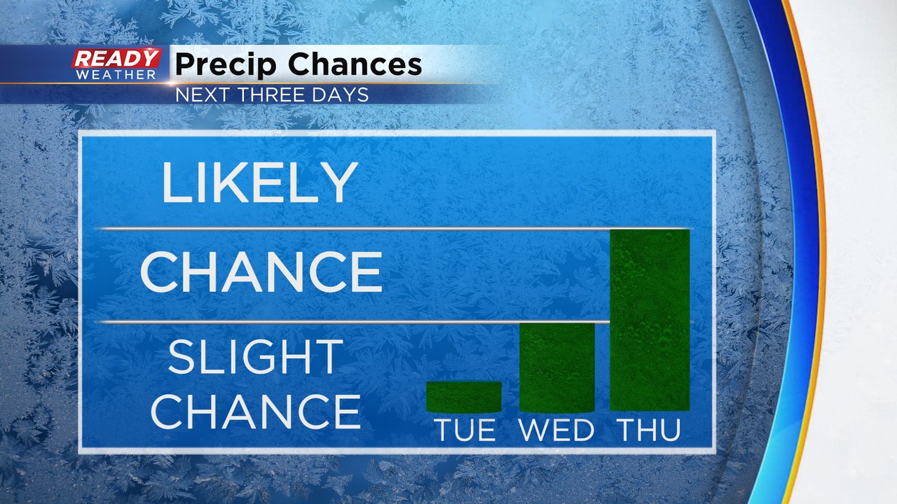
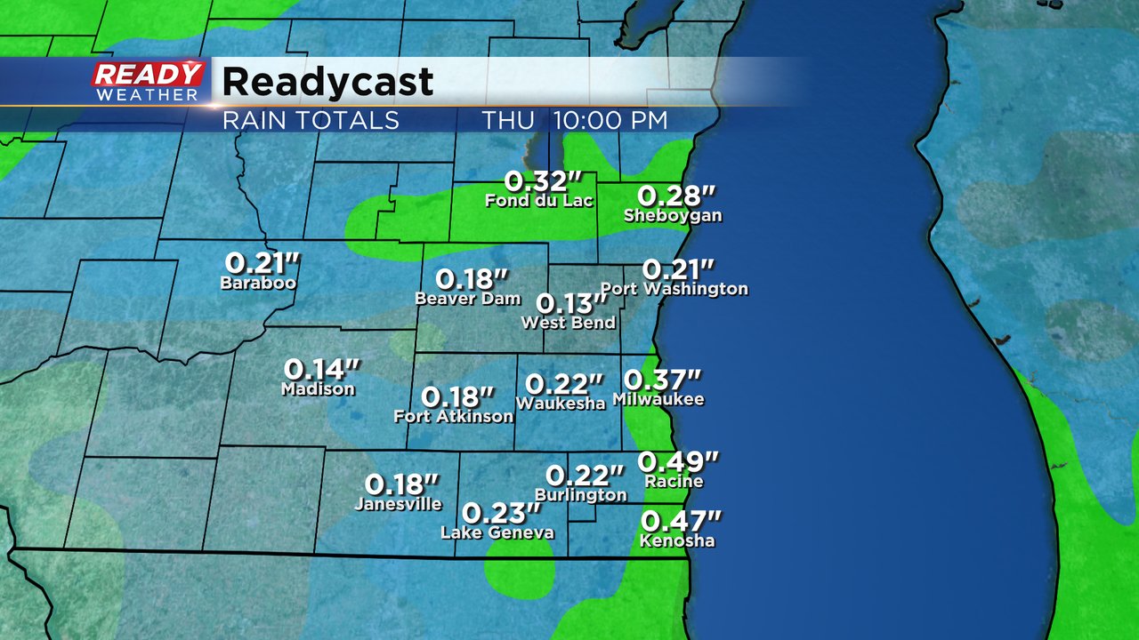
Any precipitation we see over the next three days won't amount to much for most of us with 0.10-0.25" of rain expected. Some isolated areas could see up to a half inch of rainfall. A touch of accumulating snow for some northern counties is not out of the question for Thursday morning.
Download the CBS 58 Ready Weather app to track the rain and snow chances.