


After a frosty weekend, we finally warm up this week with temperatures consistently going above-average for the first time since the middle of April.
A frost advisory was issued for both Saturday and Sunday nights for some inland and northern counties. A few northern communities like West Bend, Sheboygan and Fond du Lac saw a freeze Sunday morning with temps in the low 30s. There was widespread frost for many inland spots as well.

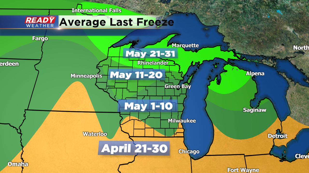
This is right around or just after the time of year we see our last freeze on average. For inland communities it happens during the first ten days of May. We could get close to frosty numbers Tuesday morning although a frost advisory is not expected. After that feel free to plant the spring flowers without worry.
Despite a lake breeze at times this week, temperatures will warm nicely. Starting Tuesday we get into the 60s and stay there for the rest of the forecast.

The average high for Monday is 64° and temperatures from May 16 through the 22 are expected to be above-average. Widespread 70s don't look likely but a few may be possible, especially towards next weekend.

Download the CBS 58 Ready Weather app to track the latest temperature trends.