


Just two days after all of southeast Wisconsin had a soaking rain Sunday with most seeing 1-4" of rain, we are getting another helping of rain Tuesday. It started with some sprinkles and light showers Monday night but during the morning commute Tuesday we had some pockets of heavy rain with totals starting to reach an inch in some communities.
Here's a radar image that will update with time:

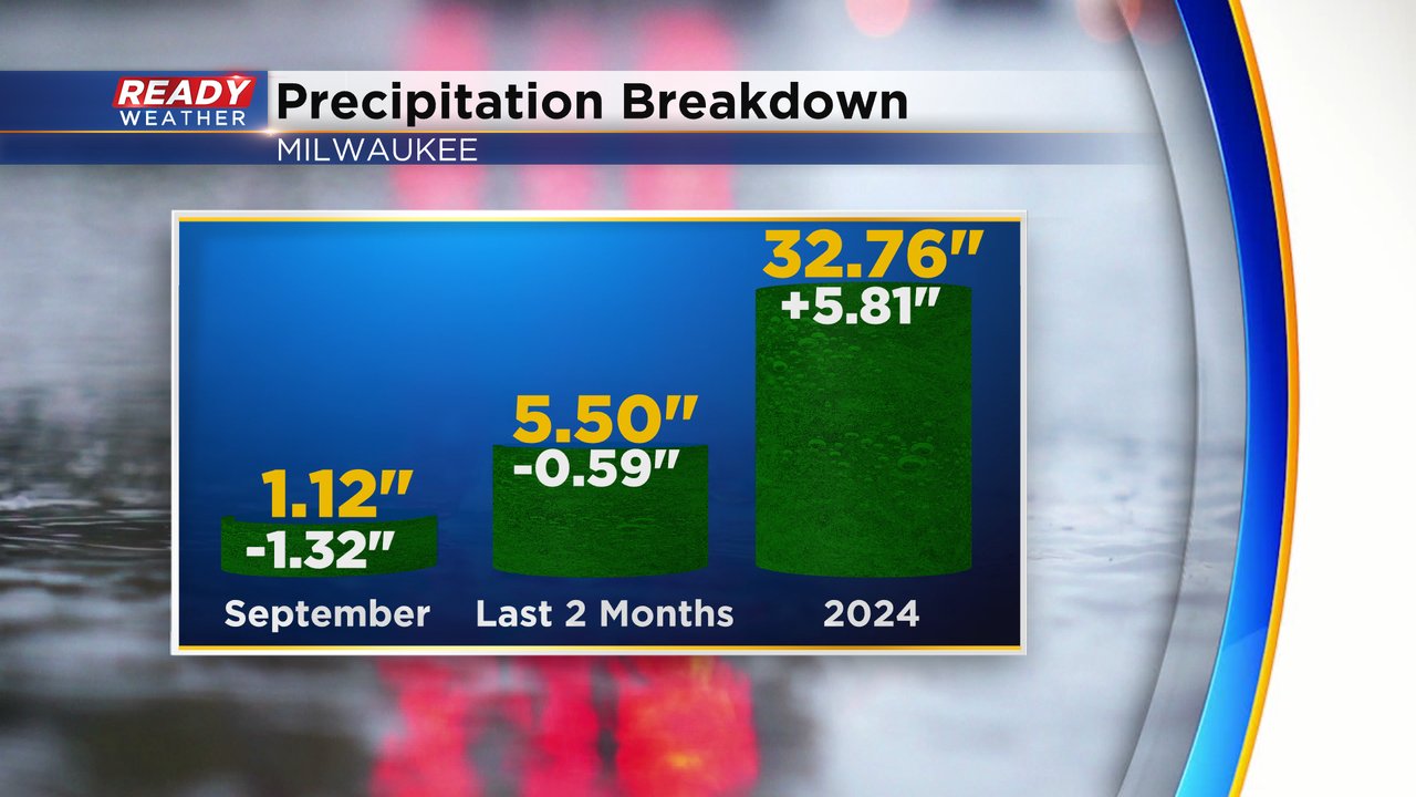
Going into Tuesday, Milwaukee had a September rain deficit over an inch but we could come close to making that up by the end of Tuesday if the heavy pockets of rain hold on. Over the last two months we have a rain deficit of nearly 0.60" but for the year our precipitation total is just fine with a surplus of almost six inches.
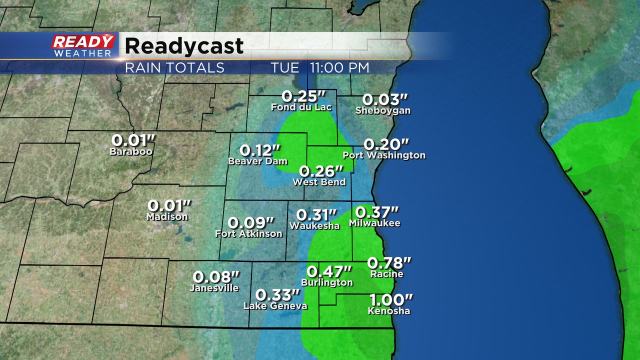
Rain totals for Tuesday will reach or surpass 1" in some locations with parts of Racine and Kenosha County seeing the best chance. Some northern and western counties will only get a tenth of an inch or so of rain.
Download the CBS 58 Ready Weather app to track the rain with the interactive radar.