Wintry weekend leads to roller coast week of temperatures
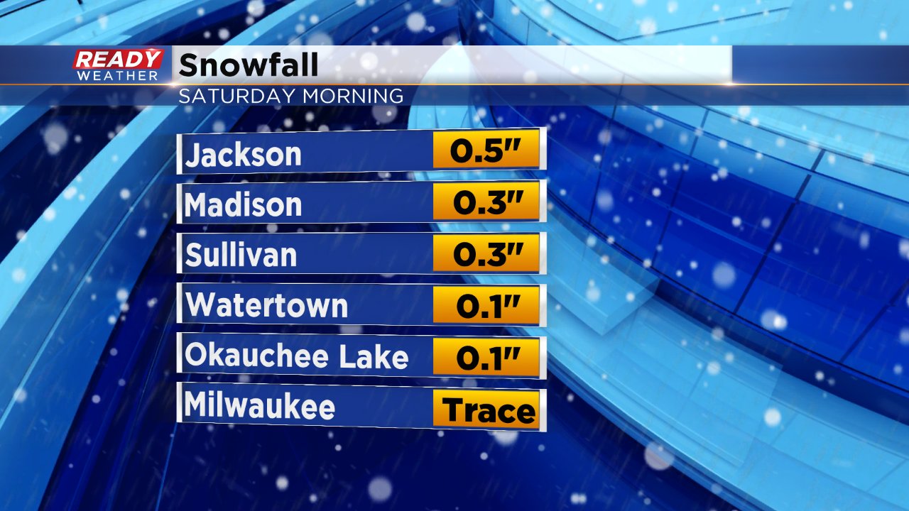
SOUTHEAST WISCONSIN (CBS 58) -- The wintry weekend is over and now all that's left is a little seasonable chill. Saturday morning's mix of rain changing to snow did accumulate in some spots, especially out west were a few tenths to a half inch of snow fell.
Once the snow left the wind picked up with gusts as high as 40 mph in some spots on Saturday. The wind lingered through most of Sunday with wind chills staying in the teens and lower 20s all day Sunday which will last until Monday morning.
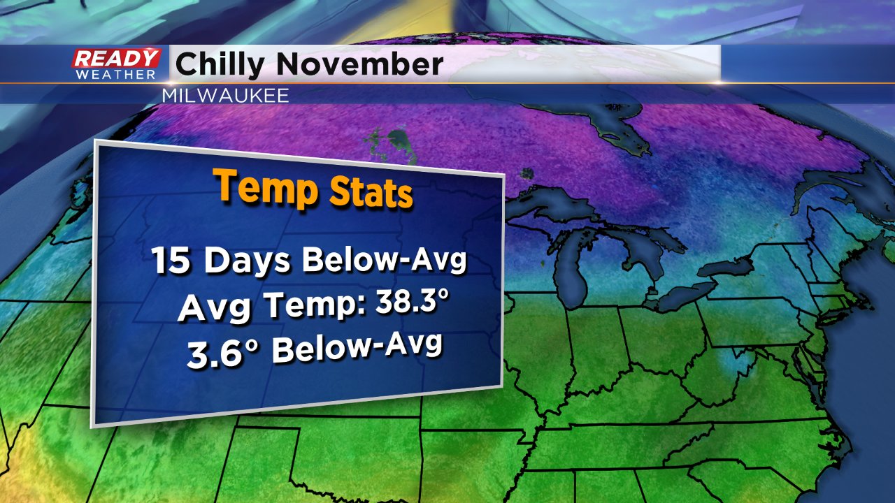
Sunday's chill was just more of the same for the month of November. Out of the 19 days of the month so far, only four have been above average for highs. The month is currently running about three and a half degrees below-average.
There is some warmth on the way for the week ahead but it comes with plenty of temperature fluctuations. Monday's highs could reach 50 for some but at least upper 40s look likely. That warmth is short lived though as a cold front arrives by early Tuesday morning forcing temperatures to fall all day Tuesday and by Wednesday morning lows reach the low 20s. 40s return just in time for the holiday weekend.
