Midday Update: Few passing showers early this afternoon, but severe storms stay well west


Updated: Thursday, May 19th 12:30 pm:
A batch of light showers has been pushing ENE across southern Wisconsin through the morning, but they've been weakening the farther east they go. These showers are associated with a warm front that's lifting northward. These showers should either fall apart or lift out of the area by 2pm.
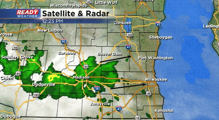
Once these showers exit the area, most of us will be dry for the rest of the afternoon and evening. The severe threat will primarily stay to our west today. Severe storms are already firing along with Minnesota/Iowa border and will continue to push ENE into the afternoon.
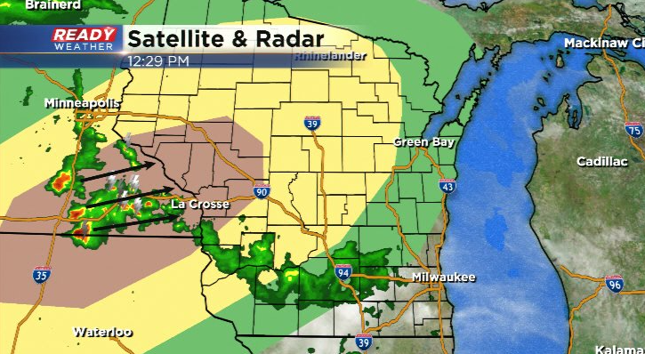
Additional storms will fire into tonight in this region ahead of the cold front. A few of these showers and storms may reach Fond du Lac, Dodge, or Sheboygan counties later tonight. These storms will be weakening, but could still produce hail and strong winds.
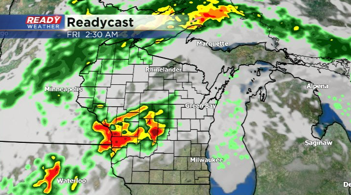
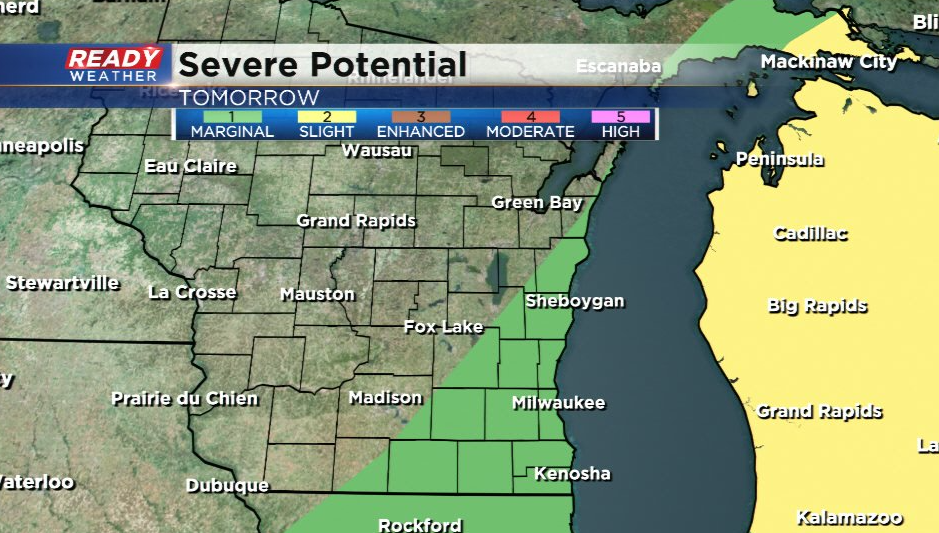
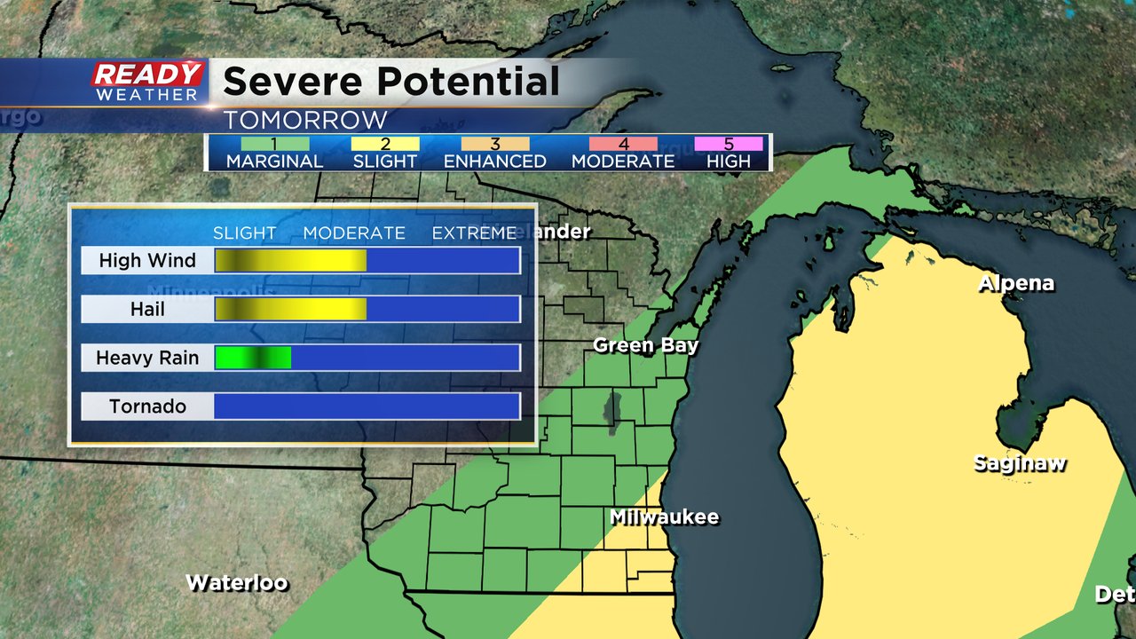
That front stalls across SE WI Friday morning and will bring another chance for stronger storms with hail and gusty winds, but that will depend on where the front stalls and *if* we can get a little bit of sunshine ahead of the front Friday morning.
With a lower chance for strong storms Friday morning, the level 2 of 5, Slight Risk, has been dropped from all of SE WI. A level 1 of 5, Marginal Risk, remains in place for an isolated stronger storm or two.
----------------------------------------------------------------------------------------
The roller coaster temps of the last week continue Thursday with highs soaring back into the middle 80s after only reaching the 50s for many areas on Wednesday. Friday is also expected to be a warm day with highs around 80 before temperatures drop for the weekend barely reaching 60* in some areas.
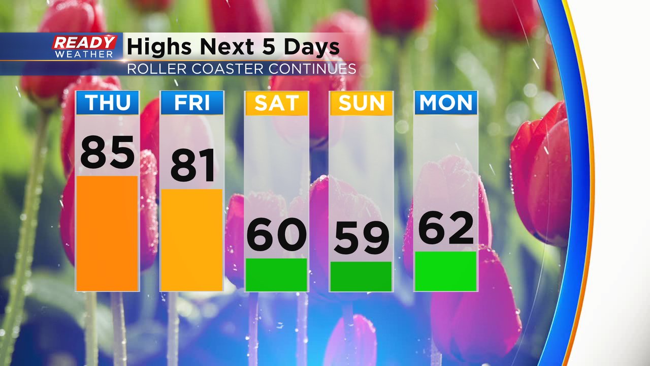
In addition to the warming temperatures, we will start to see the humidity level increase as well. Most of this week the dew point has been off the charts in a good way but on Thursday you might start to notice a little humidity. Friday is expected to be the muggy day with dew points in the middle 60s. The humidity will drop as temperatures drop this weekend.

With the heat and humidity returning and a cold front ready to move across southeast Wisconsin. We have the potential to see some thunderstorms the next 36 hours. An isolated shower or storm cannot be ruled out Thursday. The rain chance starts to increase Thursday night as the front with the storm chance moves across the state. That front will likely stall out just west of our local area or over our northwest counties. Friday morning the front will get moving again giving us our best chance for some storms.
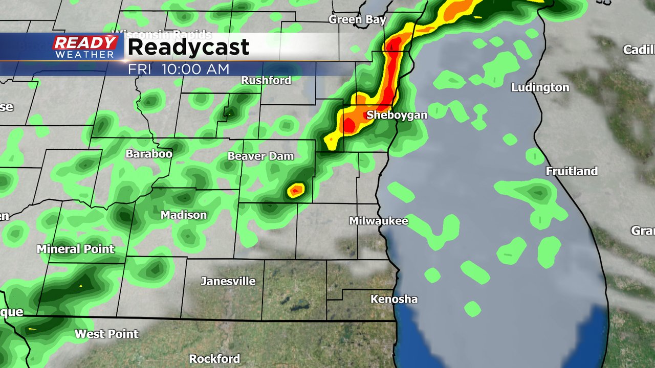
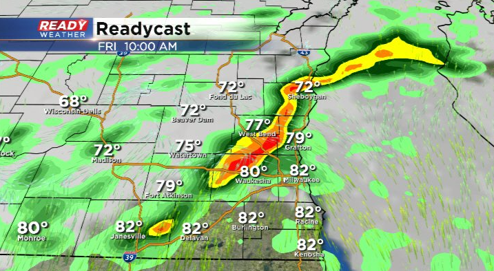
Any of the storms that do roll in Thursday night and Friday could be on the stronger or even isolated severe side. Thankfully there is no tornado risk but a few storms with some strong wind or hail are possible. We will watch for some redevelopment with storms Friday afternoon but the better storm chance will be Friday morning.
Download the CBS 58 Ready Weather app to track the radar and any storms that pop up the next 36 hours.