


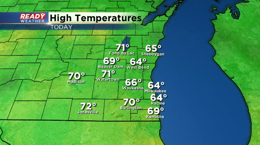
It was a rather nice end to the weekend across southeast Wisconsin as high temperatures climbed into the mid 60s to low 70s under a mix of sun and clouds.
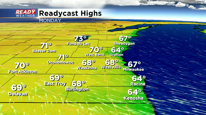
Clouds will thicken up tonight with lingering clouds south of I-94 on Monday as a system passes to our south. With more clouds and a breeze off the lake, highs will be stuck in the 60s in most spots south of 94 and lakeside, but more sunshine to the north will allow temps to easily climb into the low 70s.
Tuesday will be a transition day as a warm front approaches and eventually tracks through the area Tuesday night into Wednesday morning. More clouds and a few scattered showers are possible ahead of this front Tuesday afternoon and evening.
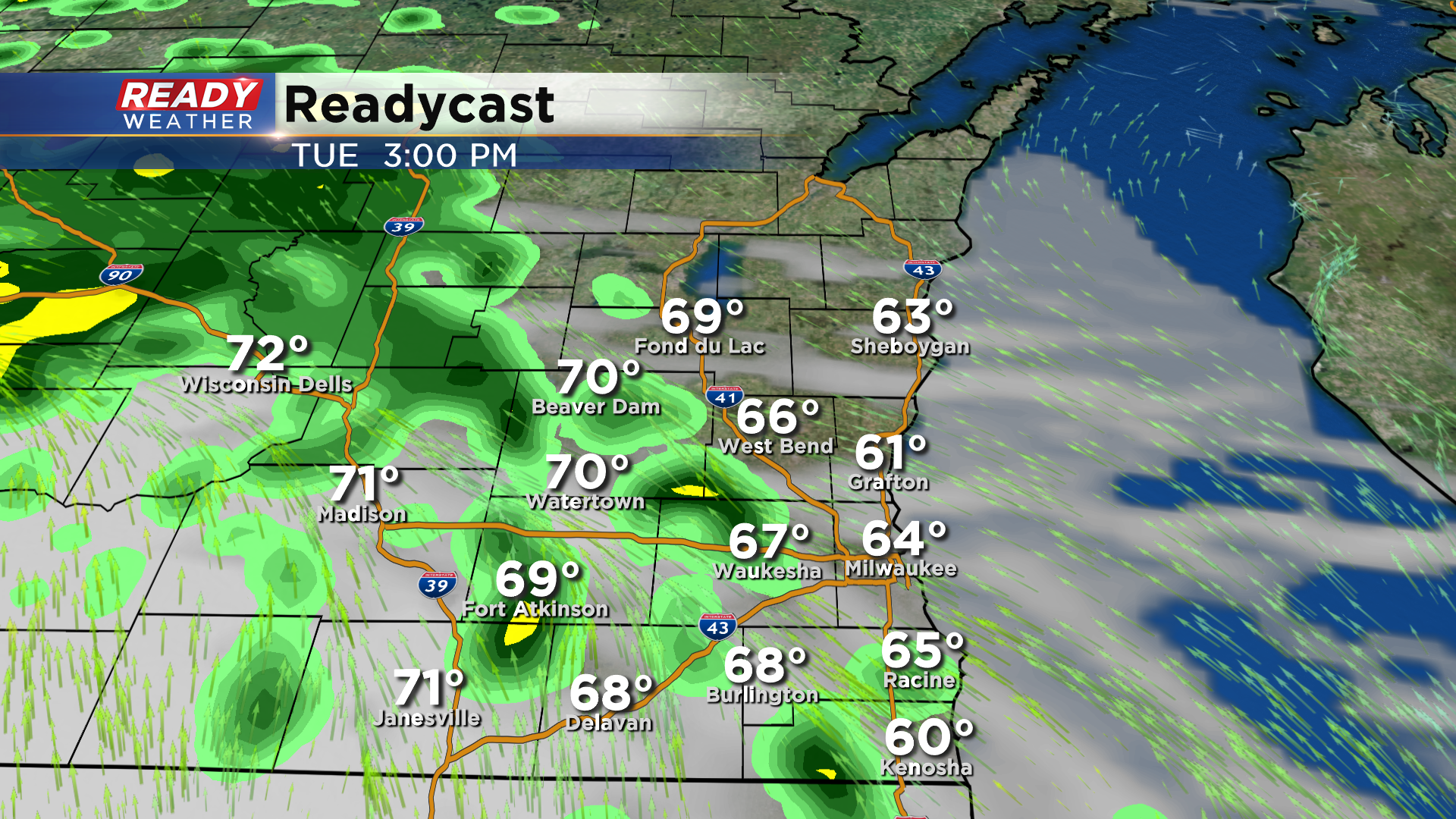
The cloud cover and southeast wind will keep temps in the 60s Tuesday, but temperatures will warm into the 70s behind the front Wednesday with upper 70s to low 80s expected Thursday and Friday.
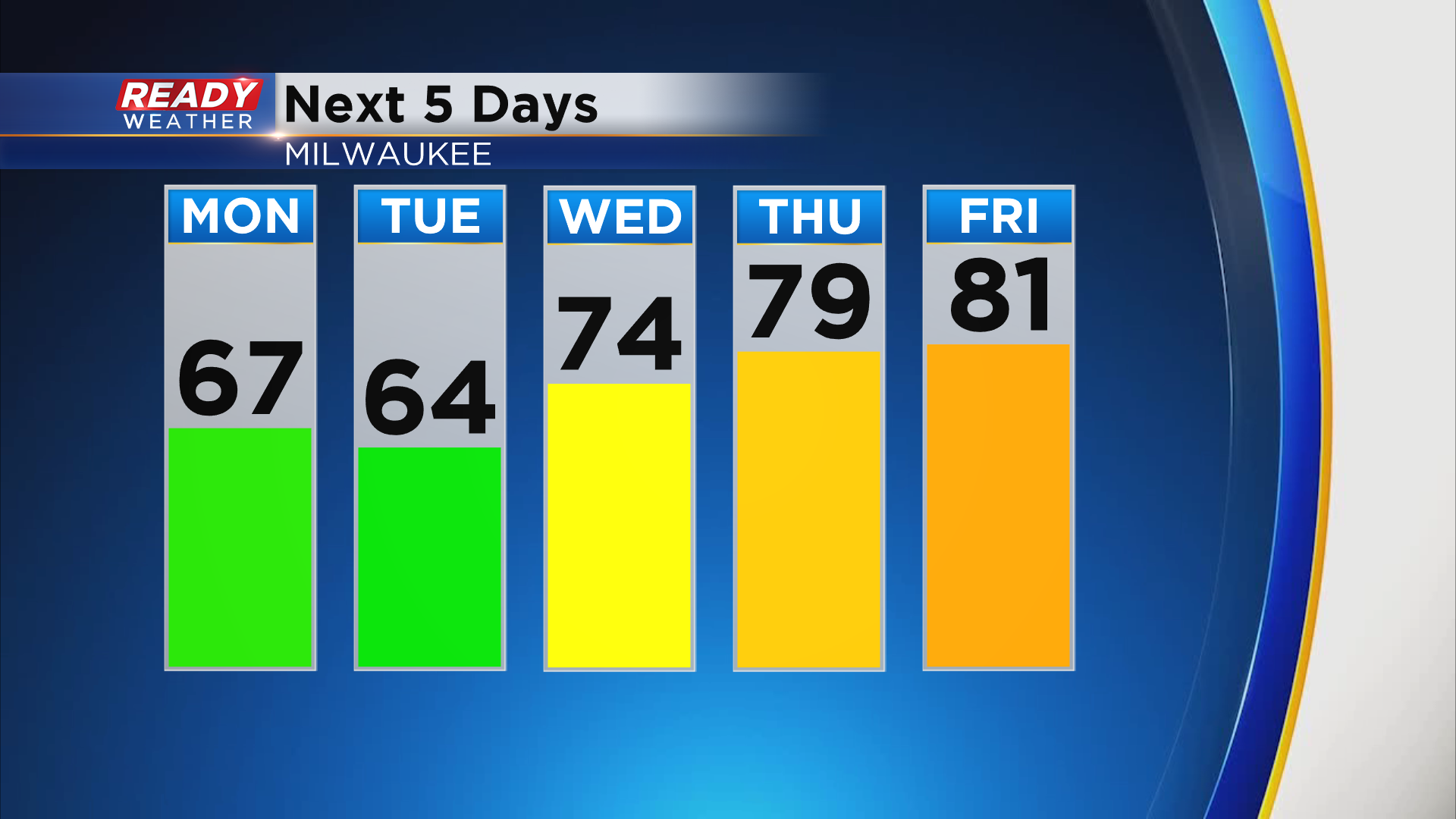
You'll also notice an uptick in humidity for the second half of the week as dew points climb into the 60s for the first time this year.
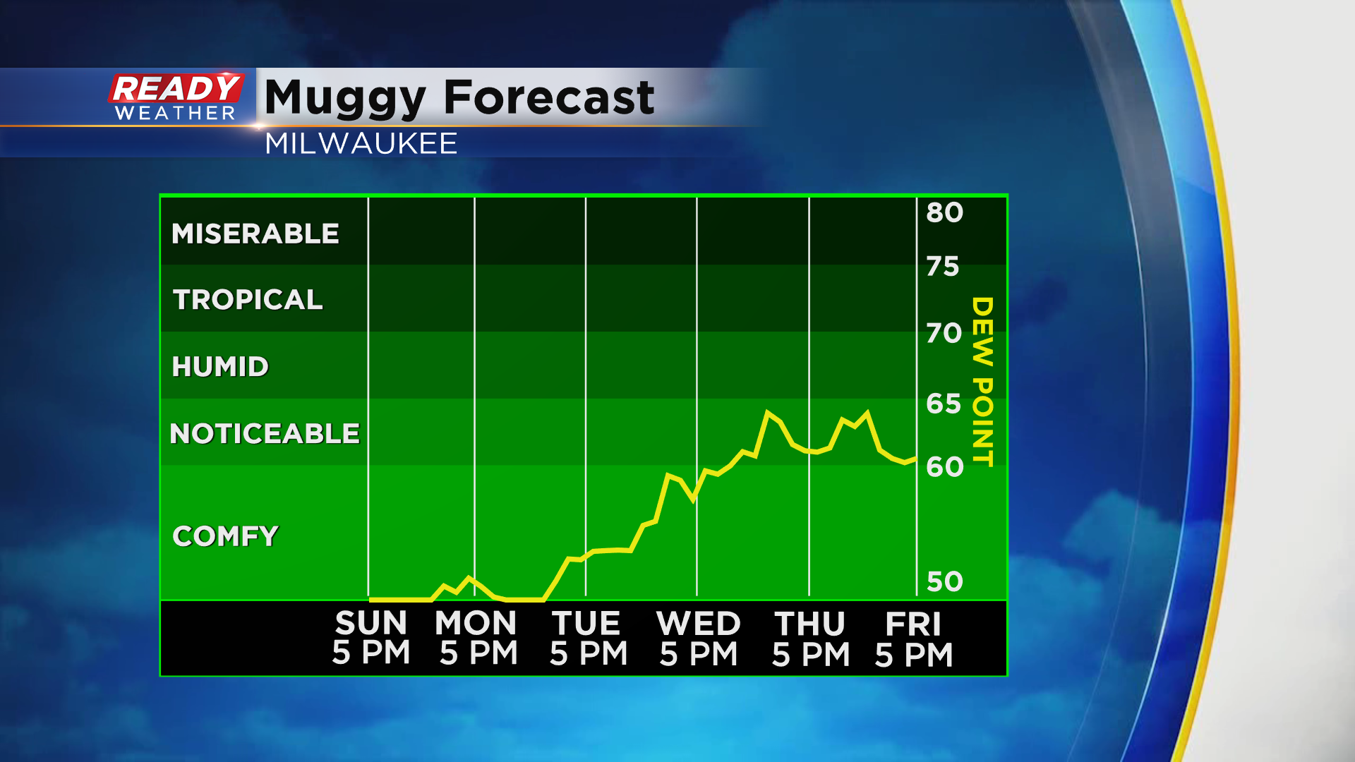
The heat and humidity will create chances for pop up storms at times during the second half of the week, but no day looks to be a washout. This summer-like weather looks to continue into next weekend as well. Download the CBS 58 Ready Weather App to see the full7 day forecast.