


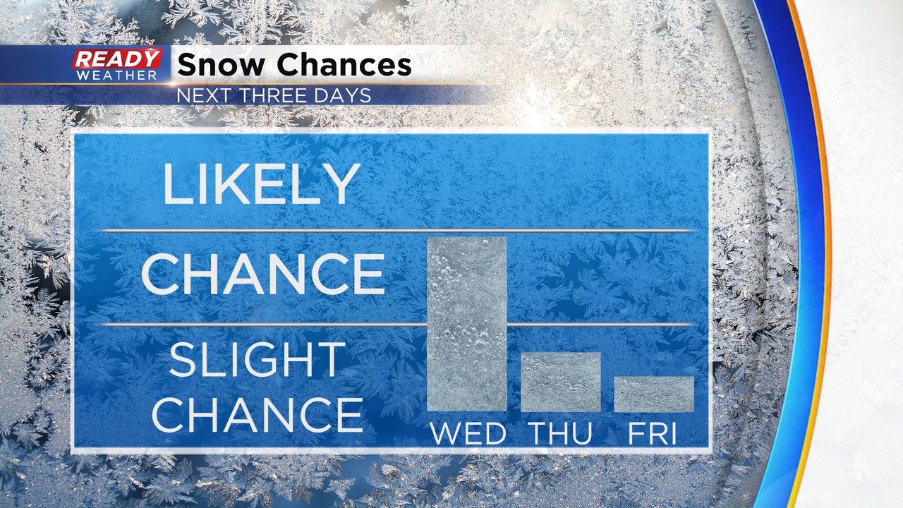
The next chance for snow arrives after the evening commute Wednesday through early Thursday morning. These look like scattered snow showers so not everyone will see the same amount of snow. The best timing for snow looks like 7 PM Wednesday through 2 AM Wednesday.
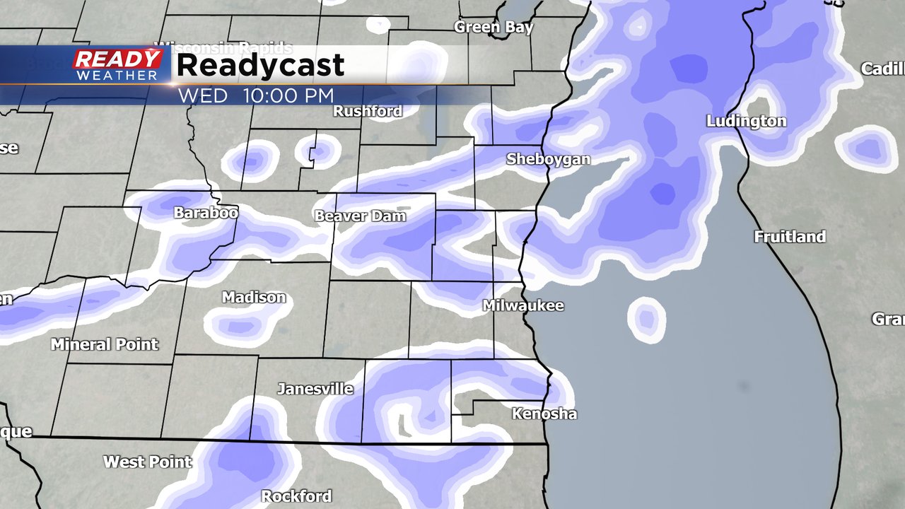
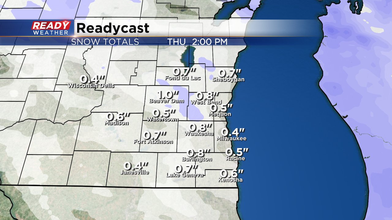
Snow totals are not expected to be overly impressive with most of southeast Wisconsin seeing under an inch of snow. The accumulating snow will miss both the Wednesday evening commute and the Thursday morning commute but anyone traveling late Wednesday or early Thursday could see some slippery roads.
After the good chance for snow Wednesday night a few flurries could linger through Thursday morning then dry out Thursday afternoon. On Friday we will have to watch a storm system to our south that could bring rain or snow. That looks to stay south at this point.
Download the CBS 58 Ready Weather app to track the next chance for snow.