Rain changing to wet snow tonight, turning windy Monday


We lucked out today and had some bonus sunshine around midday after the fog had lifted. We’ve been able to escape most of the shower activity so far today as most of it has been falling along and north of a front that’s stalled out across Wisconsin. Heavy snow is falling north of the front, while rain and a few storms are tracking through Iowa.
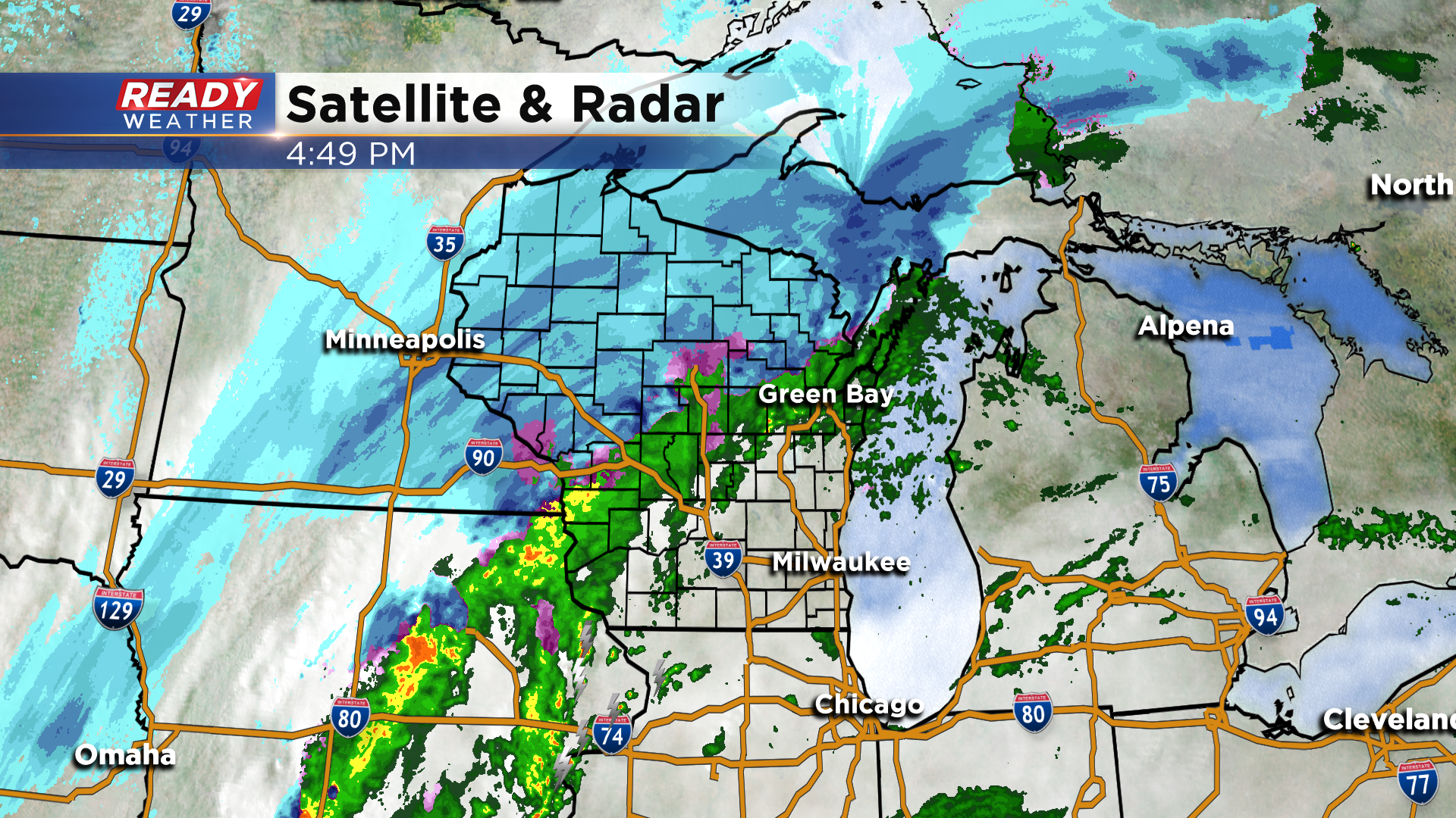
These are the showers and storms that’ll move into our area late this evening. The stalled cold front will slam through SE Wisconsin between 3 and 6am, changing precip from rain, to a wintry mix, to wet snow from west to east.
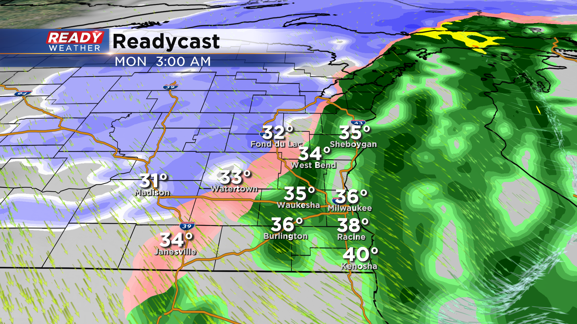
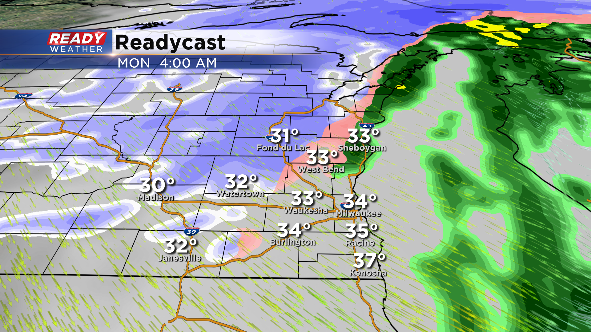
Any wet snow will be exiting the area around 7am.
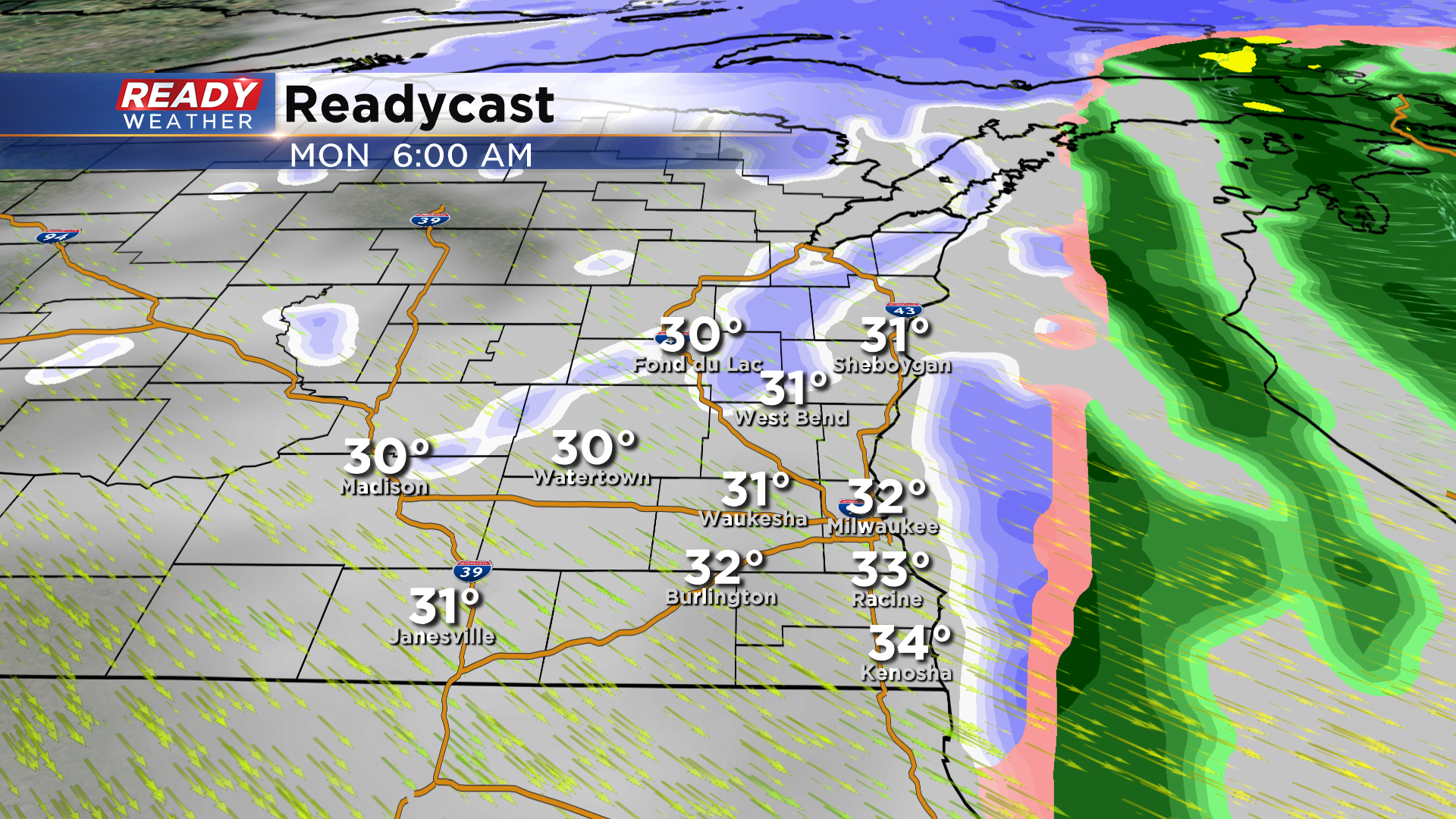
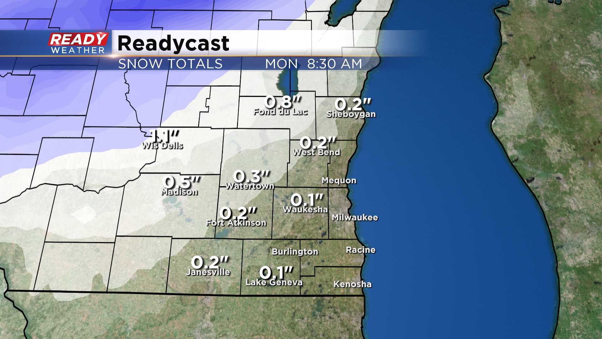
We aren’t expecting much in the way of accumulation in Milwaukee and southward. A dusting or couple tenths of an inch of slush are possible inland, with totals approaching 1” in western Fond du Lac county.
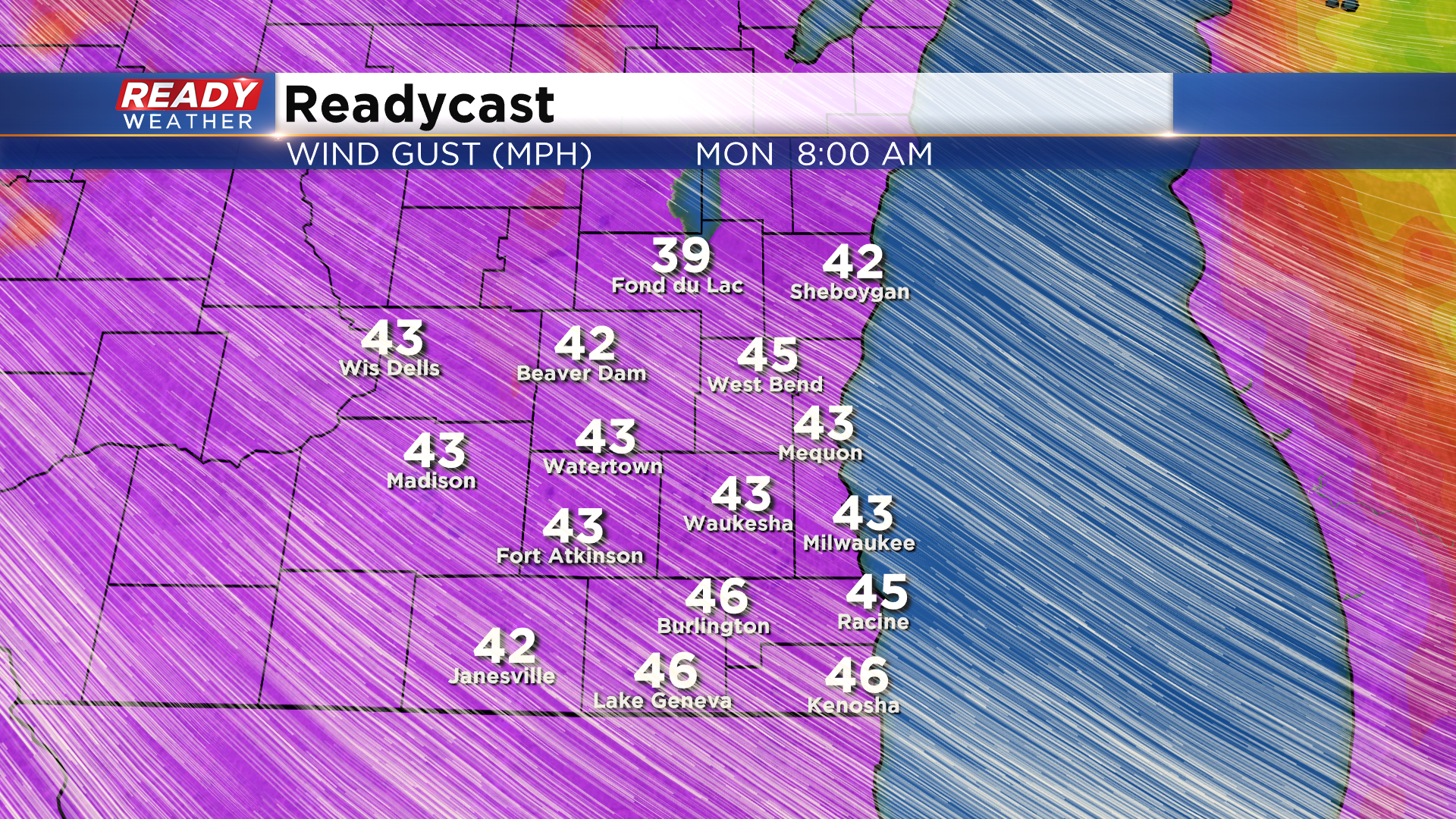
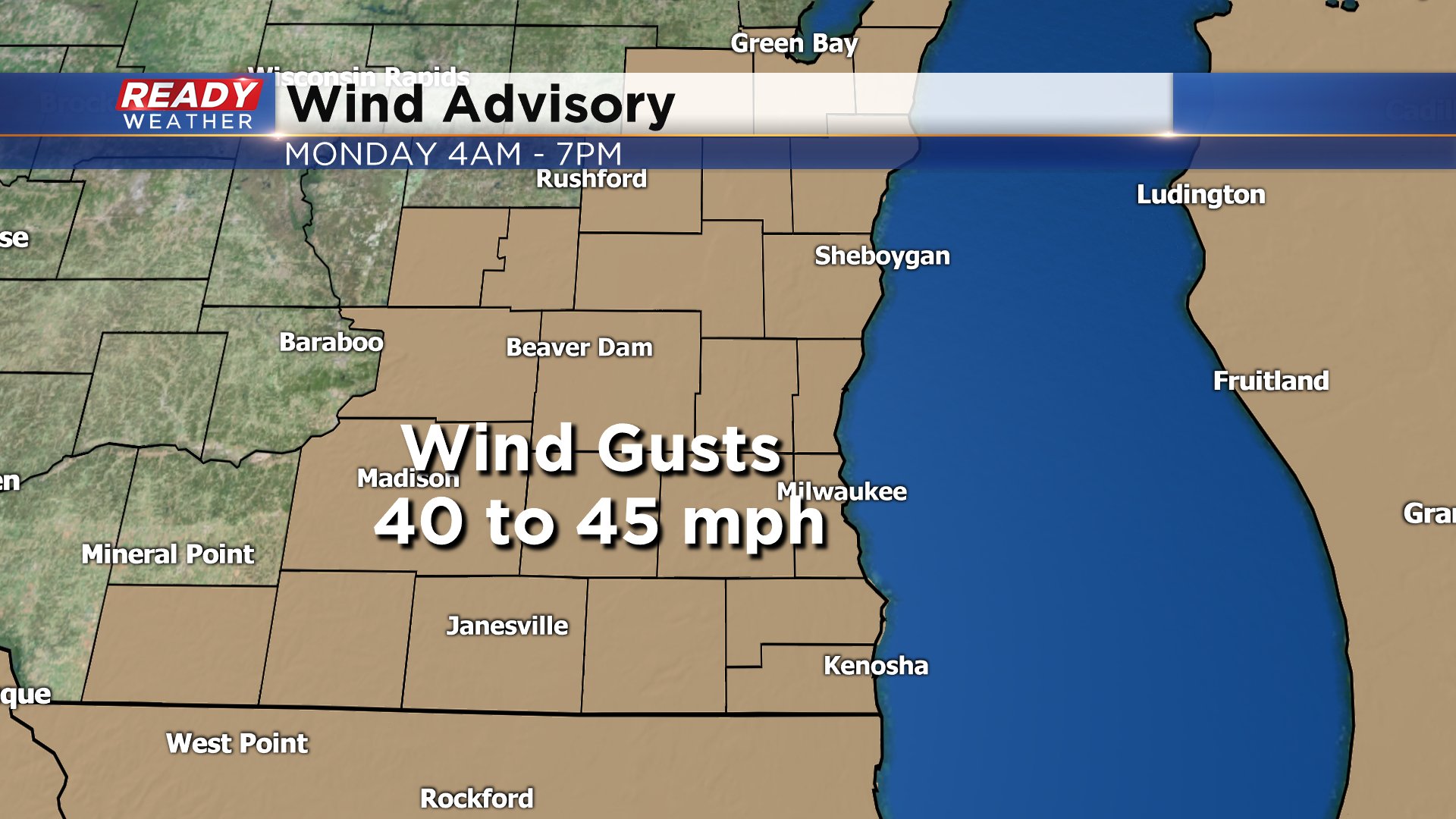
This shouldn’t have much, if any, impact on the Monday morning commute. What will have more of an impact are the strong winds that will move in behind the front. Winds will likely gust between 40-45 mph throughout the day, with isolated gusts up to 50 mph possible. With temps in the 30s, this will make it feel like it's in the 20s all day.
A Wind Advisory will go into effect for the entire area 4am Monday through 7pm Monday.
Spotty snow or graupel showers will be possible Monday afternoon, but no additional accumulation is expected.