


The warmth continues! We've now had three days in a row in the 80s starting Saturday. Sunday and Monday both fell just short of records but our best chance comes Tuesday. The forecast high of 85* will comes very close to the current record high of 86*. We get one more day in the 80s Wednesday before a temp drop rolls in.

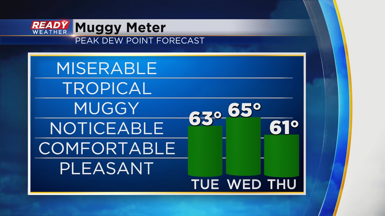
In addition to the heat, we will keep around some humidity with dew points hanging around the low 60s Tuesday and a touch more humidity Wednesday with a rain chance before it drops throughout the day Thursday.
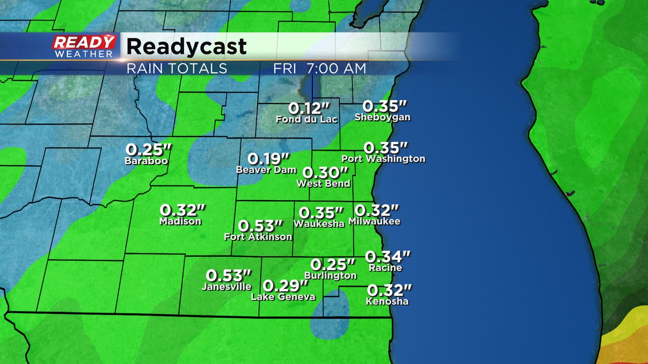
Rain chances right now look best on Wednesday and Friday with a lower chance Thursday mainly in our SE Counties.

This won't be a 2", 3", 4" rain like last week was, but a soaking 0.10-0.50" of rain will be possible from Wednesday through Friday.
Download the CBS 58 Ready Weather app to track the near record heat and rain.