More rain arrives with high wind
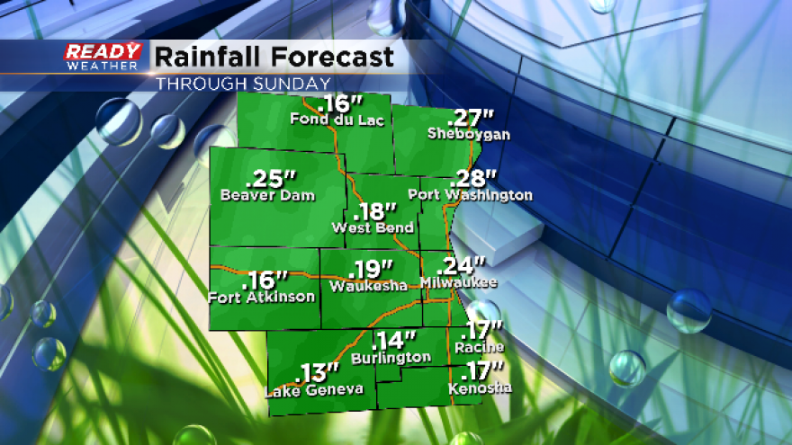
Rain showers are expected across southeast Wisconsin Saturday evening lingering through Sunday morning. Most of the rain will be scattered, but a few downpours are possible especially if thunderstorms develop. About a quarter to half inch of rain is expected in most locations.
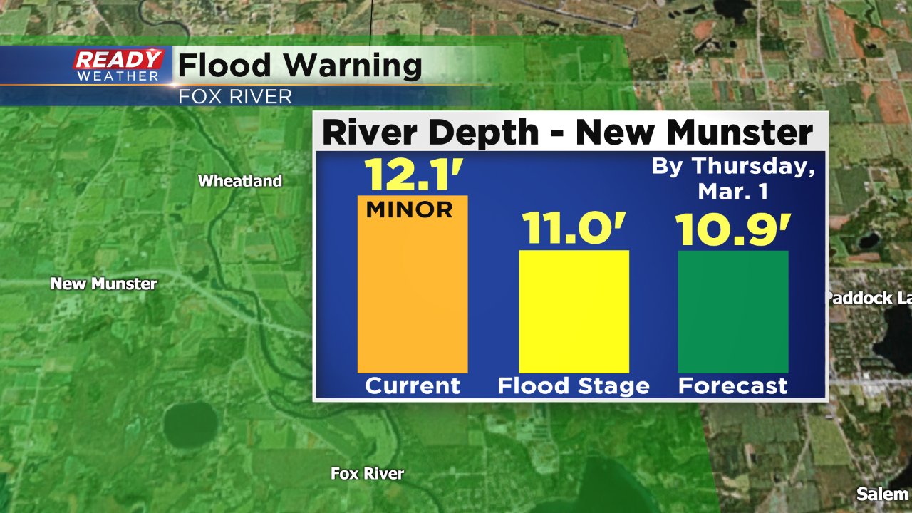
Although the rain shouldn't lead to any additional flooding, it will likely lengthen current flood warnings since it will take an extra day or two for rivers to go below flood level with the additional precipitation. A flood warning for the Milwaukee River around Cedarburg has been extended until Saturday night and the flood warning for the Fox River in western Kenosha County has been extended two more days until next Thursday.
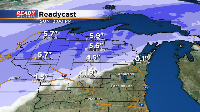
A few snowflakes may mix in the rain showers Saturday night, but no accumulation is expected. The counties with the best chance for a dusting are Dodge and Fond du Lac. Parts of northern Wisconsin could see up to 6" of new snow.
Wind will be a big concern once the rain stops. A wind advisory has been issued for northern and lakeside counties including Fond du Lac, Sheboygan, Washington, Ozaukee, Milwaukee, Racine and Kenosha from 3 a.m. Sunday morning until 3 p.m. Sunday afternoon.
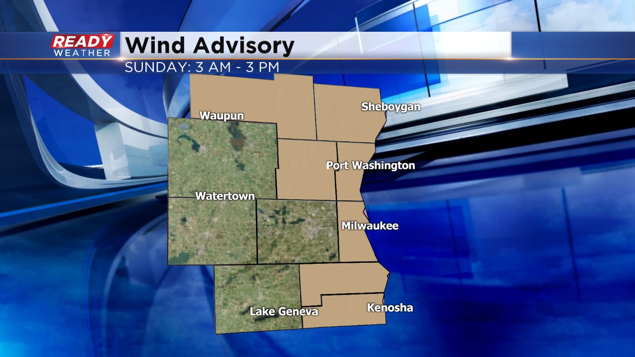
During the wind advisory wind gusts could reach over 40 mph. This could cause some additional concerns with light objects blowing around and make it difficult to drive on north south freeways like I-43.
Download the CBS 58 Ready weather app to see how fast the wind is gusting in your neighborhood and see when the rain will arrive.
