Afternoon Update: Isolated afternoon snow showers and plenty of wind to go around on your Friday


Afternoon Update:
There's just a few isolated snow showers around this afternoon. The bigger weather feature at this point is the wind. It's driving chills to the teens and low 20s this afternoon.
Updated: 9:42 a.m. Feb. 20, 2026
The lull in action between the heavy rain from Thursday night and the snow/mix showers the rest of the day is over. Some light snow showers have now moved in from the west and could be with us in a scattered fashion through the afternoon. As the showers get closer to the lakefront they could mix and switch with some rain. Little snow accumulation is expected the rest of the day with only isolated locations seeing light snow up to an inch.
Here's a radar image that will update with time:

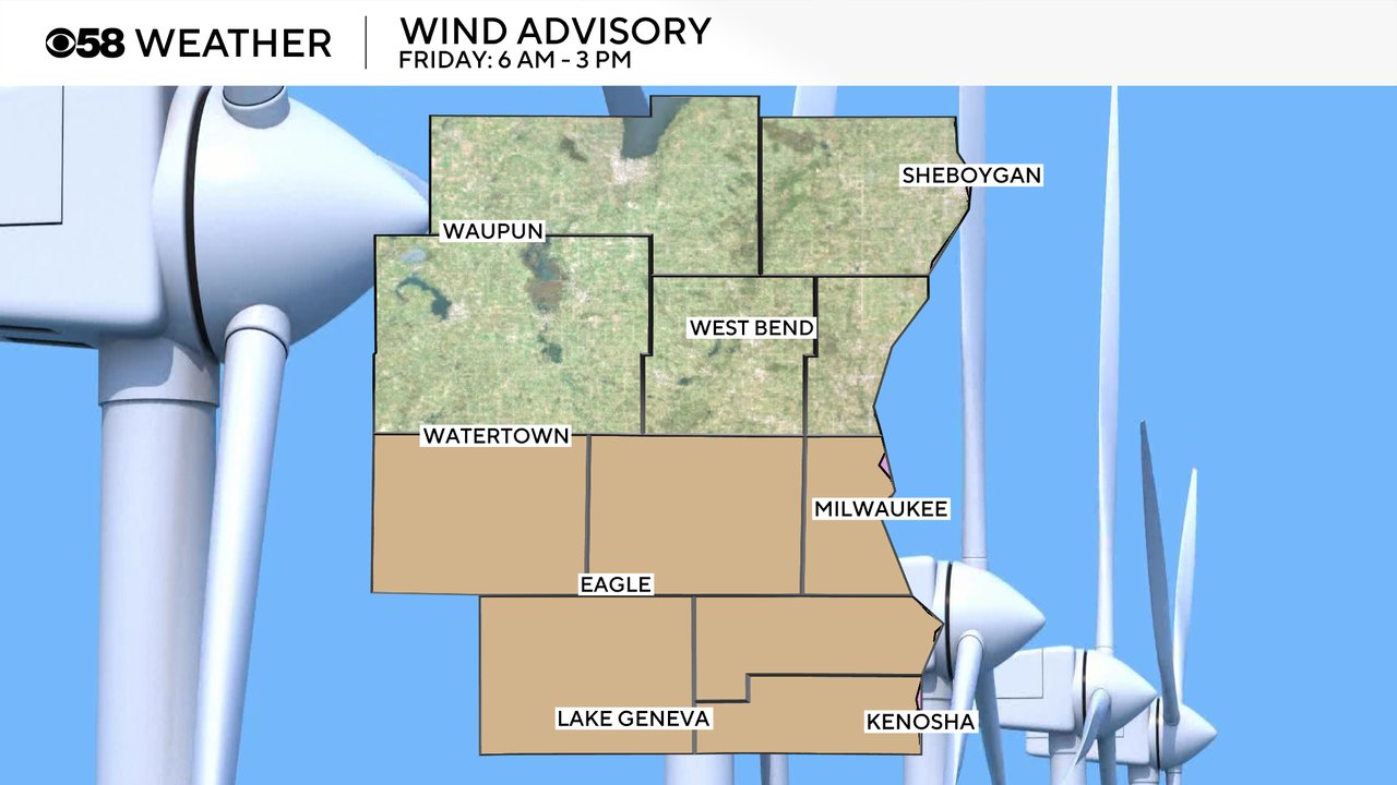
The other big story today is the wind. A wind advisory remains in effect for our southern half of counties until 3 PM. The wind has now shifted to the NW and will stay that way the rest of the day keeping temps steady then dropping us into the 20s.
Here are current wind gusts that will update with time:

Wind gusts could get as high as 45 mph on Friday then a breeze lingers through the rest of the weekend from 10-15 or 10-20mph.

------
Posted: 5:09 a.m. Feb. 20, 2026
Parts of southeast Wisconsin saw some heavy rain and even rumbles of thunder Thursday night into Friday morning. Most of us are now seeing a lull in the rain action. More precipitation, this time in the form of rain and snow, has been falling west of Madison and some of that precipitation will likely move our way.
The best chance for some rain and snow showers locally will be during the morning hours, but some snow showers could linger in northeast counties like Sheboygan and Ozaukee Counties through Friday afternoon and evening.

Snow totals have come down overall with only a dusting to an inch expected for most of southeast Wisconsin. Even then, most of our local areas will be closer to a dusting than the inch mark.

In addition to rain and snow showers Friday, it's also going to be a windy day. Wind gusts Friday could surpass 40 mph in some areas. A Wind Advisory has been issued from 6 AM until 3 PM on Friday.
Download the CBS 58 Weather app to track the rain and snow showers.