


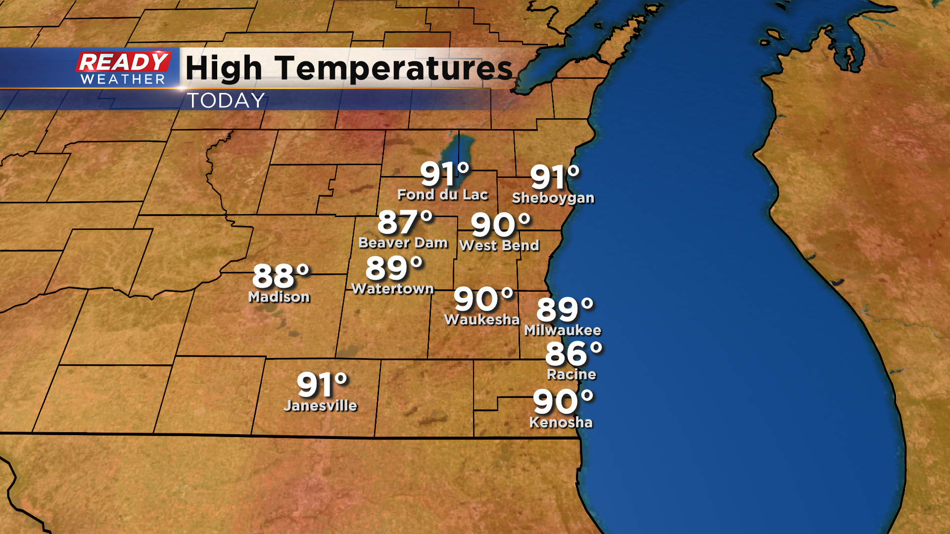
Many places across SE Wisconsin warmed up to 90 degrees this afternoon with a good deal of sunshine.
There were a few pop up storms in Milwaukee and Sheboygan county sparked by the lake breeze, but those are fizzling out. There are a few storms near the Fox Valley that may hold together and work into northern spots this evening, but no severe weather is expected.

The heat and humidity will continue for several more days with highs around 90 degrees expected Monday through Thursday.
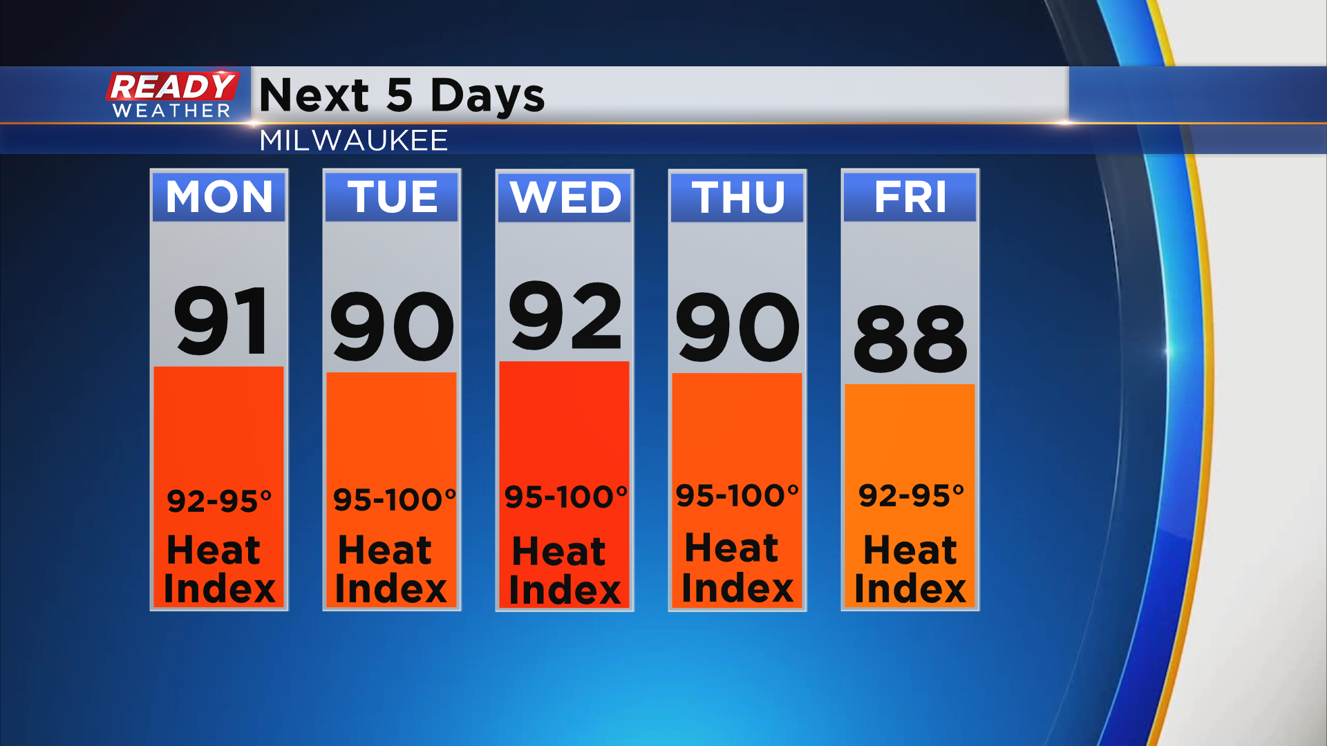
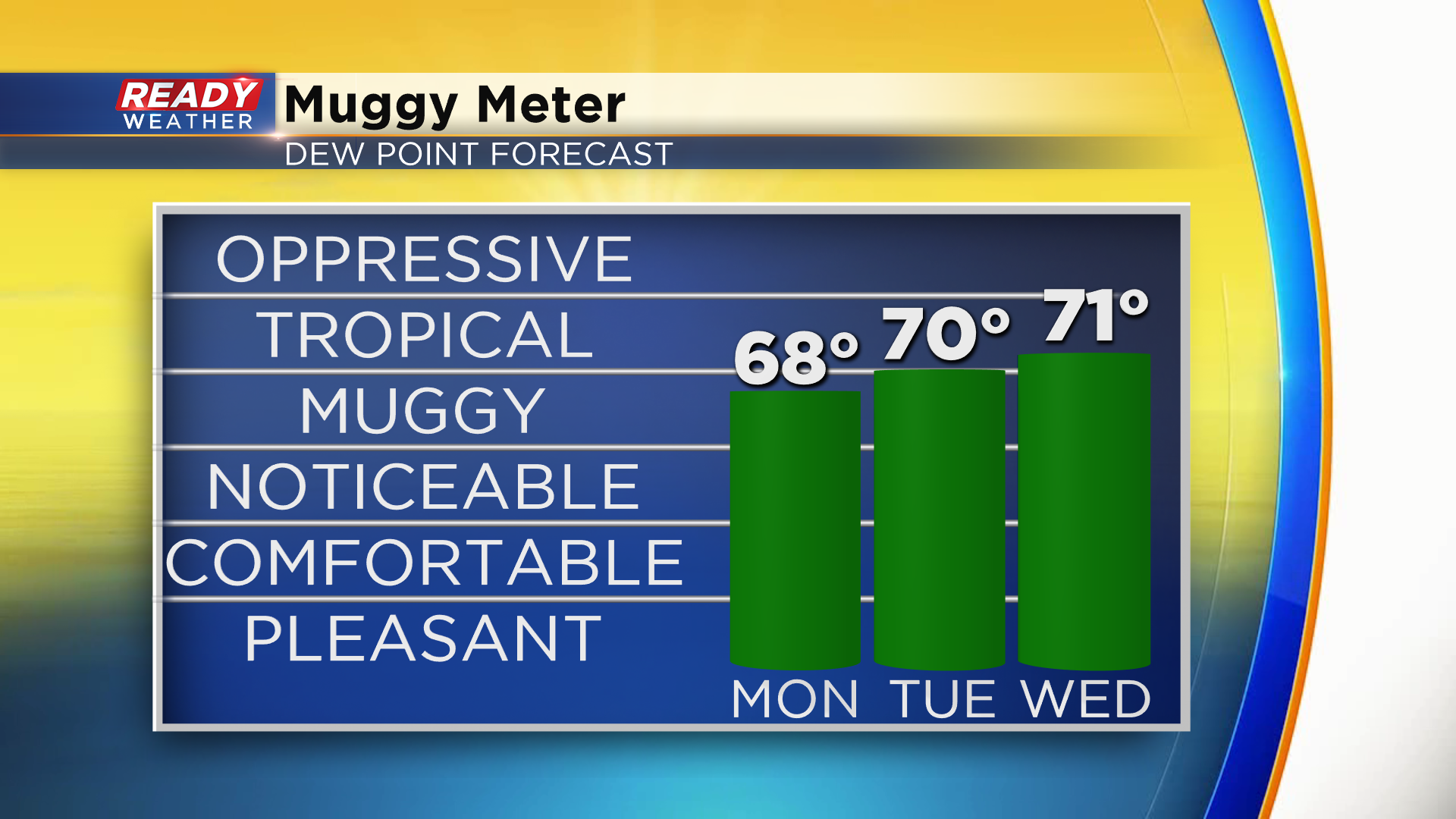
The worst of the humidity is expected Tuesday through Thursday as dew points climb into the 70s. Combine that with the 90 degree heat and it'll feel closer to 95-100° during the middle of the week.
With all of the heat and humidity in place, pop up storms will be possible in the afternoon Monday and Tuesday. Monday's storms will be similar to today's where they don't move much and drop a ton of rain, but severe weather isn't expected.
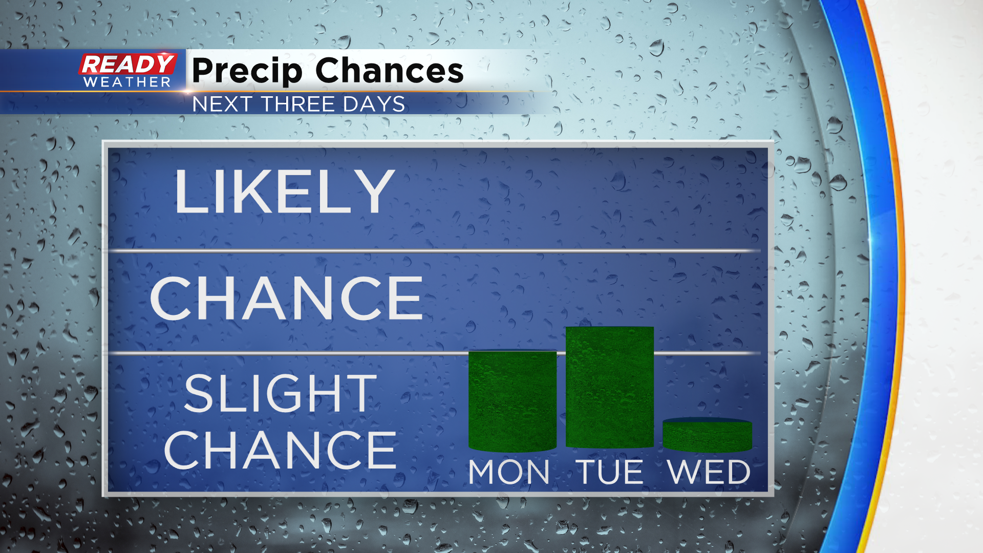
Best chance for scattered storms this week will come on Thursday as a cold front slides through the state. See if temps will cool down behind that cold front by downloading the CBS 58 Ready Weather App.