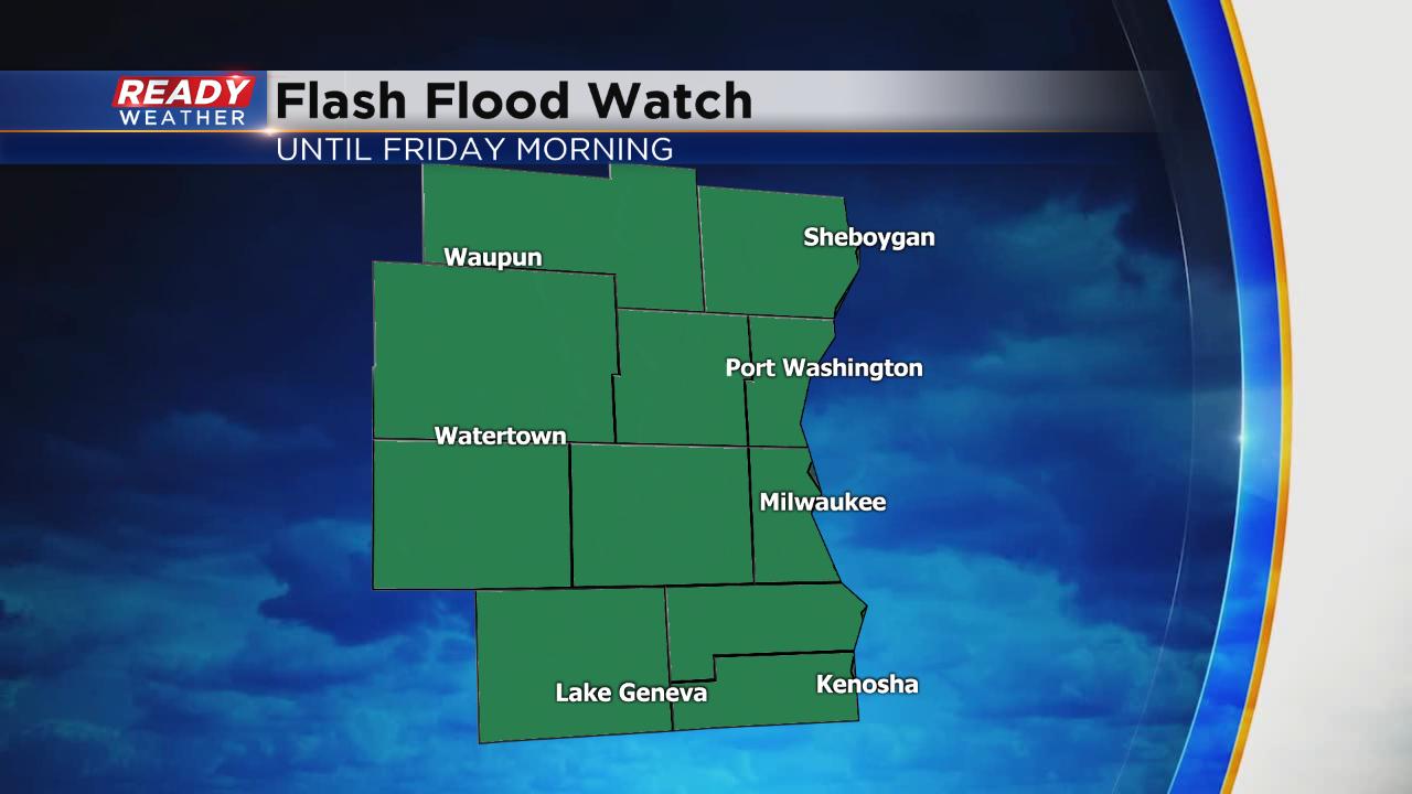
Flash flood watch issued; another round of heavy rain on the way


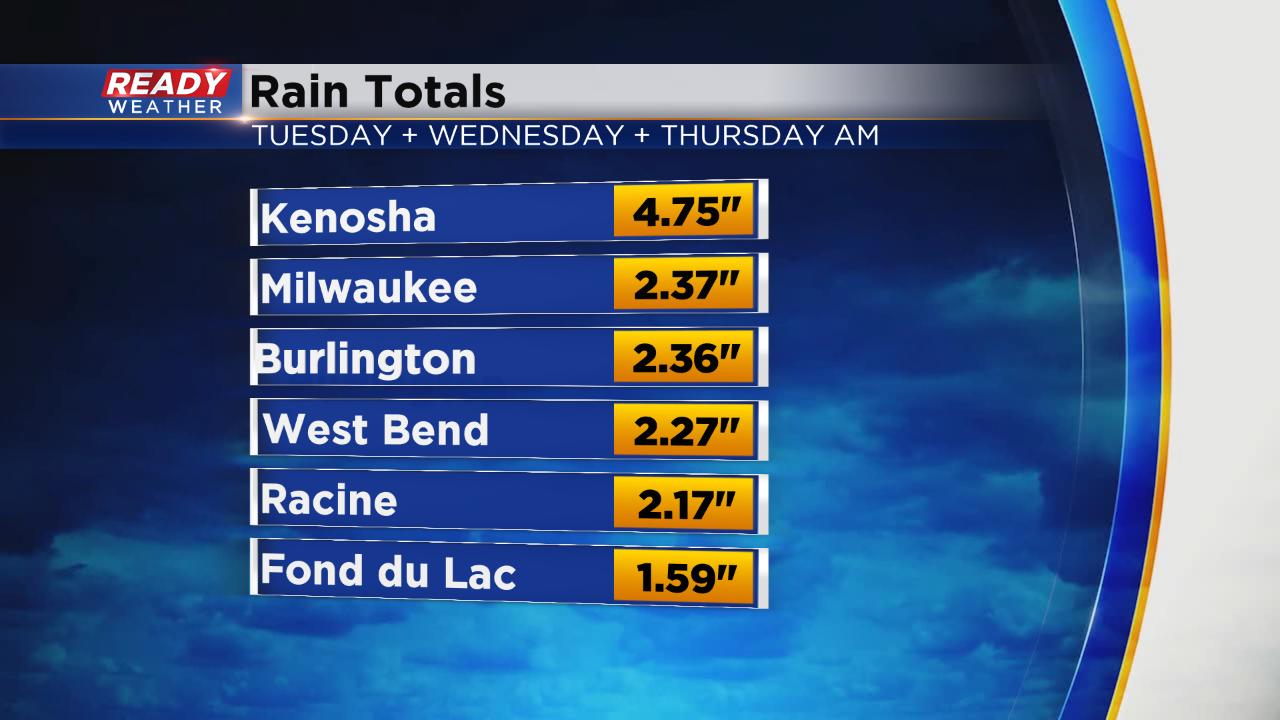
It's been a wet week in southeast Wisconsin. Since Tuesday some spots have picked up nearly 5" or 6" of rain and more is on the way.
A few showers and storms may be possible Thursday afternoon but the activity should be isolated. A little more activity is possible this evening with heaviest rain arriving overnight.

Another half inch to 2" of rainfall will be possible. Isolated spots may get more. The rain finally wraps up by mid-morning Friday with some sunshine returning Friday afternoon and most of Saturday.

An isolated strong storm may be possible Thursday evening and tonight but the threat for severe weather is not as high as it was on Wednesday. Heavy rain remains our biggest threat and because of additional heavy rain on top of the soaking we've already seen a flash flood watch has been issued for all of southeast Wisconsin through Friday morning. If you come across flooded roads remember to turn around and don't drown.
Download the CBS 58 Ready Weather App to track the storms and see when rain is most likely where you live.