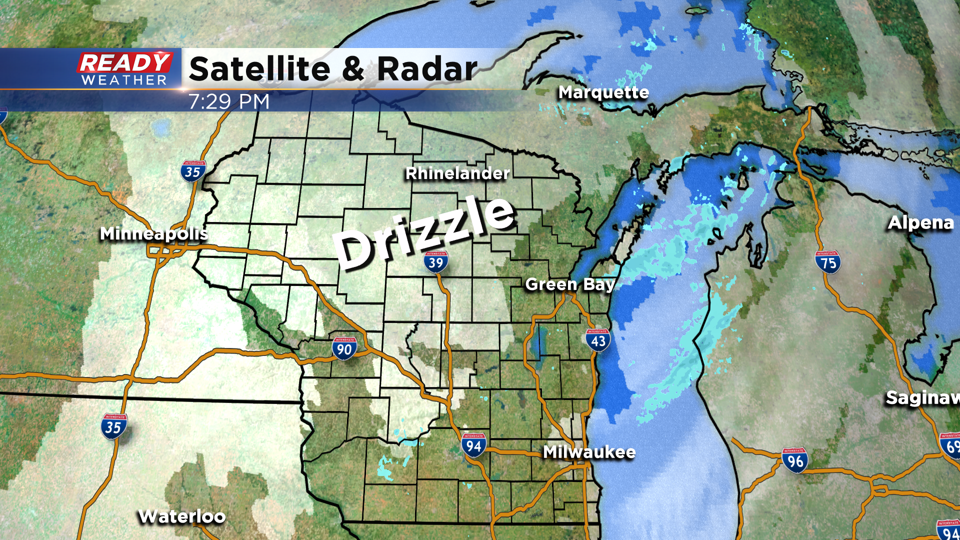
Drizzle and flurries expected overnight into Monday morning


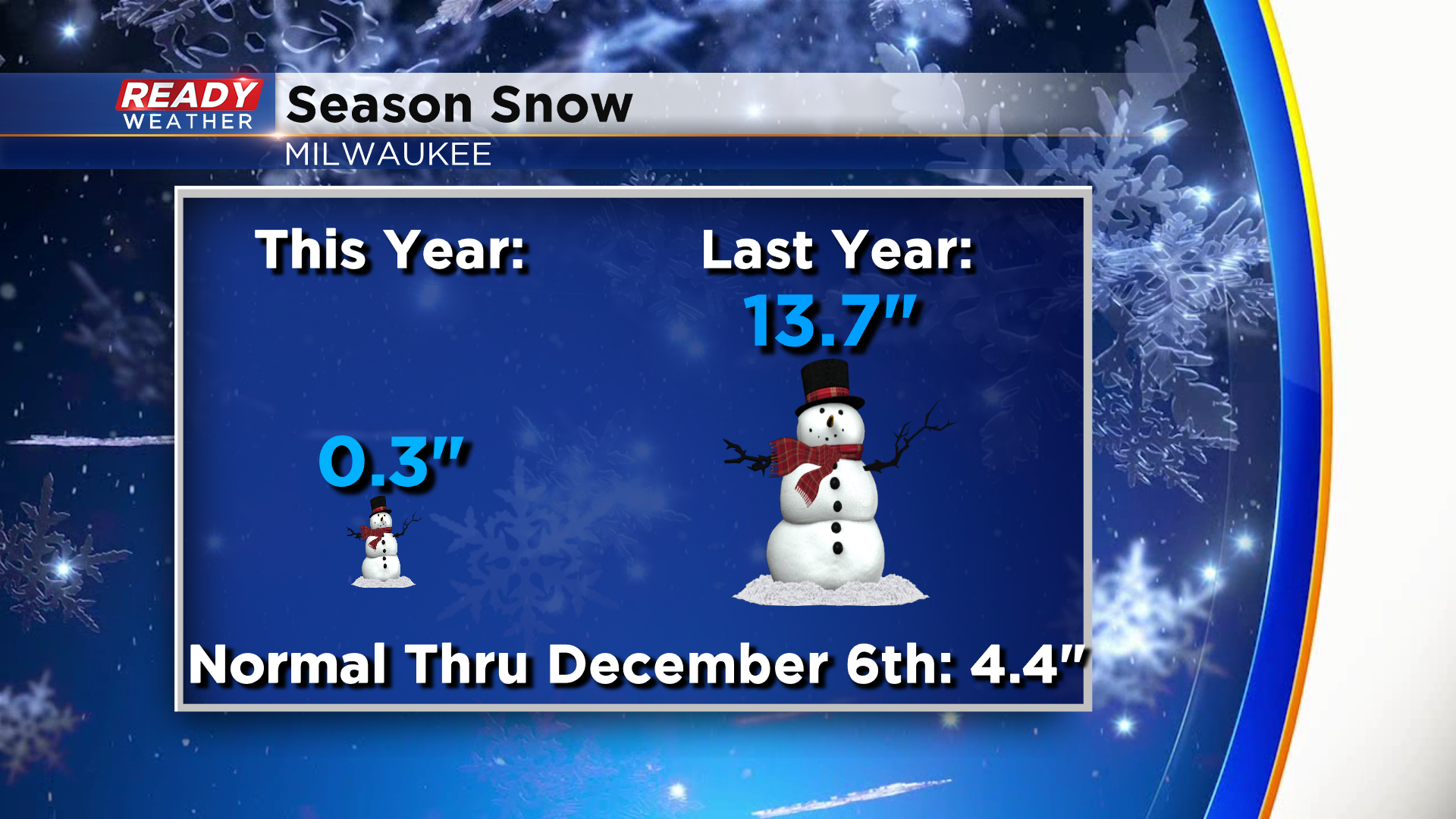
A few lake effect flurries were able to sneak onshore this morning and early afternoon, dropping 0.2" of snow at the airport in Milwaukee. This brings our season total (since October 1st) to a whopping 0.3". On average, Milwaukee usually has had around 4.5" of snow through today's date.
There's another batch of flurries and drizzle dropping in from northern Wisconsin, and this will push through overnight. While we aren't expected any snow accumulation, temperatures are sitting in the upper 20s to low 30s away from the lake, so the drizzle may create a few patchy slick spots overnight.
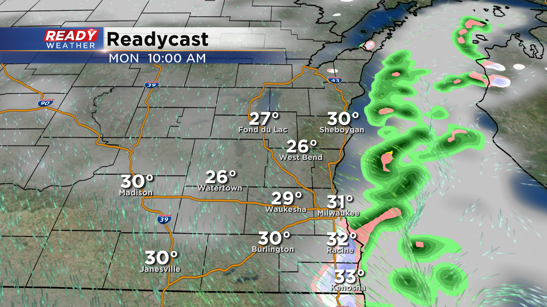
While inland spots dry out during the day on Monday, a few lake effect snow showers may come onshore during the morning hours along and east of I-94 from Milwaukee southward. Similar to this morning, the snow will reduce visibility and could make roads slick, but not much more than a dusting is expected.
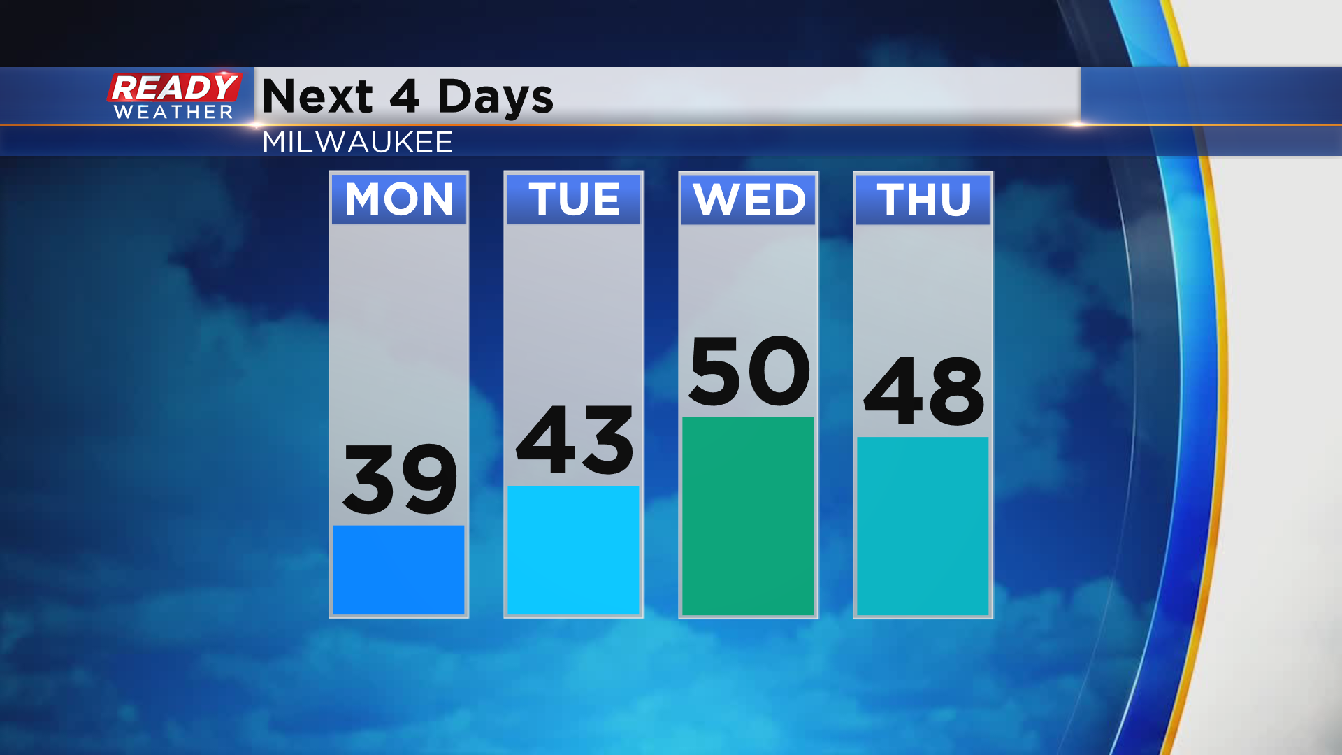
Winds will shift in the afternoon and send that precipitation back over the lake with a mix of sun and clouds expected for the rest of the day. We'll dry out and see more sunshine during the middle of the week with temps on a warming trend, reaching the upper 40s to low 50s Wednesday and Thursday!
It looks like our stretch of mainly quiet weather will come to an end by the end of next week as a larger area of low pressure takes aim at the Upper Midwest, bringing both a chance of rain and snow into the area. Download the CBS 58 Ready Weather App to track the flurries and drizzle through Monday morning.