


Updated as of 12:30 pm, Monday, December 6th
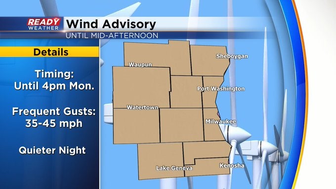
Our Wind Advisory is now in place until 4 pm. We'll continue to see gusts around 40 to 50 mph this afternoon as temps plummet behind an arctic front through the 20s. Bundle up and wear the layers since wind chill numbers will be in the single digits and falling fast. The winds should quiet down tonight but look for lows to be near 10 with negative wind chill numbers. We could see some light snow enter the forecast into tomorrow evening, especially north of I-94.
_____________________________________________________________________________________________________________
The wintry mix that brought Milwaukee it's first measurable snow of the season (0.1") has moved out of the area, but there are some slick spots out there this evening.
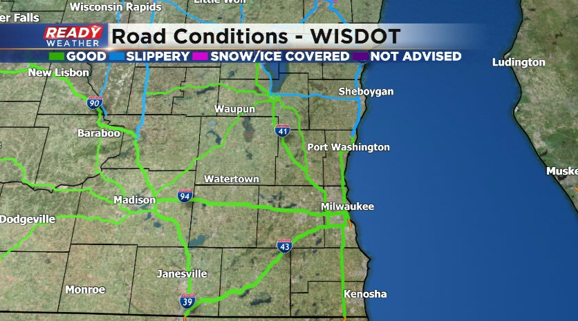
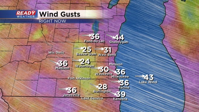
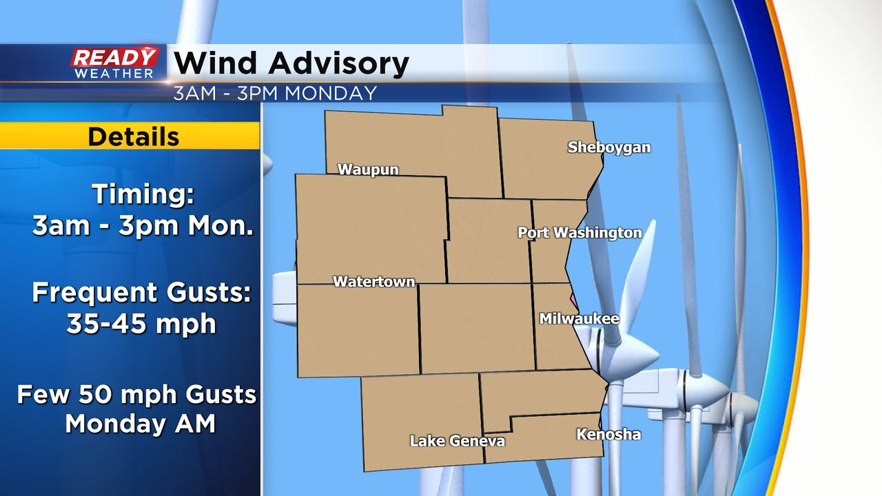
As puddles refreeze overnight there could be some more patchy slick spots early Monday morning, but main roads and highways will be fine. The bigger story heading into Monday morning will be the strong westerly winds that arrive behind the cold front. Wind gusts of 35-45 mph are expected early Monday morning, with a few gusts approaching 50 mph near the lake around mid morning.
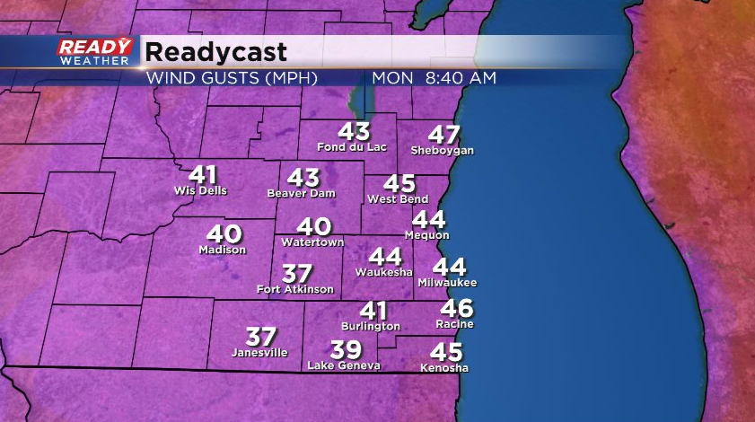
25-35 mph gusts will continue through the afternoon before subsiding in the evening. A Wind Advisory has been issued for all of southeast Wisconsin until 4pm Monday. High profile vehicles traveling north or south may have some difficulty.
That strong westerly wind will cause temps to drop throughout the day, with most of the day spent in the 20s.
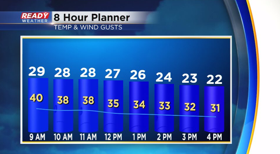
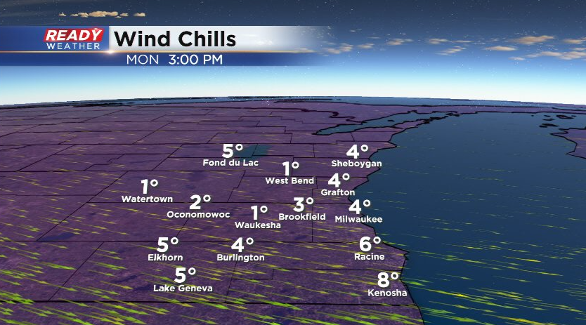
Factor in the strong wind and it'll feel like the teens in the morning and the single digits throughout the afternoon.
Actual air temperatures will drop to the single digits to around 10 degrees to start the day Tuesday and we won't climb out of the low 20s, but temps return close to normal by the end of the work week.
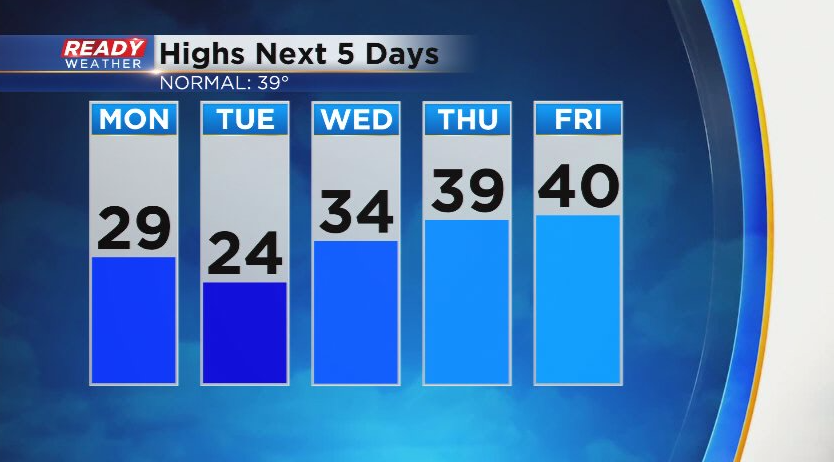
Thursday and Friday have the best chance at actual impactful precipitation this week in the form of both rain and snow. However, some flurries are possible Monday morning and again Tuesday evening into early Wednesday morning. Download the CBS 58 Ready Weather App to track temps and road conditions.