Chilly fall temperatures return close to their average arrival


The coldest air in a month rolled into southeast Wisconsin this week with lows dropping into the 30s and 40s Wednesday and Thursday mornings. Thursday was the coldest morning of the season and the coldest since the beginning of June!

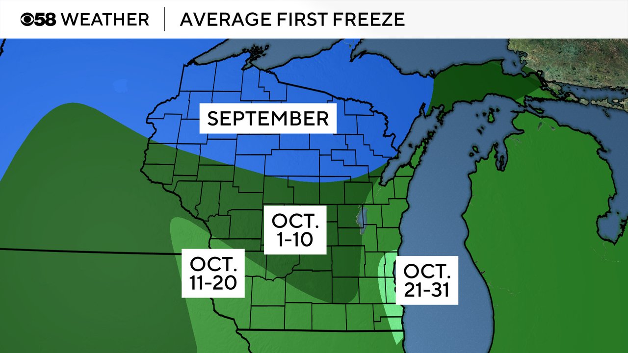
While we were in the 30s and 40s here in the southern part of the state, northern Wisconsin was in the 20s both mornings for their first freeze of the season. That's actually a little late for them to be seeing their first freeze. On average the first freeze happens in September up north. Central Wisconsin saw some frost this week but no widespread freeze even though the first week of October is when they experience the first freeze, on average. Here in southeast Wisconsin we typically see our first freeze on average during the second half of the month.
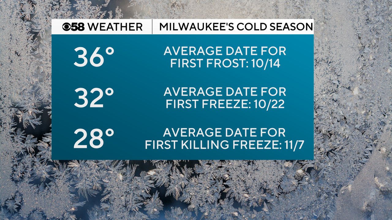
Milwaukee's average date for the first frosty temp of 36 degrees or colder is coming up quick on October 14th but we haven't even hit the low 40s yet. The average date for the first freeze is about a week later but the average date for the first killing freeze isn't until the start of November.
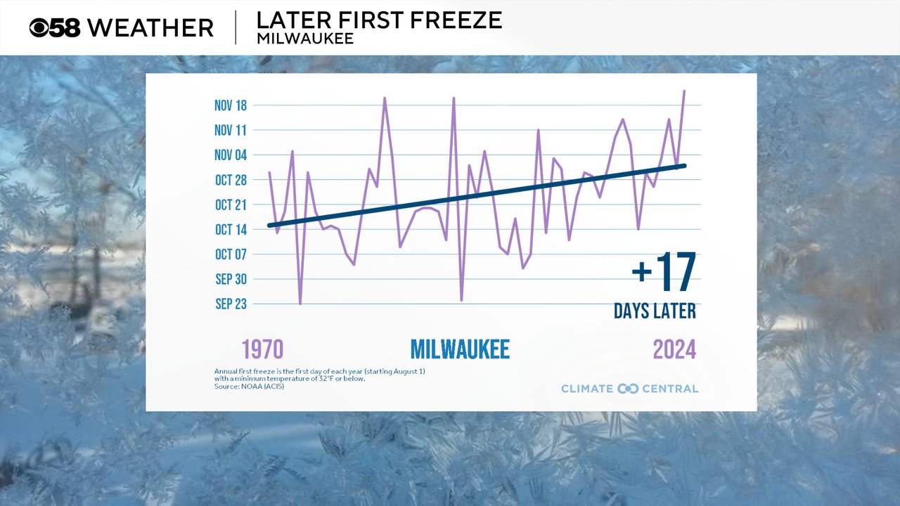
As our climate in Wisconsin continues to warm, our first freezes are happening later and later. While the average date for the first freeze now might be in the middle of October, some years it's been as late as mid November and comparing that to the 1970s when we had our first freezes in the middle of October we are average a first freeze about 17 days later now compared to 50 years ago.
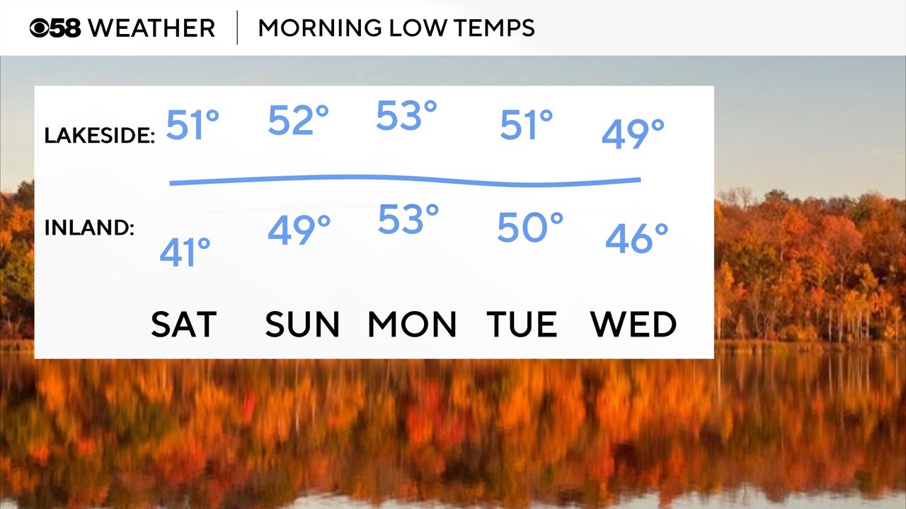
Lows might be a bit chilly Saturday morning, especially away from the lakefront where they will have more clear sky, in the upper 30s to around 40. Lakeside we should stay in the upper 40s and low 50s for lows from the middle of next week. Some inland locations even wake up around 50 for the start of next week.
Download the CBS 58 Weather app to track the next round of cold air on the 10-day forecast.