Another round of light, wet snow possible Friday morning


The clouds return to our area Thursday night with a mix of rain and wet snow looking likely early Friday morning. A band of wet snow looks to move in from the west around 3 am and will mix/change over to rain around sunrise for most. Any rain/snow looks to exit by 9-11am.
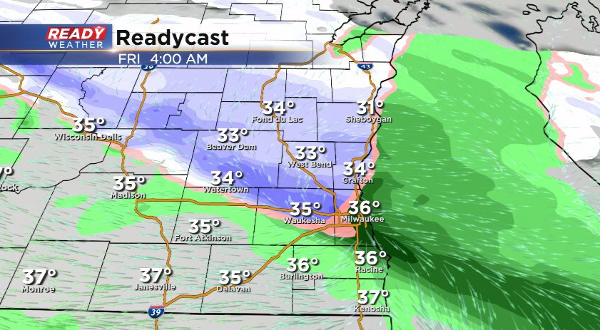
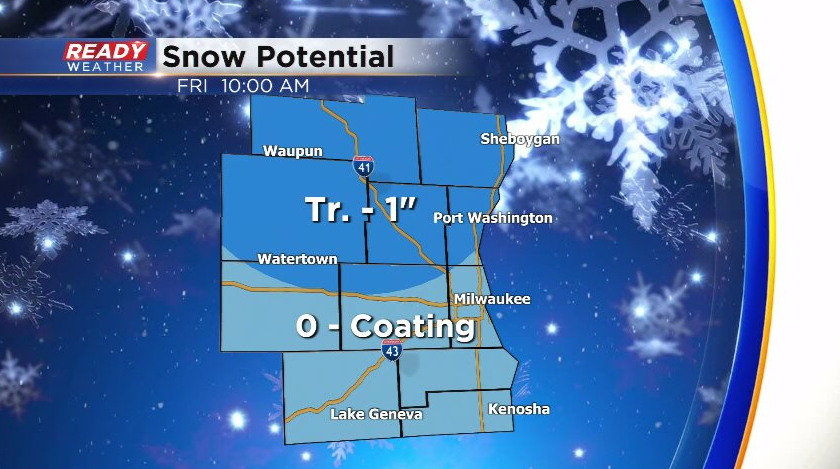
Some minor snow accumulation is possible for some communities, especially north of I-94 and away from the lake where a few tenths to up to an inch of snow may be possible. Most of the accumulating snow will stay on grassy surfaces. Roads in the Milwaukee and Waukesha metro areas should stay mainly wet but some slushy snow may be possible on roads in our northern counties.
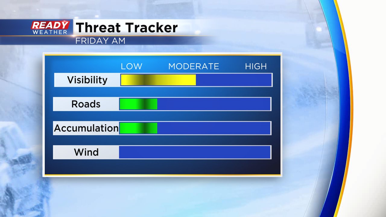
The impacts to the Friday morning commute will be fairly light but some moderate bands of snow could reduce visibility. Wind will not be an issue. After a gusty Thursday the wind is much lighter Thursday night and Friday.
Download the CBS 58 Ready Weather app to track the approaching snow.