Updated: 8:16 a.m. Aug. 17, 2023
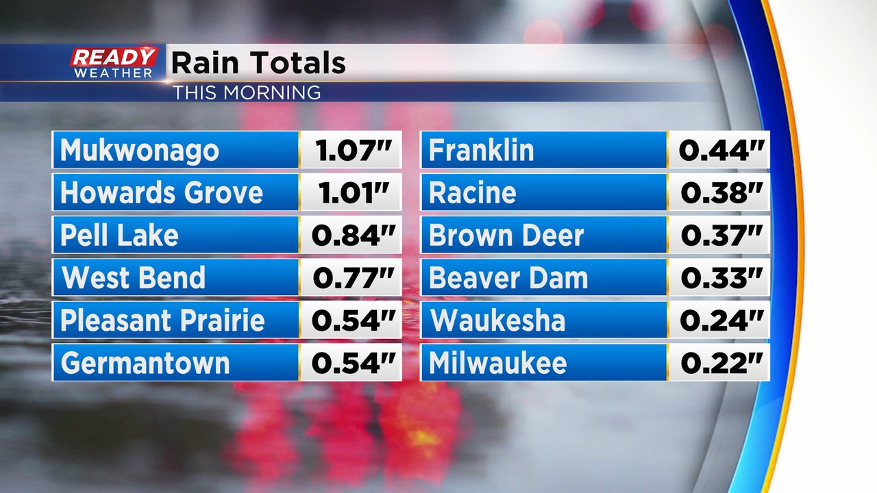
The round of storms for Thursday morning has ended. Most of southeast Wisconsin saw torrential rain, frequent thunder and lightning and some small hail. Rain totals from Thursday morning ranged anywhere from 0.25-1.00" bringing in another soaking rain.
------
Updated: 6:05 a.m. Aug. 17, 2023
The severe thunderstorm warning in Walworth County has ended. Some beefy thunderstorms are still in place from southern Milwaukee County to Lake Geneva and moving east. Lots of thunder and lightning with small hail are likely with the storms. Most of southeast Wisconsin should be done with the storms by 6:30 AM but some lingering showers are possible through mid-morning.

------
Updated: 5:34 a.m. Aug. 17, 2023
Our anticipated line of storms has arrived. It started rolling into our northwest counties around 2 AM Thursday morning with a beefy line of storms moving through the entire viewing area. Lots of thunder and lightning has been reported for all areas that see these storms and a few hometowns have reported small hail of pea or penny size.
A stronger storm has popped up near the WI/IL border with hail stones there the size of quarters which could do some minor damage. A Severe Thunderstorm Warning has been issued for this storm for southern Walworth County until 6 AM for hail the size of quarters.

Most of southeast Wisconsin should be done with the storms by 7 AM but a few showers behind the storms could linger through 9 or 10 AM.
------
Posted: 3:41 p.m. Aug. 16, 2023
We had soaking rain on Monday. Milwaukee broke the daily rainfall record which previously was .84" set in 1981 picking up 2.04" on the 14th. Many other locations across our viewing area saw over three and even four inches of what is needed rain. But with solid drought conditions in place that lead to flooding issues. Now we've had two days to dry out and we're eyeing our next rain chances which comes as a cold front blows through overnight into Thursday morning. While there is a threat for severe storms northwest of our area, the time of arrival here is at night with less intability to work with so although we could still have some gusty storms, severe weather is not anticipated. Here's the start time for this event.


