Winter weather advisory issued for heavy snow Friday


Updated: Thursday, March 21st 12:15pm:
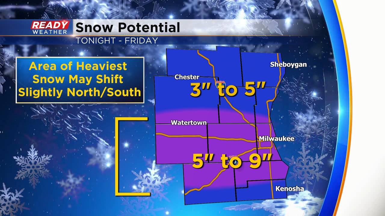
Data coming in this morning suggests a slight southward shift in where the heaviest snow band may set up Friday morning. Areas near and along the I-94 corridor may end up in the bullseye for this event, thus the 5-9" totals have shifted a touch farther south.
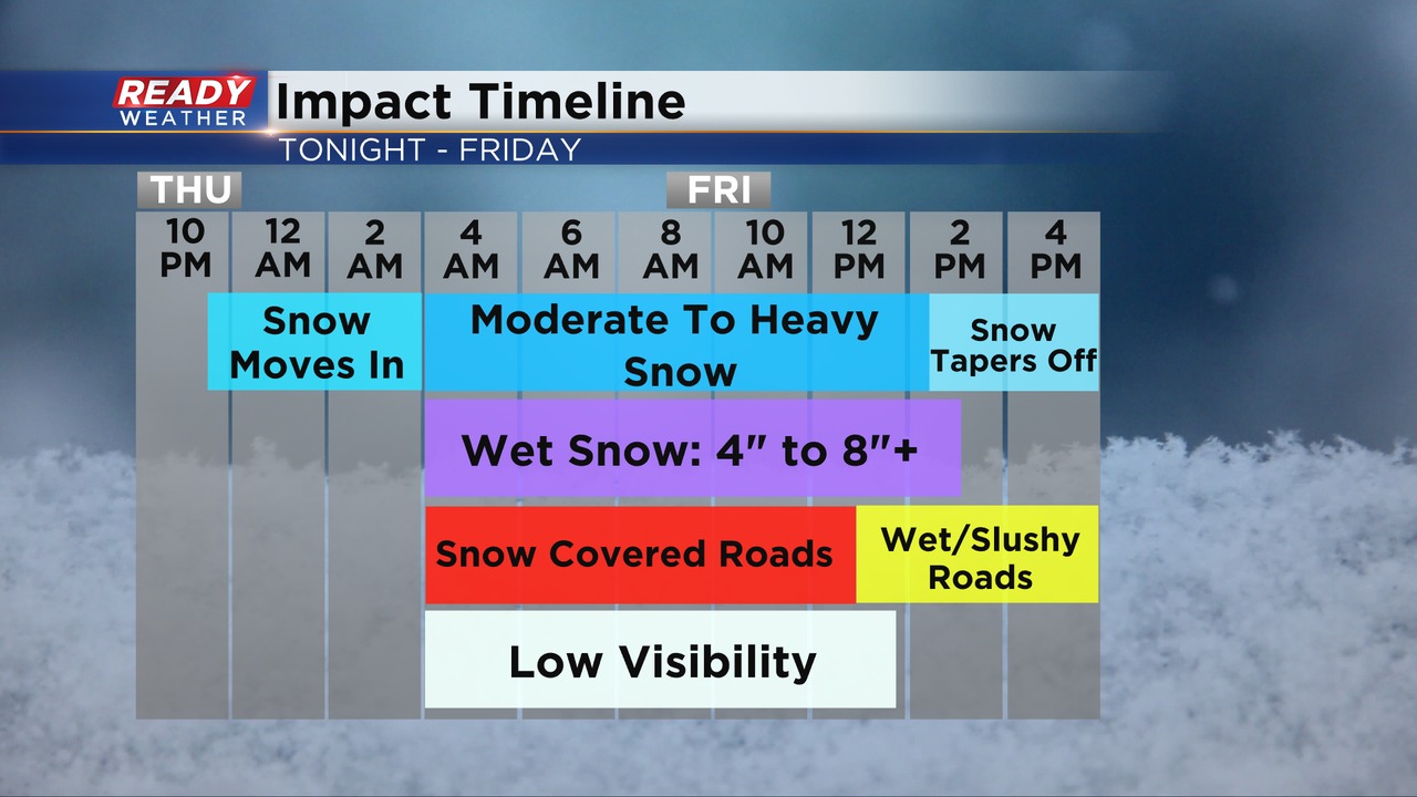
The overall impact timeline of this event has not changed. The main concern isn't the final snow totals, but how hard the snow will be coming down Friday morning, especially between 7-10am. Roads will improve in the afternoon as temps rise above freezing & the stronger March sun angle takes over.
The axis of where the heavy band of snow sets up may still shift north or south, so continue to check back for updates.
------------------------------------------------------------------------------------------------------------
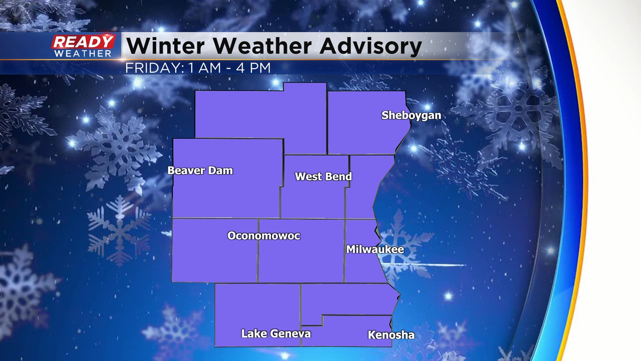
It's been 35 days since southeast Wisconsin saw an inch or more of snowfall but that could change in a big way to end this week. A winter weather advisory has been issued for Friday for all of southeast Wisconsin. That advisory starts at 1 AM and lasts until Friday afternoon.
The snow starts around or just after midnight Thursday night and quickly becomes steady and heavy during the early morning hours of Friday. The heaviest snow is expected from mid-morning through the early afternoon. Travel is not advised during this time.

Snow totals have increased from what we showed you on Wednesday. Over 5" with the potential for as much as 9" is possible for a good swath of southeast Wisconsin including the cities of Milwaukee, Waukesha, West Bend, Beaver Dam, Port Washington. Some of our far northern hometowns and our southern counties will see the least with 2-5" expected in those communities.

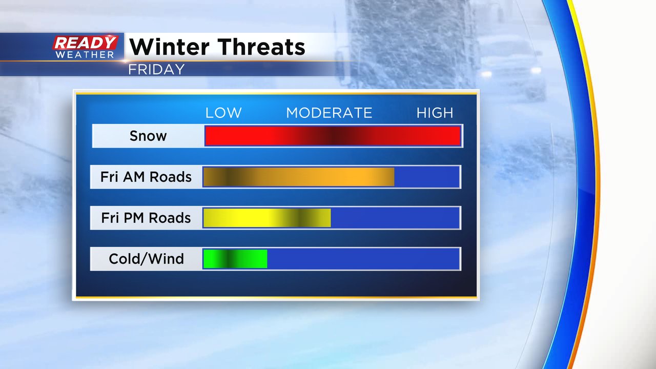
The snow will come down fast and furious leading to pretty significant impacts to the Friday morning commute. The late afternoon and evening commute will be better but slushy and slick roadways are still expected. Thankfully cold and wind will not be a big factor with this storm. If were planning to travel on Friday for spring break either move your plans up to leave Thursday evening or wait until Friday afternoon.
Download the CBS 58 Ready Weather app to track the snow as it arrives with the interactive radar.