Wind chills drop Thursday night after fresh blanket of snow


All of southeast Wisconsin woke up to a fresh blanket of snow Thursday morning. A few moderate areas of snow pushed through Wednesday night with snow exiting the area by 10 a.m. in southeast spots. Snow totals are still coming in but most spots picked up 2-4" of snow with isolated locations seeing a little more.

The snow threat the rest of Thursday remains low but wind gusts are still above 35 mph causing blowing and drifting snow that will linger through the morning if not beyond. Temperatures dropped overnight and will hang out in the low to middle teens most of Thursday.

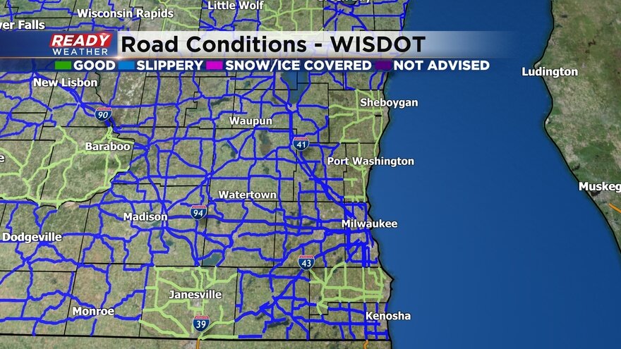
Roads were in rough shape Thursday morning but are slowly starting to improve and should get better as the day goes on. Here's a map of road conditions that will update with time:
In the record books the high on Thursday will go down as 29° which is that the temperature registered just after midnight. Then the arctic front pushed through dropping the temp about 15° in a few hours. Even though afternoon highs will stay in the teens officially it will not be our first high in the teens this meteorological winter.

So far this season the coldest high temperature happened way back in Fall on November 12 when it only reached 19°. The coldest our low temp has been this season in Milwaukee is 5° on January 19. Friday will likely break both of those with a low hovering around 0° in Milwaukee and only reaching 17° during the day. Milwaukee will come close to going below-zero Friday morning and if it did it will be the first time since the temp hit -5° on March 4, 2019.

No wind chill advisory has been issued yet but the National Weather Service is considering one for Friday morning. Between a lighter wind and temperatures well below-zero inland wind chills could get as cold as -15° or -20°.

Download the CBS 58 Ready Weather App to how cold it gets where you live on the hour-by-hour forecast.