Afternoon Update: Today's rain changes to wet snow for the Thursday morning commute


Updated: Wednesday, March 30th 3:10 pm:
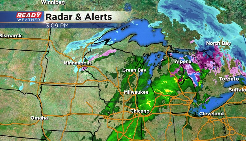
Showers have moved back into southeast Wisconsin this afternoon and will continue into this evening.
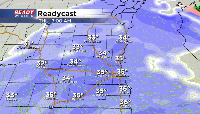
The low pressure system will track across the area tonight and strengthen while doing so, allowing colder air to wrap in on the backside of this system early Thursday morning. This will change the rain to sleet then wet snow from west to east with moderate snow likely throughout the morning commute.
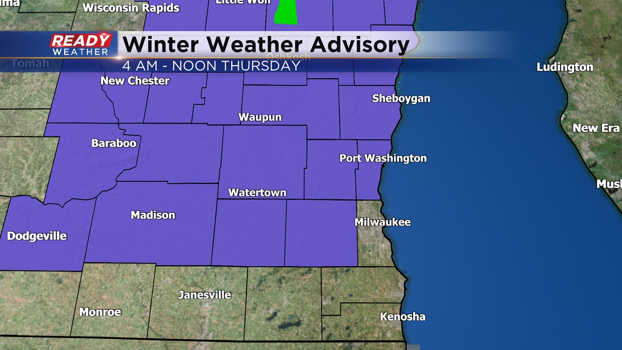
Most of the accumulation will be on the grass, but slushy spots are likely on area roads during the morning commute with slick spots north and west of Milwaukee, along with low visibility. A Winter Weather Advisory has been issued for Waukesha, Washington, Ozaukee, Dodge, Sheboygan, Fond du Lac, and Jefferson counties from 4am - Noon Thursday.
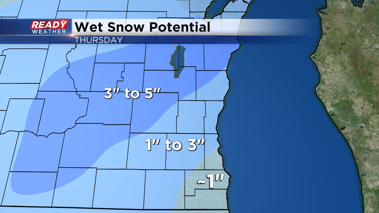
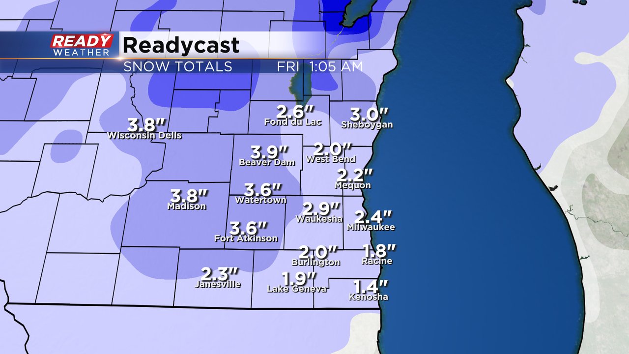
This is where snow totals may reach or exceed 3". Most of the Milwaukee metro will end up with an inch or so. Plan on a slower Thursday morning commute.
Snow will taper off heading into the afternoon, and with temps in the upper 30s to around 40°, most of what falls in the morning will melt during the afternoon. Download the CBS 58 Ready Weather App to track the road conditions.
----------------------------------------------------------------------------------------------
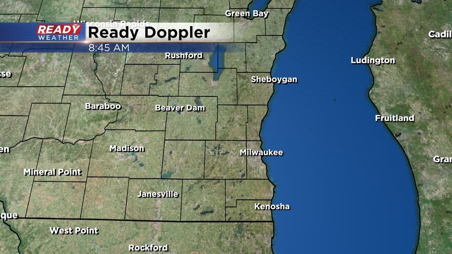
A few scattered showers and rumbles of thunder started to roll into southeast Wisconsin Tuesday evening. Rain totals so far haven't been too impressive with most seeing 0.10-0.25" of overnight rain. We will see some dry breaks off and on throughout the day. Here's a check of radar that will update with time:
The afternoon and evening is looking a little bit soggier with steady rain and a few embedded thunderstorms. That rain chance will continue through the first part of Wednesday night.
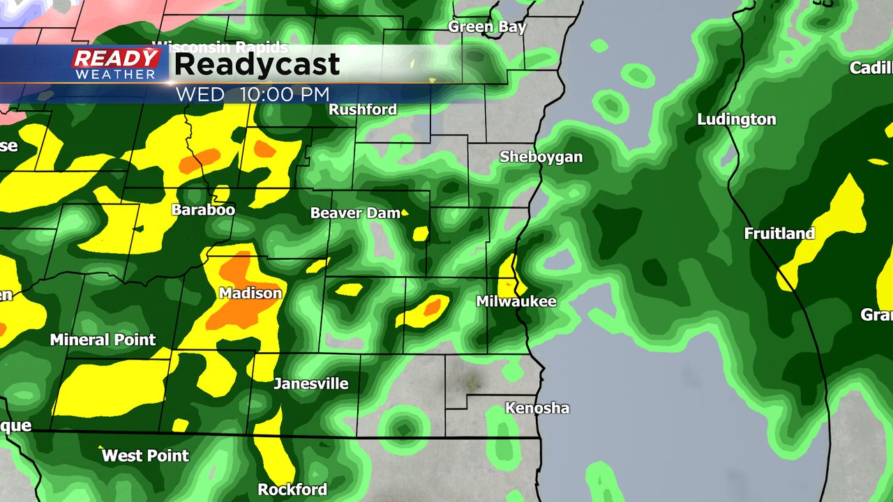
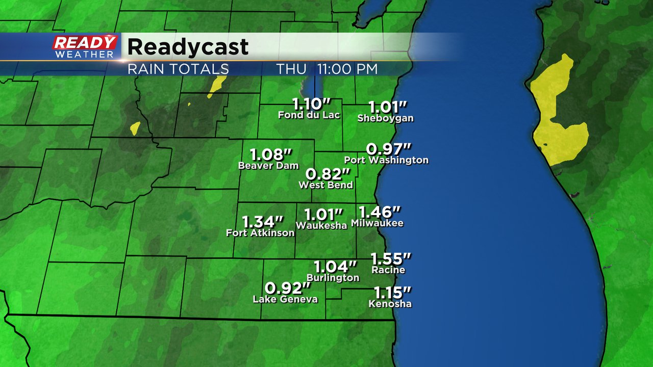
We are still looking at a good soaking rain with anywhere from 0.75-1.50" of rain possible. Communities that see thunderstorms could get up to 2" of new rainfall which will continue to ease our drought conditions.
By Thursday morning the rain will start to switch over to snow. That changeover looks to happen between 3 and 6 AM Thursday morning. Some steady, heavy, slushy snow is possible for the morning commute Thursday.

The chance for accumulating increasing snow is more and more likely. Most of the accumulation will happen on grassy surfaces but some slushy road accumulation is possible. Most of the accumulating snow will happen in the morning with light snow showers lingering throughout the rest of Thursday. Some southeast counties may only get a few tenths of slush but other areas north and west of the Milwaukee metro could get a few inches of slush.
Any snow that does fall will likely melt by the end of Friday with highs in the 40s and good sunshine. Download the CBS 58 Ready Weather app to track the rain and storms and switch to snow.