Transitioning from a wintry mix to strong storms to end the work week


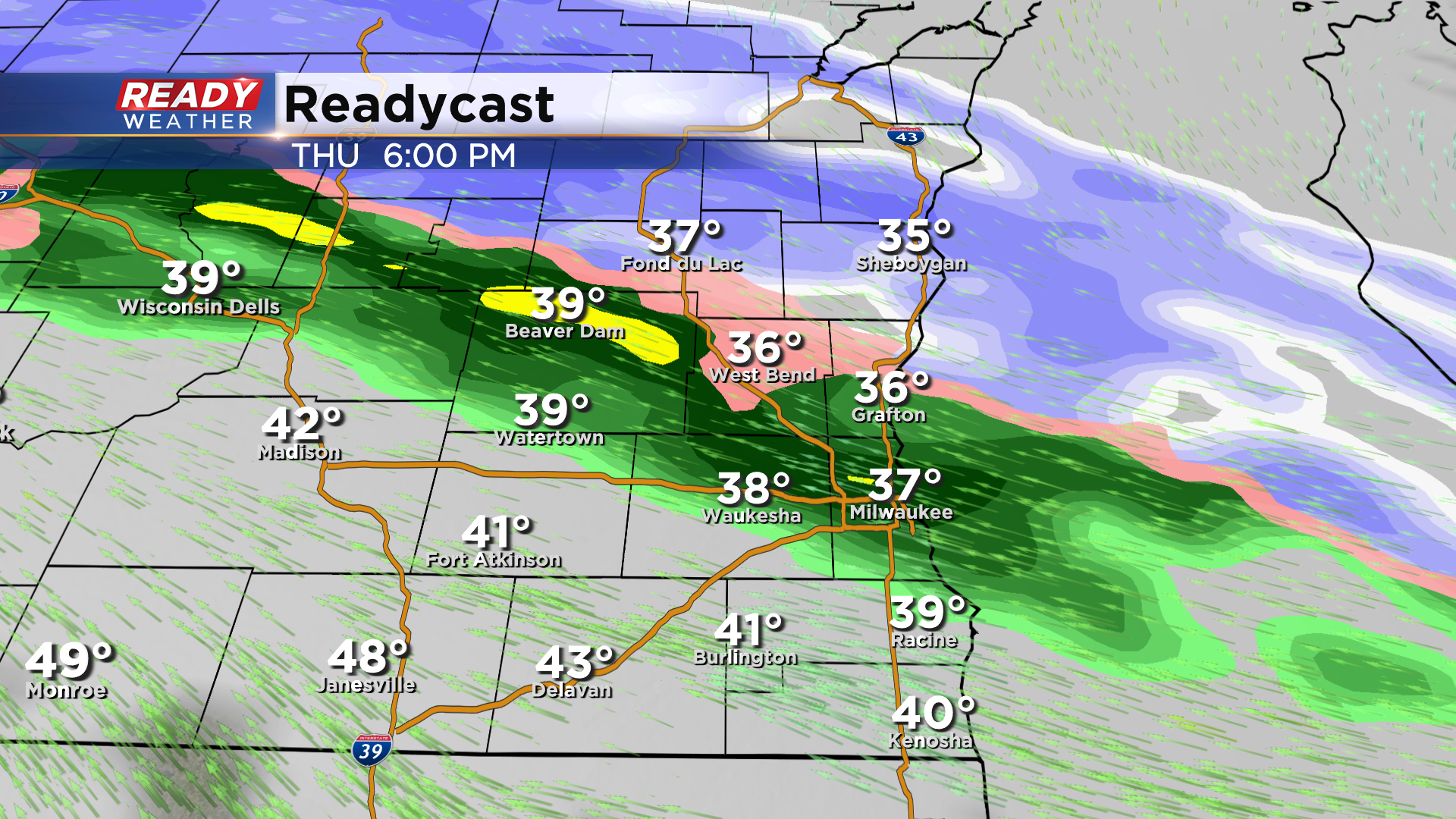
A cold front pushed across southeast Wisconsin early this morning, and with high pressure settling in we'll be dry and quiet for the rest of the day into tonight. Meanwhile, a low pressure system will be developing in the northern plains, pumping clouds back into the area on Thursday. By late Thursday afternoon, a band of wintry mix will lift across the area, but little to no impacts are expected as temperatures will continue to rise.
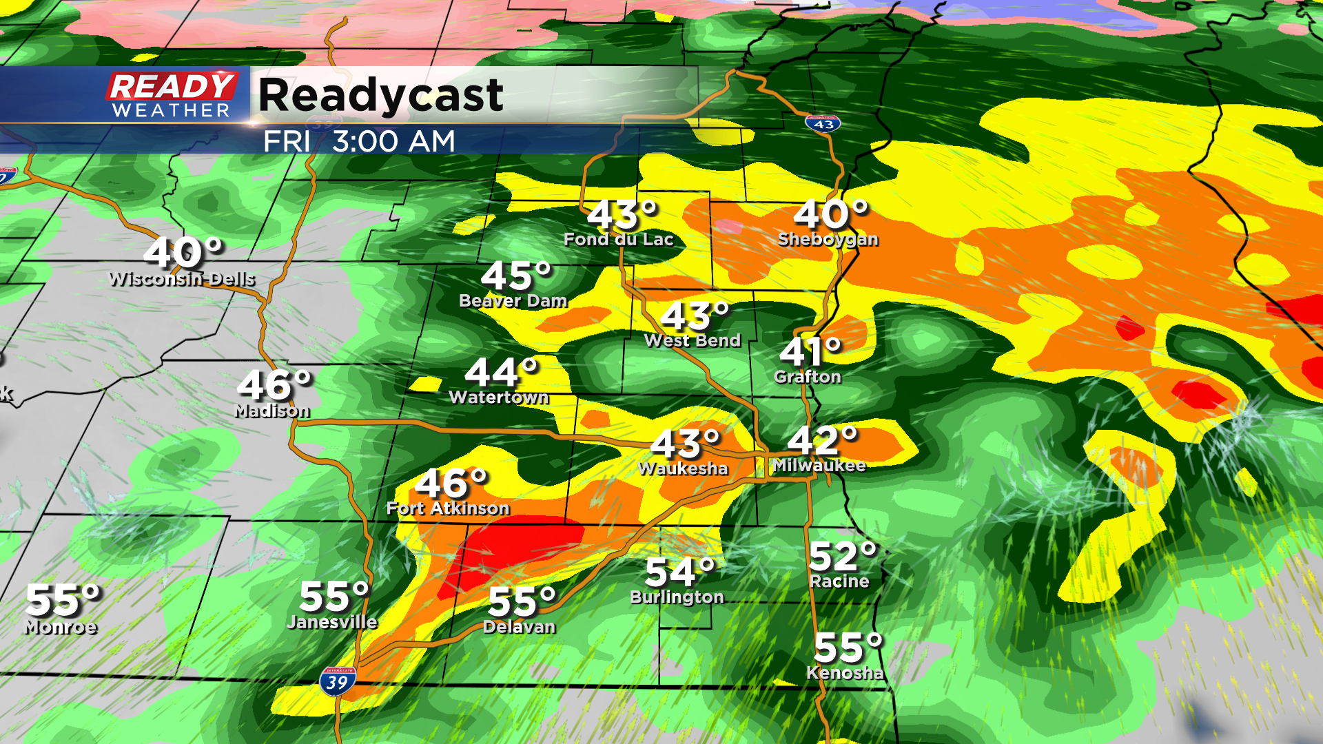
Temps will continue rising Thursday night as a warm front works into the area. This will trigger a batch of scattered thunderstorms Thursday night into early Friday morning. We can't rule out some small hail in these storms, but they should be sub-severe.
The better chance for strong to severe storms arrives later Friday. We could have several hours of dry weather Friday morning into the afternoon before storm chances return late afternoon through late evening. Severe storms are expected to develop in Iowa during the afternoon and congeal into a squall line that tracks across SE WI during the evening.
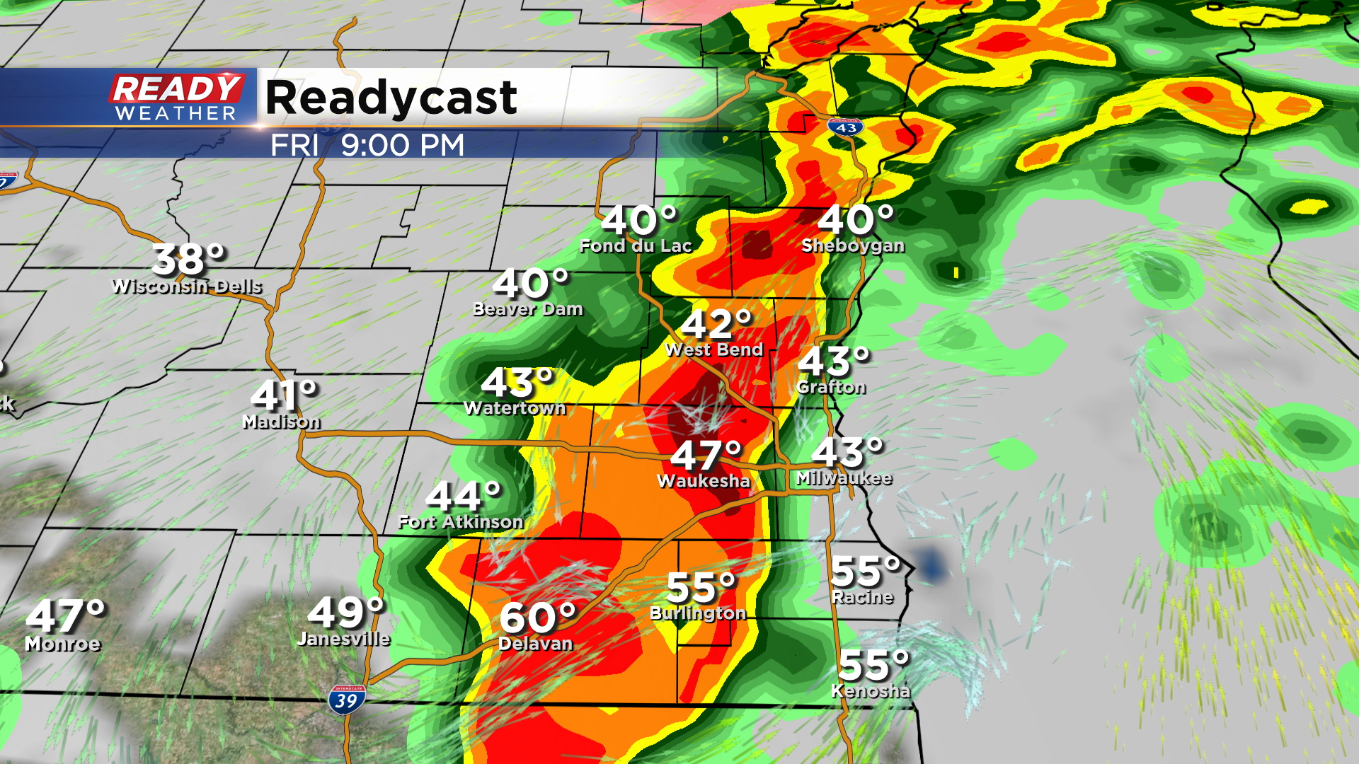
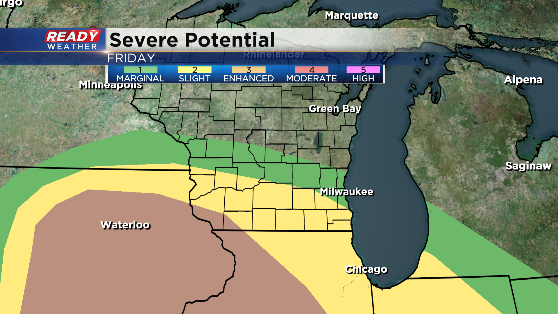
There is some uncertainty in the extent of strong to severe storms due to the placement of the warm front. This time of year, warm fronts struggle to make it this far north due to the chilly waters of Lake Michigan. At this time, the closer you are to the Illinois border and the farther away you are from Lake Michigan, the better your chance at severe storms Friday. This is reflected in the latest SPC severe storm outlook, which has places south of I-94 in the level 2 of 5, Slight Risk, while Milwaukee northward is in the lower, level 1 of 5, Marginal Risk.
Damaging winds and hail will be the primary threats, but we can't rule out an embedded tornado. The higher tornado threat will likely set up across portions of Illinois. With how fast these storms will be moving, the flooding threat is low.
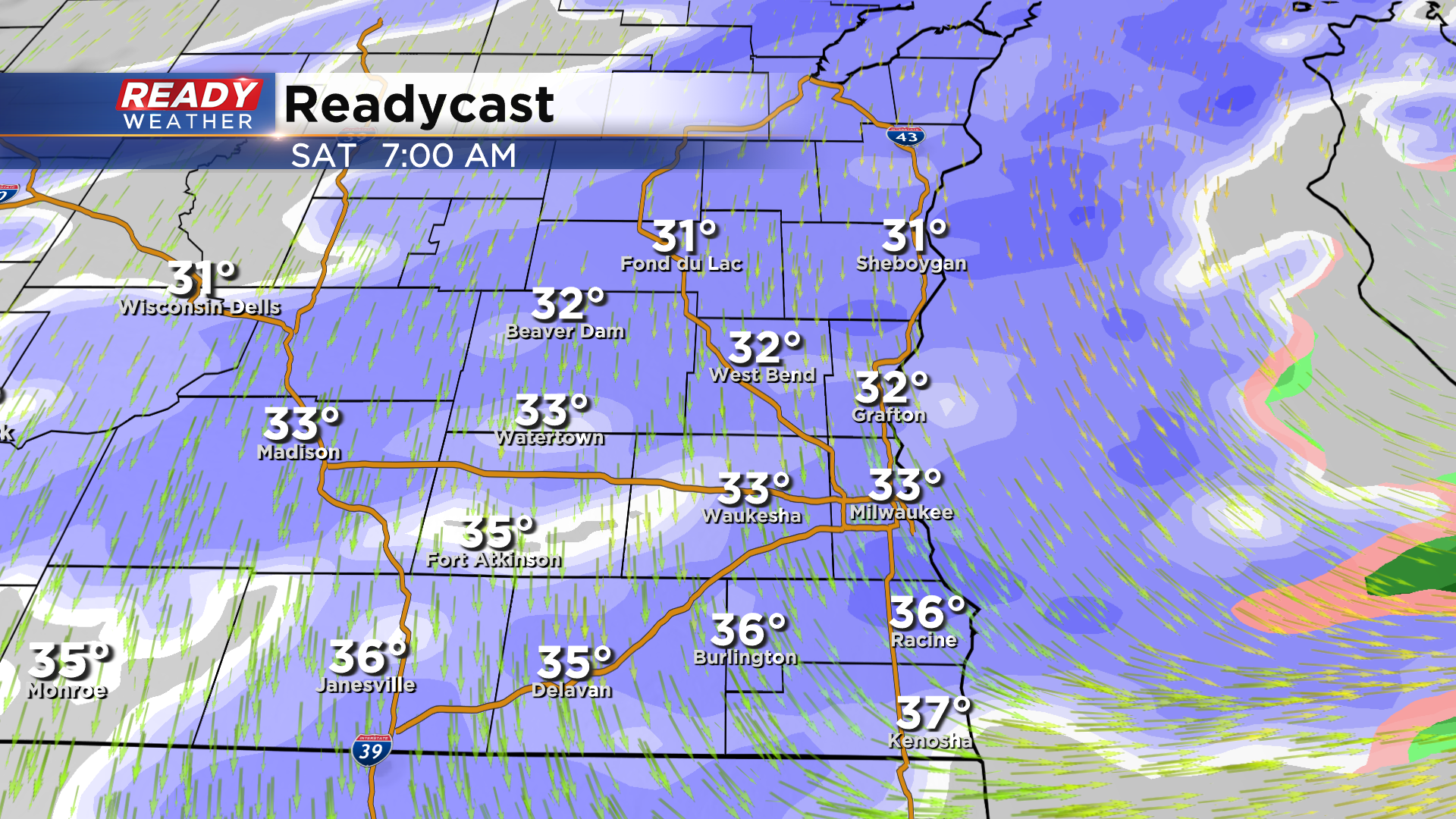
It wouldn't be spring in Wisconsin if this system didn't bring us snow on the backside, which is what will happen Saturday morning. Thankfully the snow looks wet so an inch or less is expected before it end Saturday afternoon.
It will be an active next few days, so make sure you download the CBS 58 Ready Weather app to get any alerts and warnings sent directly to your phone.