Storms Turn Severe This Afternoon


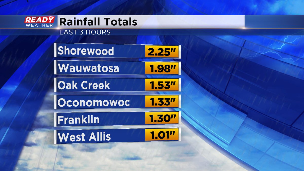
At the end of our hot and humid streak, storms have fired this afternoon across southeast Wisconsin, some severe. The storms have had plenty of heat to work with as temperatures peaked in the low 90s today with dew points in the 70s. As a cold front moves down across the state, clashing into this sultry air mass, storms have erupted. With the high dew points, heavy rain has been an issue. Take a look at rainfall in just a short time from a sample of locations:
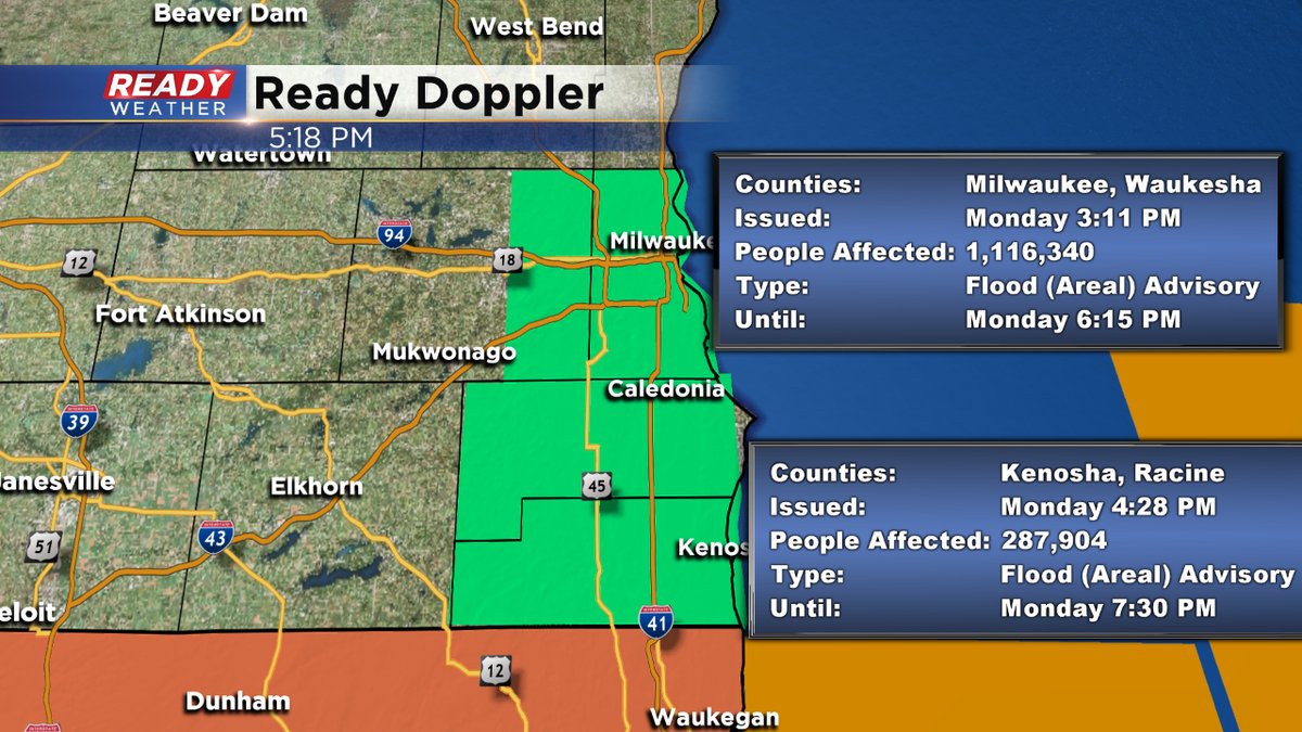
Due to the heavy rain with these storms, we have Flood Advisories for the heart of the viewing area:
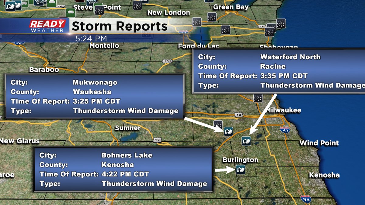
There have also been a handful of thunderstorm wind damage reports:
While the main line of severe storms has dropped southeast of the area, additional storms are still brewing. We continue to monitor the radar for stronger storms this evening.
I'm meteorologist Rebecca Schuld