
High pressure continues to hold in control of our weather keeping us quiet yet again today. Because of the way this system moves, a southeast wind continues to push in for this Thursday. This will bring slightly above average temps yet again but also keep temps near the Lake a touch cooler than further inland.
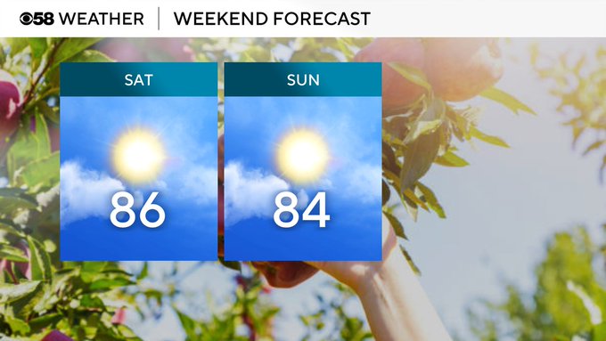
Low pressure is developing to our west, and while this unfortunately won't bring an end to our dry stretch, it will bring in some more clouds but also bring in a southwest wind! This will push more heat and even a touch of humidity in for the next 3 days. Highs will be back into the mid-80s, and we will be on record watch! The chance to tie or even break record highs for Friday through Sunday is possible. We could even potentially break our warmest October day ever on record which is 89 degrees from back in 1963. A 90-degree day has never been recorded in October for the city of Milwaukee.
This heat and humidity will help fuel our next round of rain and possibly some thunderstorms by Monday and continue into Tuesday. Behind this rainy system, we will turn quiet, but also a northerly wind will return cooling us back into the 60s for the middle of next week.
