Southern counties have best chance for some snow Friday


A headache of a forecast is on the way for the end of the work week. Huge differences in the storm track between weather models mean confidence is low on who gets snow in southeast Wisconsin and how much. A majority of weather models have trended towards a farther south track which would give southeast Wisconsin less of a chance for snow.
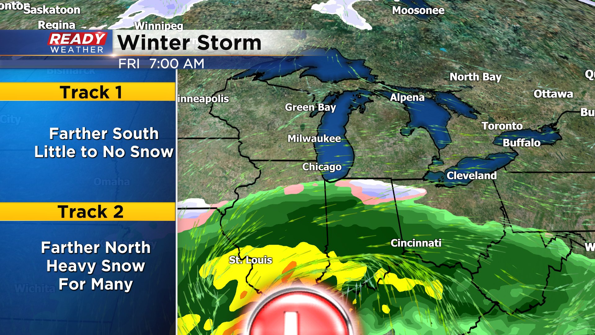
However, there are still some outlier models showing a farther north track that brings in the chance for heavy snow in most of southeast Wisconsin.

If snow does indeed fall in southeast Wisconsin it likely misses the morning commute with better chances for snow in the mid to late morning hours through the afternoon then ending around dinnertime. Northern and western counties such as Fond du Lac, Sheboygan, Dodge, Washington and Jefferson Counties have little to no chance for snow.
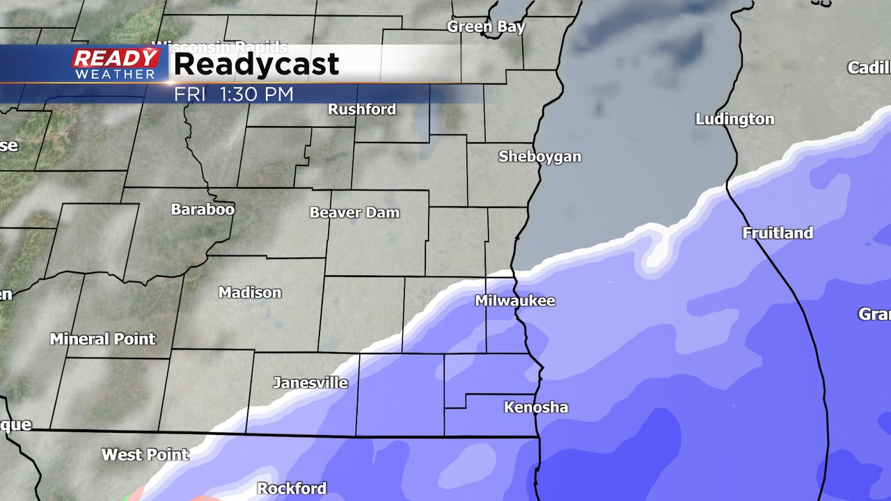
Hometowns closer to the Illinois border have the best chance to see some snow with up to 2" possible south of a line from Mequon to Waukesha to Whitewater.

Expect changes to this forecast as the track of the storm continues to shift. Download the CBS 58 Ready Weather app to keep track of those changes.