


A long lasting storm system is currently moving across the Upper Midwest. That storm stared in Wisconsin on Sunday with some scattered snow showers. A few communities picked up a dusting of snow and some northern counties saw a few tenths of an inch. Sunday night we were in the dry part of the storm and as of Monday we are on the warmer side of the storm with some scattered showers.
Here's a radar image that will update with time:
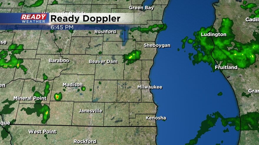
Scattered showers are likely for the morning and afternoon but the best chance for some steady rain will be in the evening through Monday night into early Tuesday morning. Then more scattered showers are likely the rest of Tuesday with most of the rain wrapping up by dinnertime Tuesday.

Rain totals for Monday and Tuesday look soggy. All of southeast Wisconsin can expect at least a half inch of rain with most hometowns closer to a full inch or even 1.50" of rain.

In addition to all of the rain it's also going to be a couple of windy days. The wind will gust to 30 mph Monday and Tuesday and could be at their highest strength Monday night with gusts getting close to 40 mph. The breeze will linger into Wednesday to 20 mph.

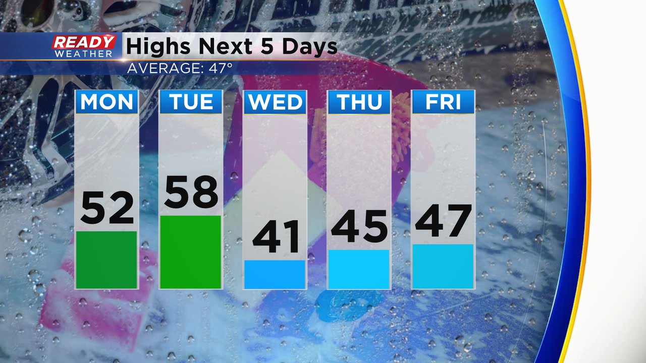
At least with all the rain and wind, the temperatures will stay mild. High temperatures Monday and Tuesday will warm up into the 50s. 40s for highs on the way from Wednesday through Friday.
Download the CBS 58 Ready Weather app to track the rain with the interactive radar.