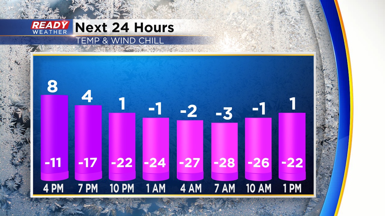
Evening Update: Dangerous cold has arrived. Snow coming to an end.


Updated: 8:000 p.m. Dec. 22, 2022
Snow is still hanging on across portions of the area. The snow should come to an end by 10 pm. Roads have become very slick, so use caution if you are heading out. Roads aren't expected to improve with the bitterly cold arctic air.
Once the snow moves out it's all about the brutal cold. Temperatures will drop below zero tonight; however, wind chills will drop from -20 to -35 below. Unfortunately, the cold will linger through the weekend. Winds will gust as high as 50 mph on Friday!
______________________________________________________________________________________________________________
Updated: 5:30 p.m. Dec. 22, 2022
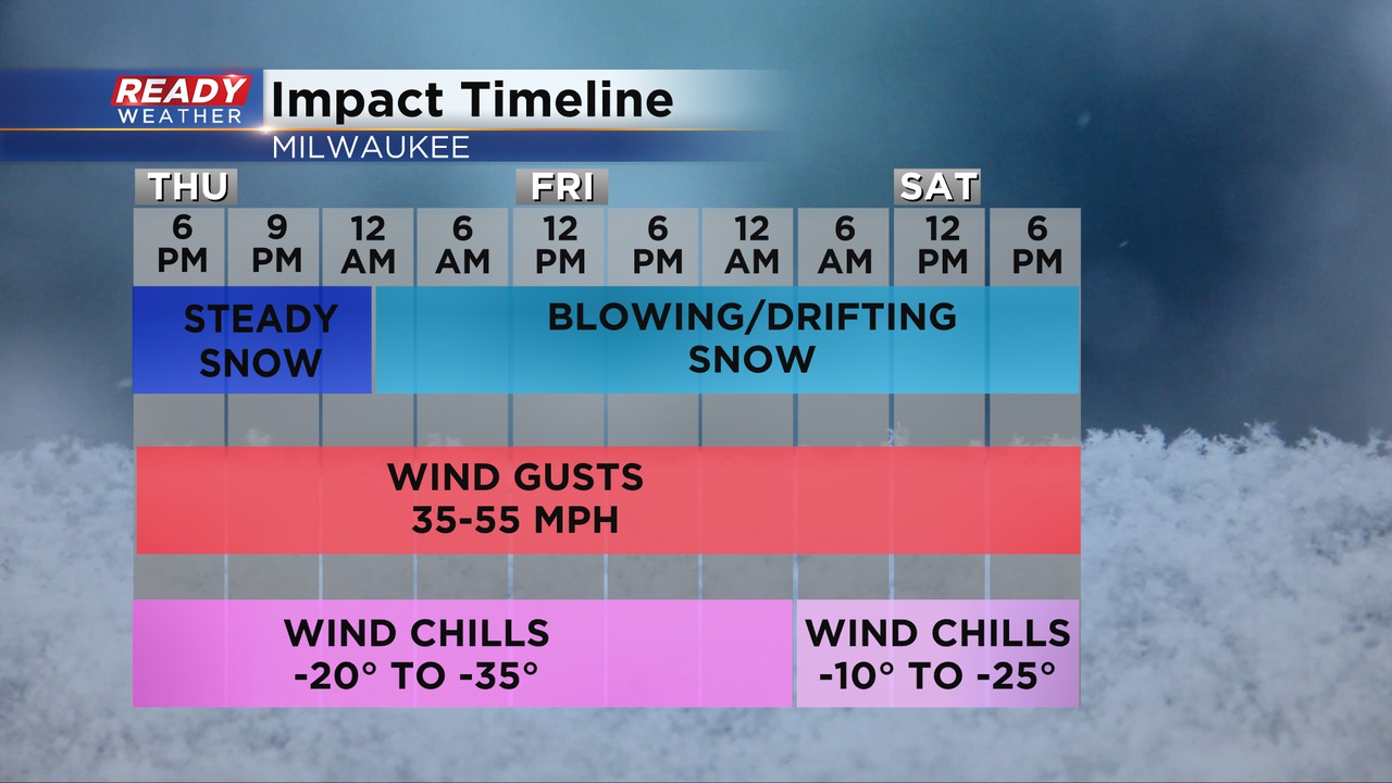
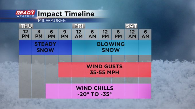
Here's the latest impact timeline. Overnight through tomorrow will have the highest wind gusts around 50 mph. Unfortunately, those wind gusts will bring wind chills between -20 and -35 below!
The steady snow will come to an end by 7; however, blowing and drifting is likely. Road conditions will be nasty tonight through Friday.
Travel is not recommended.
_____________________________________________________________________________________________________________
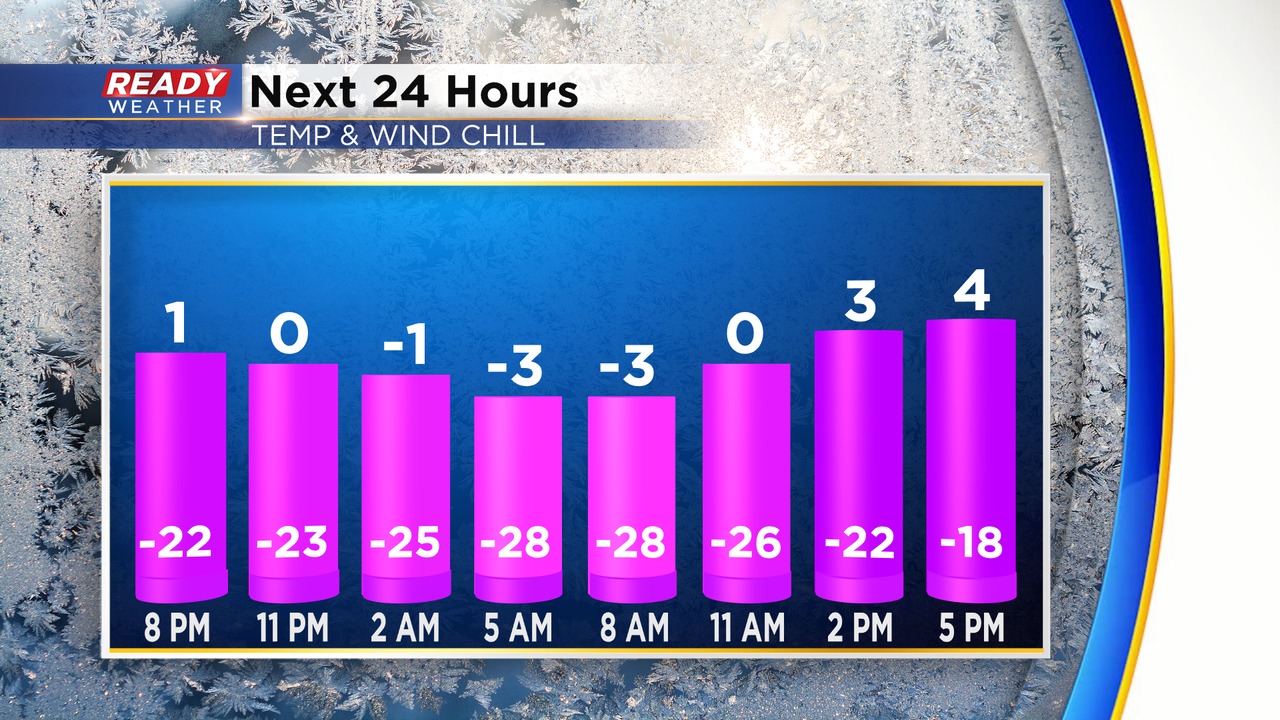
Updated: 2:00 p.m. Dec. 22, 2022
Just an awful snapshot of the temps and wind chills over the next 24 hours. Roads are slick with the arctic air and will not improve.
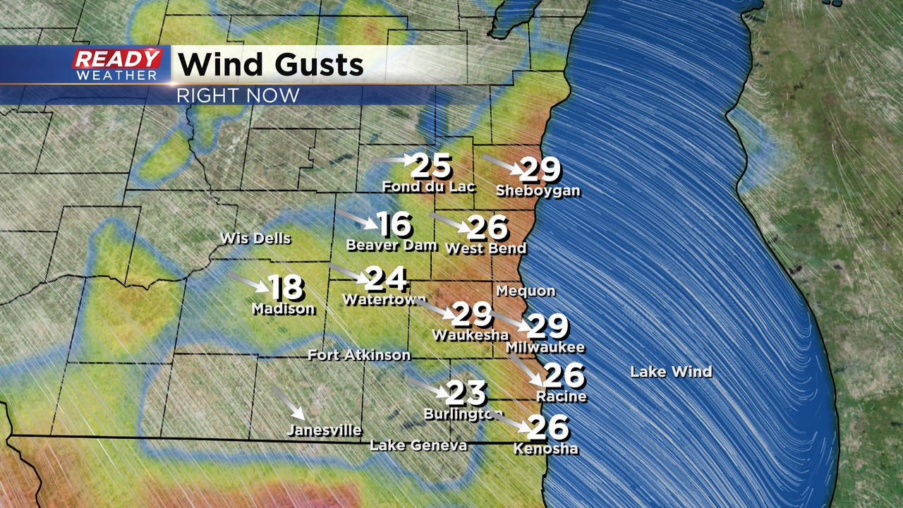
Winds are starting to gust to 30 mph. Lower visibility will be expected with snow snow showers during the evening.
_____________________________________________________________________________________________________________
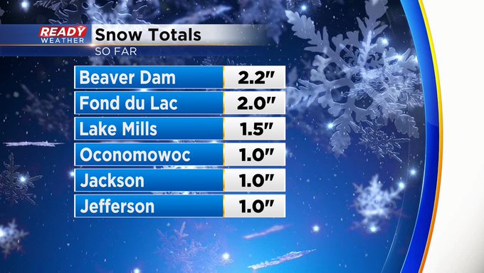
We're starting to get snow totals into the office:
Updated: 10:04 a.m. Dec. 22, 2022
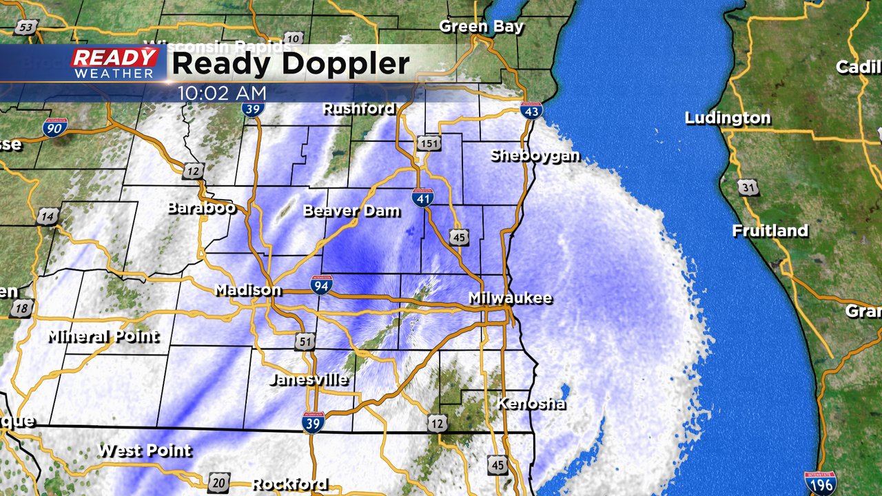
The moderate snow has begun to fall across most of southeast Wisconsin. Visibility is already reduced to one to three miles at 10 AM on Thursday with the moderate snow. The wind is starting to ramp up but wind gusts aren't nearly as bad as they will be later Thursday evening. If you have to travel today, do it now!
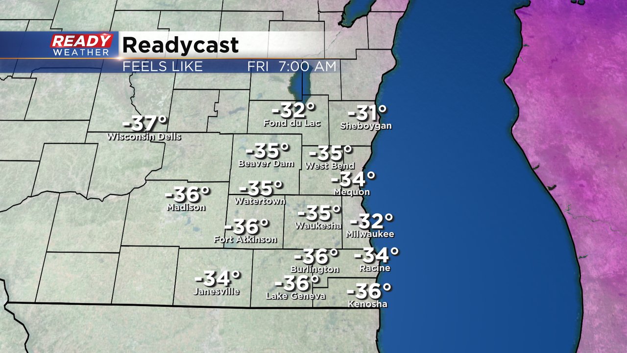
The Friday morning wind chills will be probably be the coldest during this frigid stretch of holiday weather. Wind gusts to 50 mph will force wind chills down to -35*. Frost bite can form in just 20 or 25 minutes on exposed skin in those conditions.
------
Updated: 8:03 a.m. Dec. 22, 2022
A few rounds of snow showers have already rolled through southeast Wisconsin. A few reports have already come in with an inch of snowfall in a few local hometowns. The snow is still set to become steady come the afternoon and evening hours. All of the information on snow totals, wind gusts and wind chills below is still accurate.
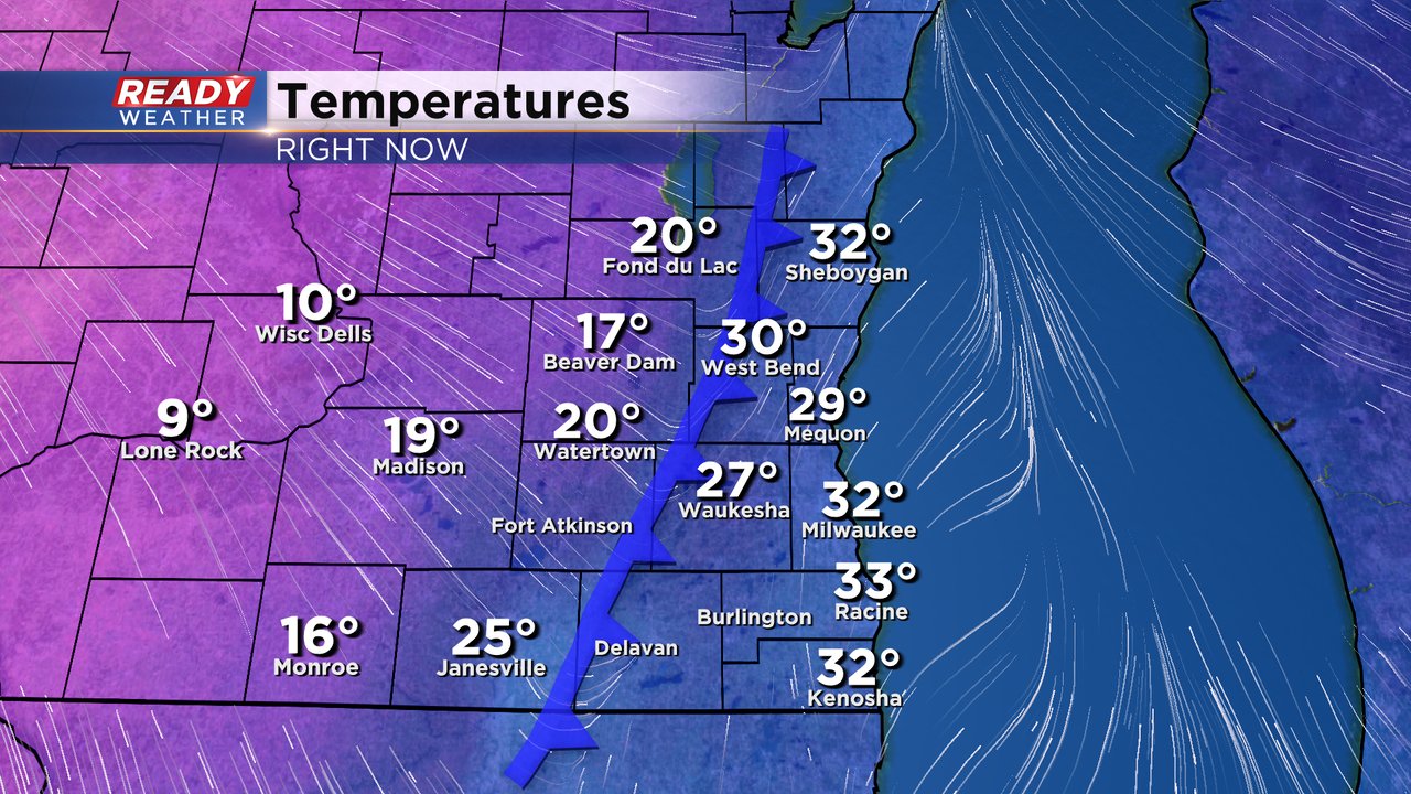
A cold front is also currently rolling through. This cold front is dropping temps fast from the upper 20s and low 30s down into the teens. Temperatures will continue to drop this afternoon with wind chills already sub-zero by mid-afternoon.
------
Posted: 5:25 a.m. Dec. 22, 2022
Snow is falling across southeast Wisconsin Thursday morning. Road conditions have gradually gotten worse and will continue to do so. See the updated road conditions in the image below. School closings started rolling in Wednesday afternoon. You can see all of those here.

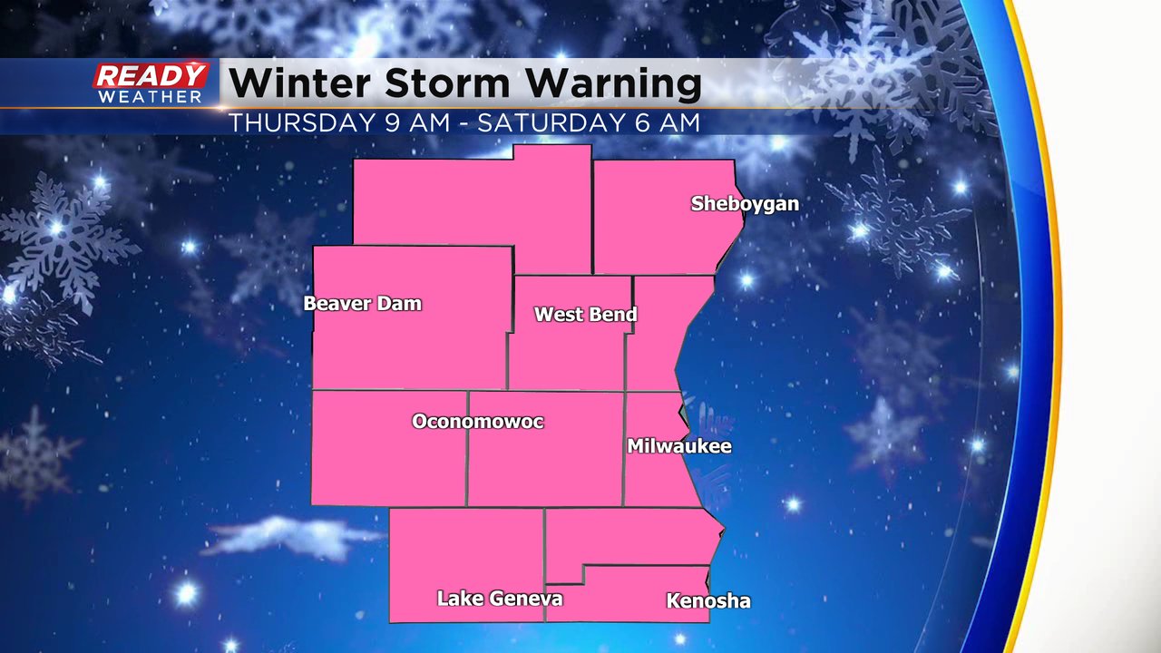
A winter storm warning was issued Wednesday afternoon and goes into effect at 9 AM Thursday morning lasting all day Friday and ending Saturday morning. It may not be actively snowing during this entire time but the blowing snow and bitter cold justify the warning.
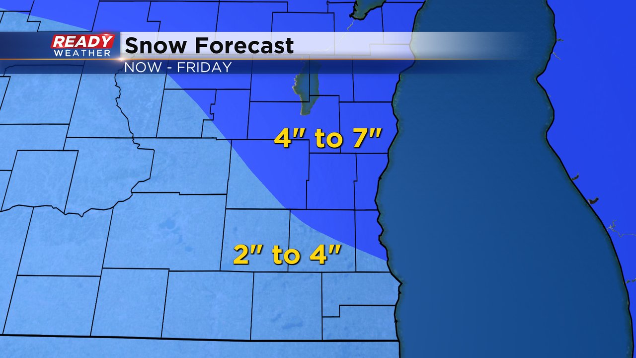
The latest snow forecast is in. And while snow totals may not be super impressive for Wisconsin standards, it's the dangerous wind that makes the snow worse. 2-4" of snow is expected in southern counties with 4-7" in northern counties. Most of this snow will fall during the day on Thursday through about midnight. An additional inch or two of snow is possible with lingering snow showers on Friday.
Winter impacts with this winter storm are pretty significant. Notice how the snow itself is not the biggest threat. The wind, cold and impact of the blowing snow on the roads is really the big problem.
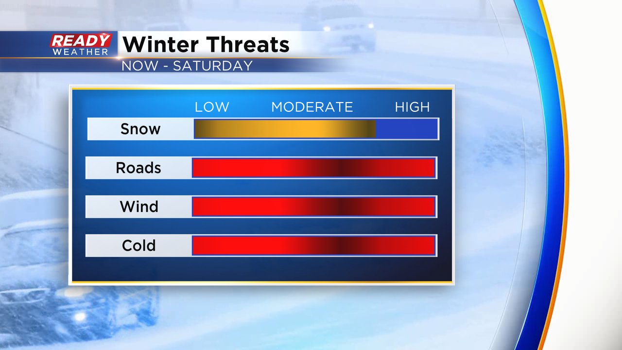
The expected wind gusts have not changed much with wind gusts ramping up Thursday afternoon and evening to 30 mph. Wind gusts Thursday night through most of Friday could be as strong as 50 mph leading to whiteout conditions in open fields and rural areas. The wind stays very strong on Saturday with blowing snow still an issue.

The bitter cold and dangerous wind chills haven't changed either. Wind chills will drop below-zero by Thursday afternoon with wind chills as cold as -35* Friday morning. They don't get warmer than -20 during the day Friday with wind chills in the -30 to -15 range on Friday and -20 to 0 range on Christmas Sunday.

Stay warm, watch the wind and be safe on the roads. Download the CBS 58 Ready Weather app to track the dangerous conditions.