Cold temperatures will continue for your Thursday. Highs should climb into the teens once again with increasing clouds during the afternoon.
Another batch of light to moderate snow will develop across southeastern Wisconsin late Thursday afternoon and especially during the evening.
Temperatures will be in the teens, so roads will become impacted by the snow rather quickly. The best arrival estimation will be from 4 pm until 8 pm. The dry air will take some time to overcome. This type of snow will be light and fluffy due to the lack of deep moisture.
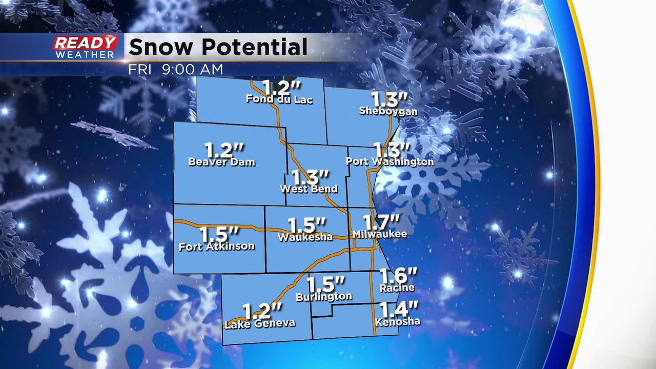
Thankfully, the surface winds won't be too strong on Thursday; however, moderate or even heavy snow could create some lower visibility. Most areas will pickup 1" to 2" of snow. There will be a northeast wind on Thursday, and that could create some lake enhancement.
The snow should be done by early Friday morning and shouldn't impact your Friday morning commute. Another chance for snow arrives late Friday into Saturday.
