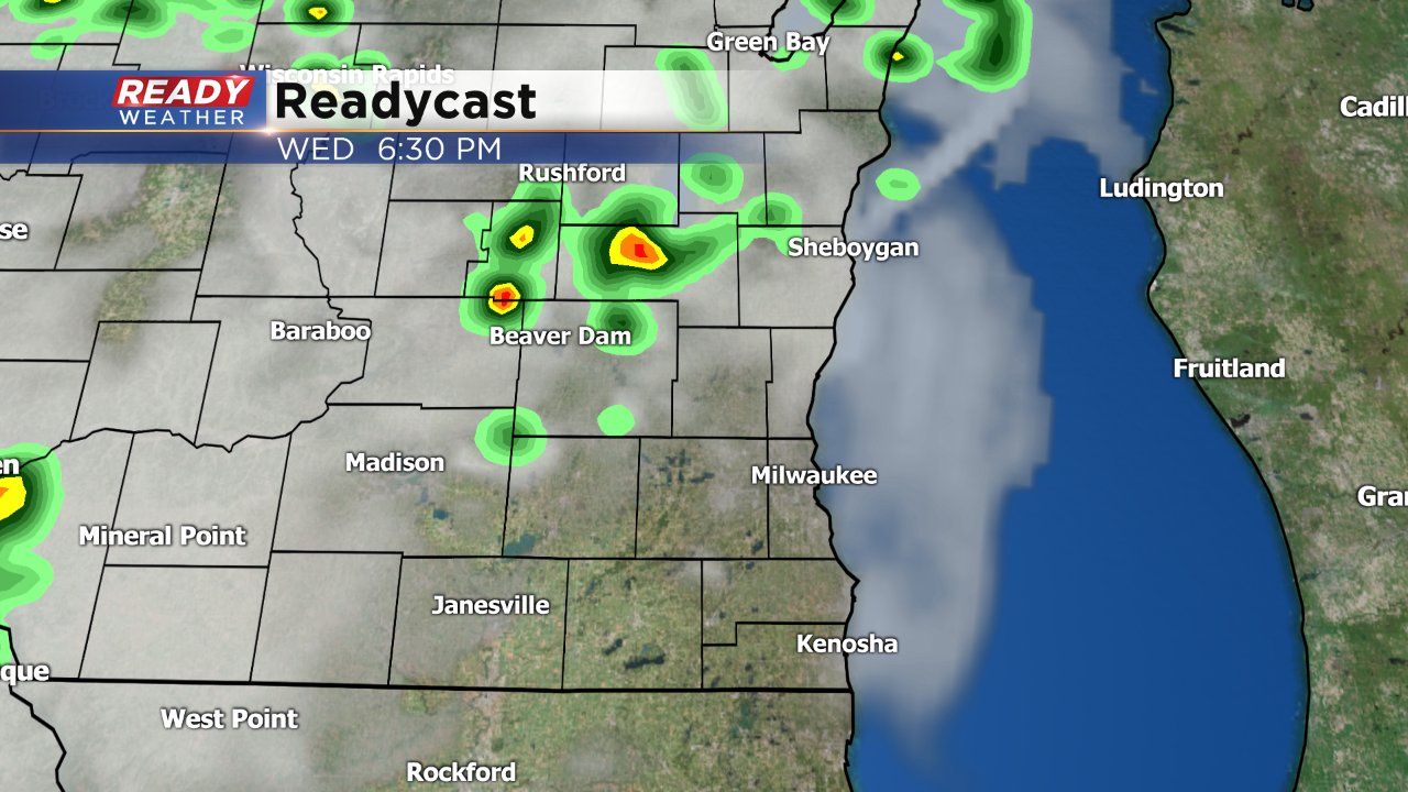
10:45 Update: Storms moving across our northern viewing area
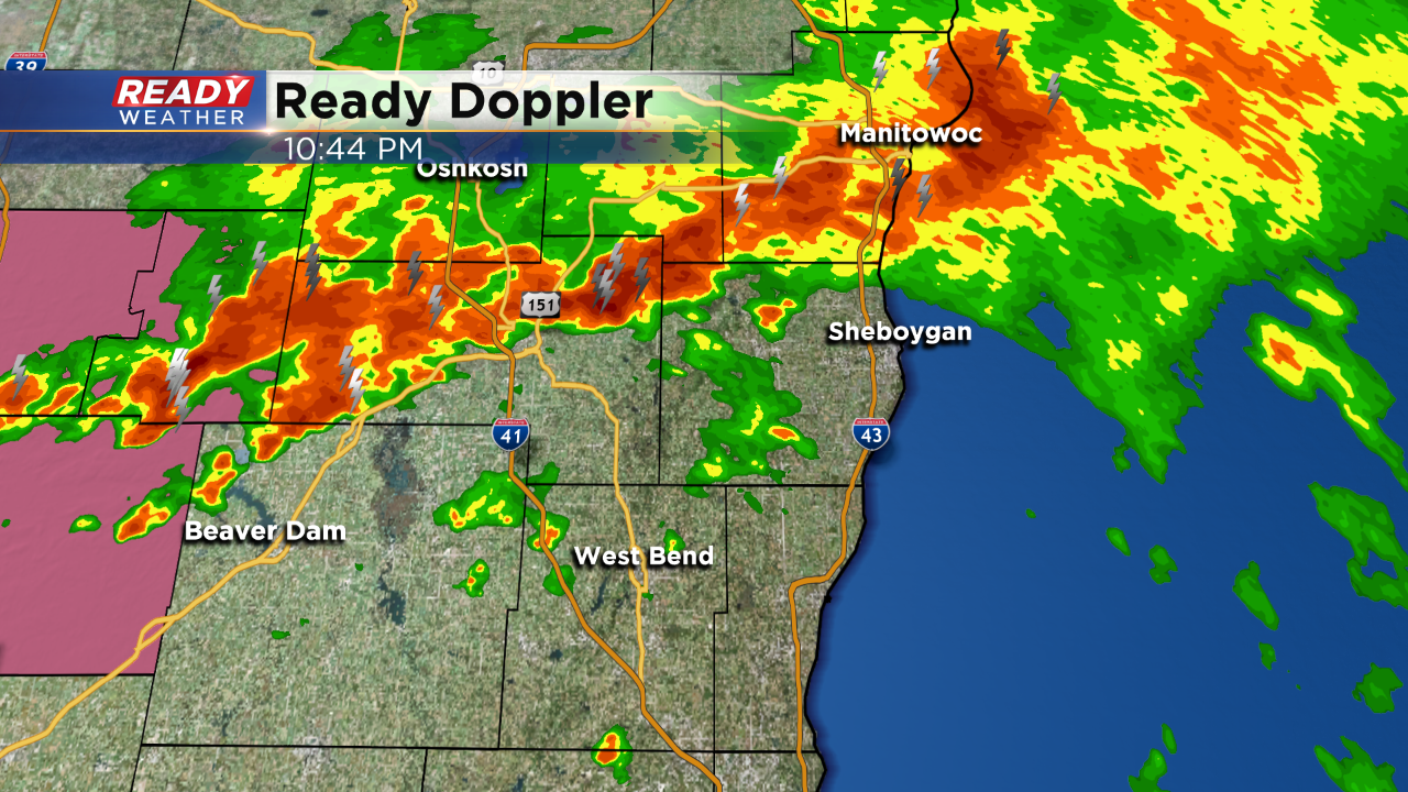
Strong storms are tracking across Fond du Lac and Sheboygan counties. These storms could produce gusty winds over 40 mph and some small hail.
This line of storms will try to move southeast; however, it might not totally make it across our southern counties. The computer models weaken the lien as it moves south.
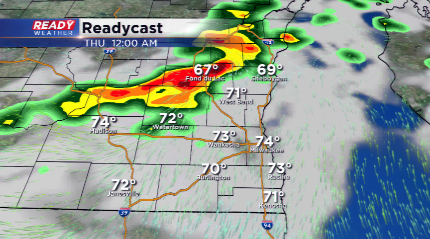
8:30 PM Update:
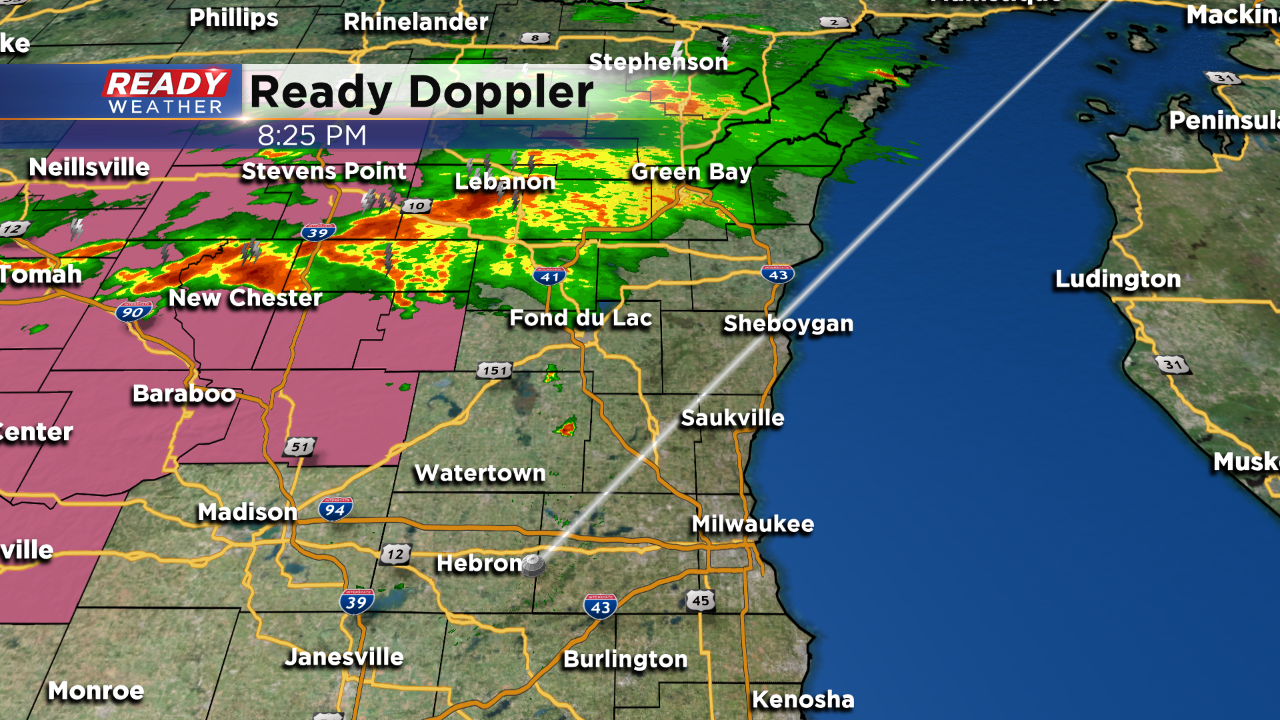
Scattered showers and storms are slowly moving southeast. Thankfully it doesn't look like the storms will become severe overnight. Locally heavy rainfall along with some brief gusty winds are possible.
We still expect the broken line of storms to move across the area between 10 pm and 1 am. The hope is for the entire area to get some rain.
Evening Update:
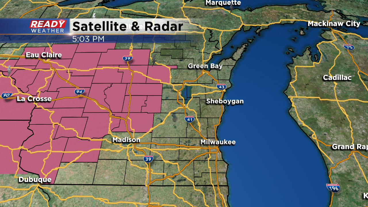
A severe thunderstorm watch has been issued northwest of our viewing area. The watch goes until 11 pm. Scattered storms over the next couple of hours within the watch could become strong to severe.
It's possible that more counties will be added to the watch. We are expecting storms to arrive between 10 pm and 1 am. Storms that fire could contain hail and gusty winds.
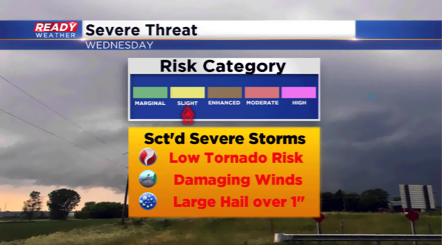
3 PM Update:
No real changes in the overall forecast for tonight. The greatest risk for strong to severe storms will occur across Dodge, Sheboygan, and Fond du Lac counties after dark.
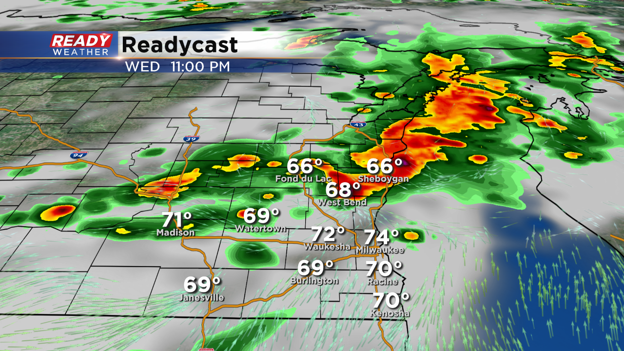
A few isolated storms could develop between 5 pm and 8 pm; however, our computer models continue to indicate better storm coverage ahead of the front. Storms will really blow up between 9 pm and 11 pm and move southeast.
The greatest severe weather risk will be winds and hail. Much cooler for Thursday with highs in the middle 70s.
_____________________________________________________________________________________________________________
Updated: 12:39 p.m. July 25, 2018
No major change to the forecast for storms Wednesday evening. A cold front will be passing across the state sparking showers and storms as it moves through. The slight risk is still in place for a few of our northwest counties where the chance for strong to severe storms is greatest.
Timing of the storms has moved up a little and now looks like 6 p.m. to midnight for most of the area.
------
Posted: 3:30 a.m. July 25, 2018
The atmosphere will heat up quickly today ahead of an area of low pressure and cold front. Highs are expected to jump well into the 80s, and very well could be the last 80 degree high of July.
With a cold front passing into the area tonight, storms will spark along it, and some of these storms could turn severe. There’s enough energy/lift along it with an upper-level disturbance to bring widespread storms from late this evening into the early parts of Thursday morning. The main threats will be damaging winds, large hail, and heavy downpours; the tornado risk appears to be low.
Due to the risk of severe weather, the Storm Prediction Center has placed a section of Wisconsin, and the viewing area, under a *slight* risk of severe storms. The rest will be under a general thunderstorm or marginal risk. Keep an eye on the skies, and make sure you have ways of getting weather information.
Temperatures behind the cold front will plummet into the 70s tomorrow and possibly into early next week. The CPC is keeping the forecast with “below average temps” expected the next week or two.
