Several inches of snow expected Saturday into Saturday Night


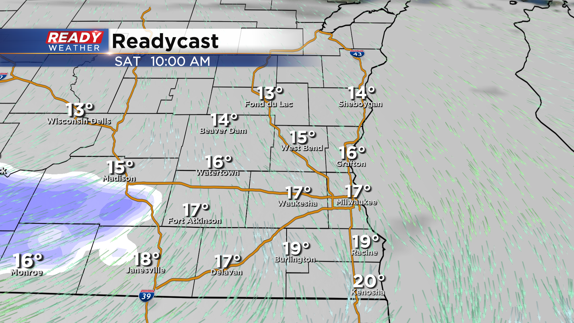
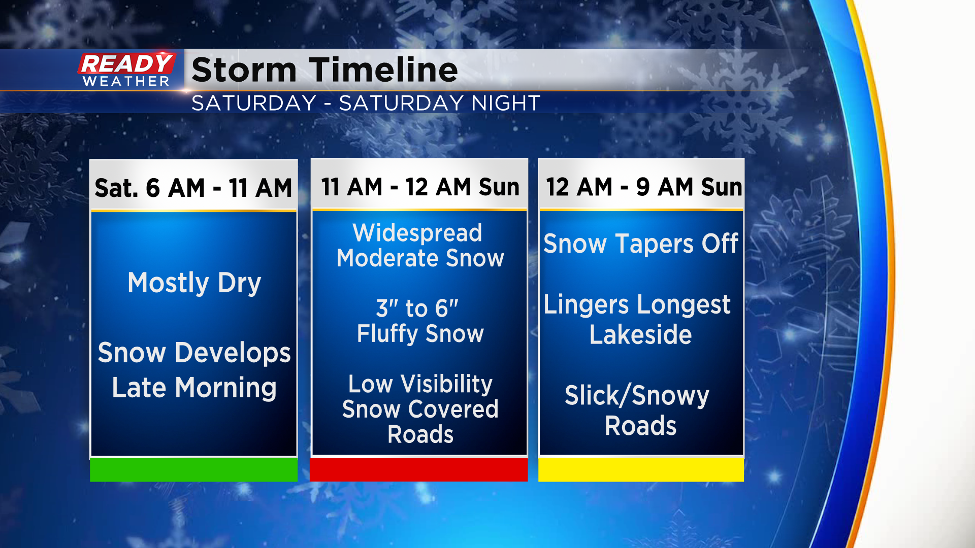
Southeast Wisconsin has been nickel and dimed all week with snow, building up to what will be a larger and more impactful snowfall to start the weekend. Saturday morning starts out dry, so you'll have a few hours to get errands done before snow overspreads the area between 10am-12pm.
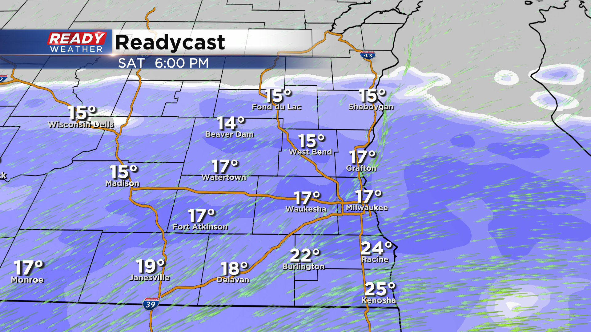
Widespread moderate snow is expected throughout the afternoon and evening. There will be a narrow, heavier band of snow that sets up in southeast WI as well, but the exact placement of that heavy band will remain uncertain until Saturday morning.
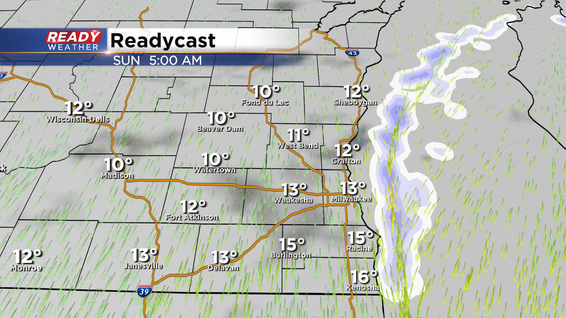
Snow begins to taper off overnight Saturday night, but a northeast wind will keep some lake effect snow showers going until 9-10am Sunday.
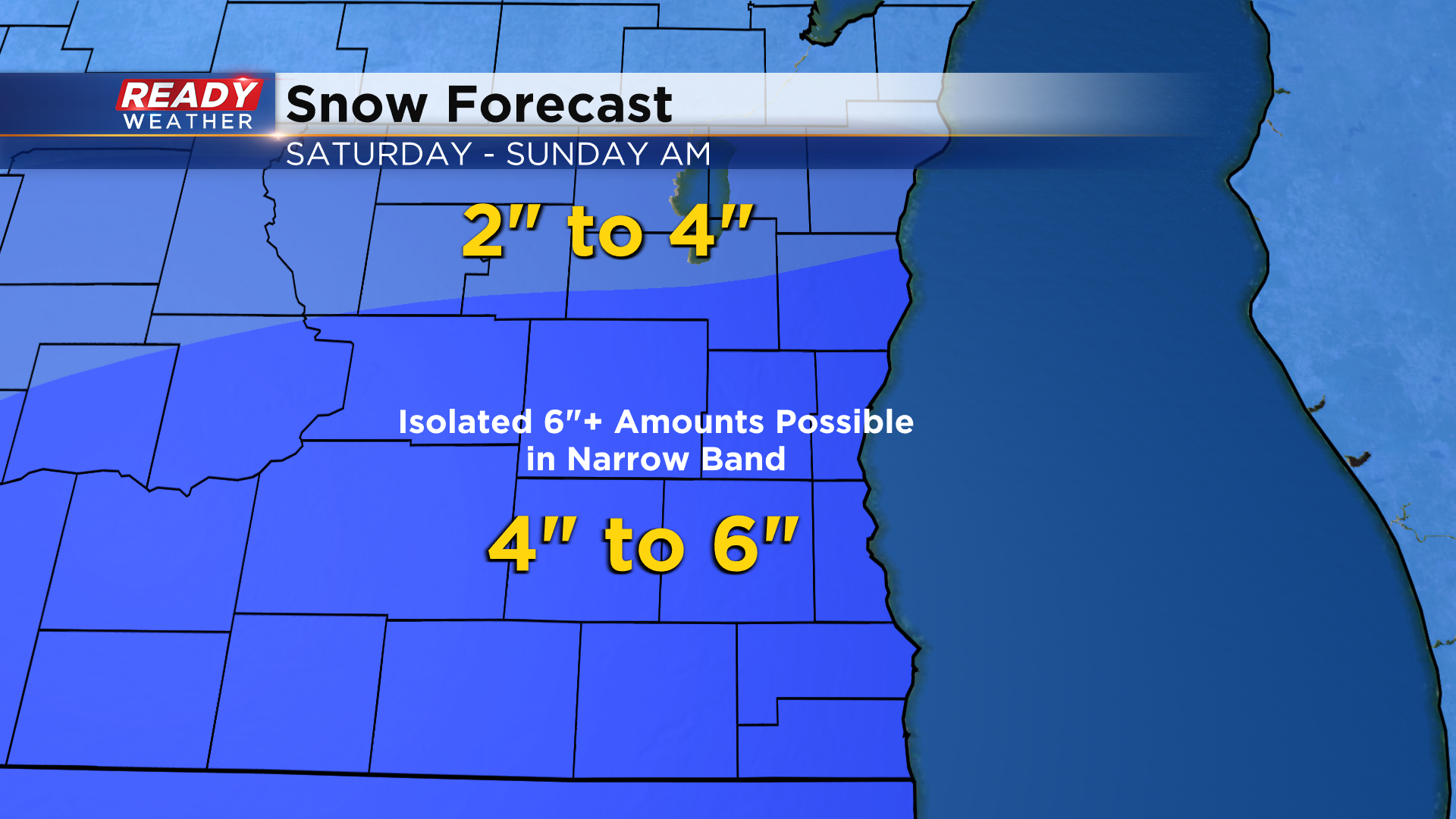
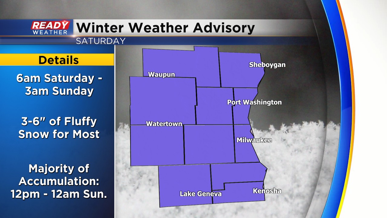
Most of southeast Wisconsin will pick up 3-6" of fluffy snow with most of the accumulation occurring during the afternoon and evening. Isolated totals of 6" or higher are possible wherever the narrow, heavier band sets up. Current scenarios either place this band along I-94 or the tier of counties north of I-94.
Visibility will be low throughout the afternoon and evening with poor roads conditions. Roads will improve through the course of the day Sunday since snow ends early in the morning.
With 3-6" of snow likely accumulating across southeast Wisconsin, everyone is under a Winter Weather Advisory from 6am Saturday through 3am Sunday.
Download the CBS 58 Ready Weather App for more updates.