Quiet weekend gives way to messy Monday and drastic cold


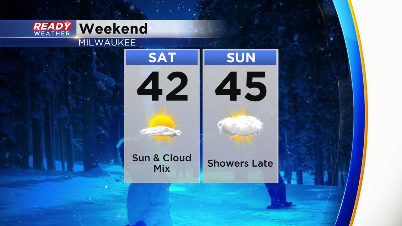
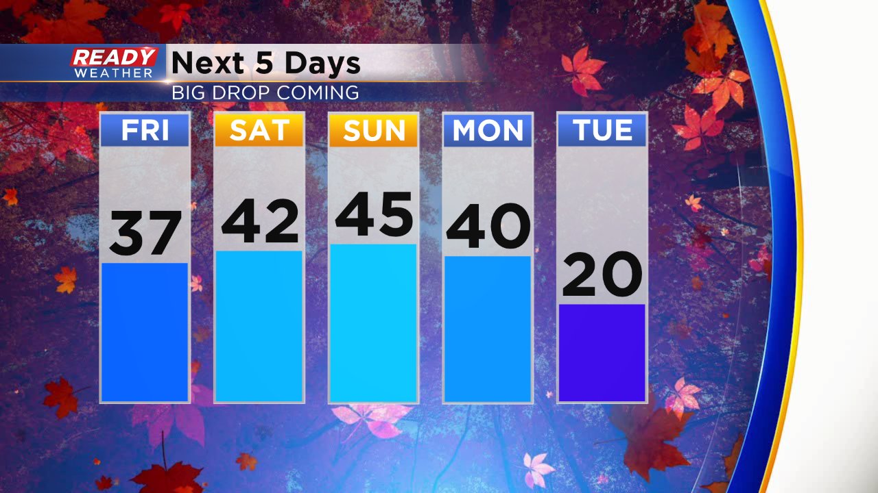
It has been a super quiet week, especially for December which usually sees its fair share of clippers and other storm systems bringing rain and snow. The quiet weather continues into the weekend with some sunshine Friday and Saturday giving way to more clouds on Sunday. Temperatures stay in the 40s with rain showers arriving late on Sunday.
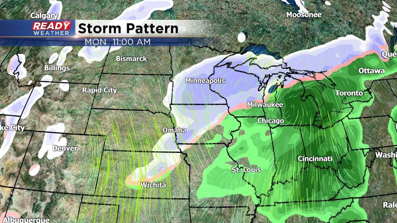
The Sunday night rain showers will continue for the first half of Monday before switching to snow by Monday evening. A little light snow accumulation is possible but most should clear out for the Tuesday morning commute.
Following the messy weather on Monday is a big drop in temps. Once highs reach their peak Monday morning they drop steadily for about 48 hours until Wednesday morning when they bottom out in the single digits.
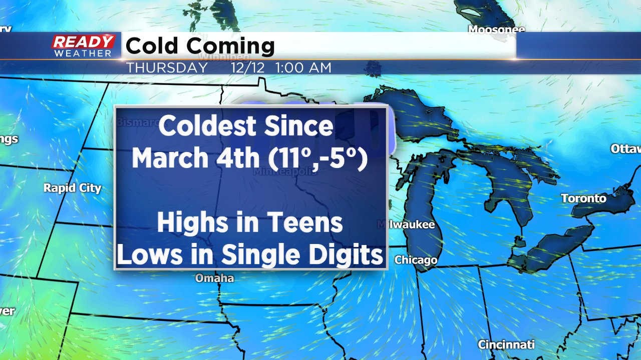
Wednesday will be the peak day during this cold with the coldest temps of the season likely and the coldest since the beginning of March. On March 4, 2019 we started with lows below-zero and then only hit a high of 11°. The current forecast high for Wednesday is 15° with lows Wednesday and Thursday morning in the single digits and wind chills well below-zero.
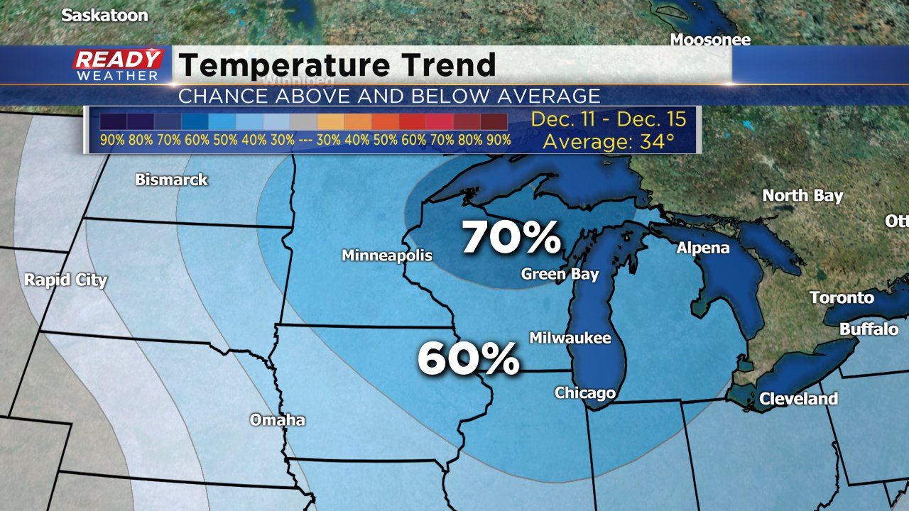
Luckily, the cold doesn't last forever and temperatures start to warm back to average levels for the following weekend around 30°. For the end of the second week of December there's still a 60-70% chance for below-average temps.
Download the CBS 58 Ready Weather app to see the full 10-day and when our next chance for snow might come.