One hiccup, really, with the upcoming work week forecast


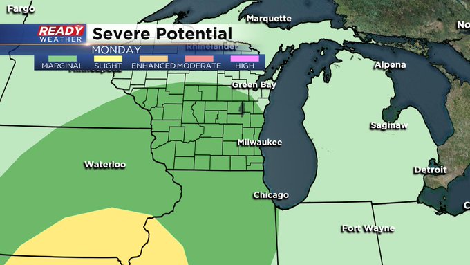
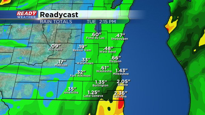
Milwaukee (CBS 58)--Our gorgeous weather is going on a short sabbatical. Basically, we're sending it away on Monday. That's the day showers and storms will be back in the forecast, in rounds throughout the day. Showers could even fall overnight into early Monday as well. There is a "marginal" risk for severe weather with the biggest threats being heavy rain. A few inches are possible, especially around Milwaukee and points south and southwest.
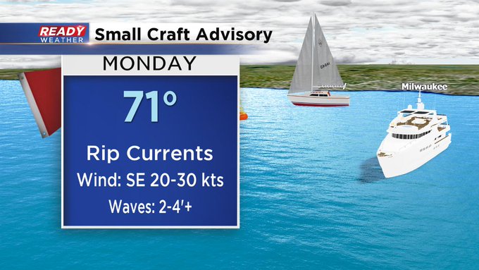
Also, boaters and swimmers be advised for the potential of high winds and waves throughout Monday as well. Rip currents are also possible. It's advised to stay out of the water.
The rain should clear into early Tuesday morning behind a cold front and low pressure area. After that, we're pretty much in the clear. Winds could be breezy on Wednesday. And some computer models are hinting at more showers on Friday with another cold front. However, the one reliable computer model doesn't include them in the forecast.
The holiday weekend, as it stands now, is looking great! Thanks, Mom Nature!!!