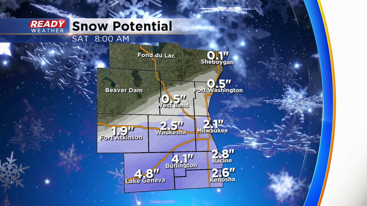
More accumulating snow is coming for New Year's Day
Most areas have just finished digging out from out last winter storm, and now we are tracking more snow for Friday. Most of the snow will fall during the late afternoon into the evening. 3 pm till Midnight is the main timing for the snow. The snow is not expected to linger into Saturday morning or afternoon.
The main impact will be slick roads within the accumulation zone. The wind won't be as strong as our last winter storm, so visibility won't be a major issue.

This system will come in from the south, so there will be a sharp cutoff in regards to snow totals. Our northern areas will experience the least amount of snow. Closer to the IL/WI border there could be some isolated 4" totals.
A slight shift to the north could bring an inch or so to our far northern areas; however, the best chance for accumulation will be along and south of 94. 1" to 3" will be common in those areas.

