
-
1:41

CBS 58’s Hometown Athlete: Milwaukee natives and NFL players...
-
0:53

Milwaukee nonprofit Food for Health provides free pre-made meals...
-
1:44

NBA Draft makes Milwaukee Bucks fans hopeful for new era
-
2:16

Race organizers, runners frustrated after Racine drawbridge raises,...
-
3:06

‘Smallwaukee’ honors Giannis Antetokounmpo, Bobby Portis
-
1:39

Man killed, 2 others injured in early morning shooting near Brady...
-
1:00

Couple renews vows at Wisconsin Dells water park as part of Guinness...
-
1:06

St. Camillus residents show patriotic spirit during annual parade
-
1:22

Greenfield residents urged to monitor mail after thefts continue...
-
1:58

ICE detains 8-year-old boy and mom at Wisconsin Dells home, community...
-
1:55

‘Bucks basketball won’t be the same’: Bucks fans say goodbye...
-
0:39

3-alarm fire damages vacant Milwaukee warehouse

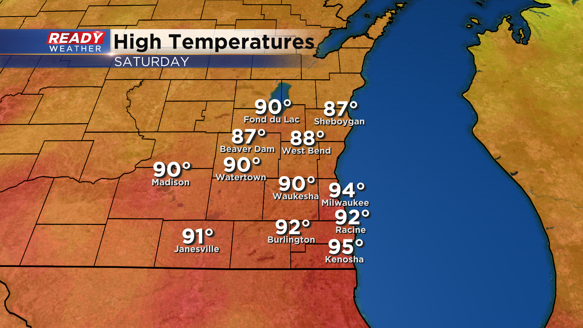
It was a very hot and humid day across southeast Wisconsin on Saturday with highs topping out in the upper 80s to mid 90s.
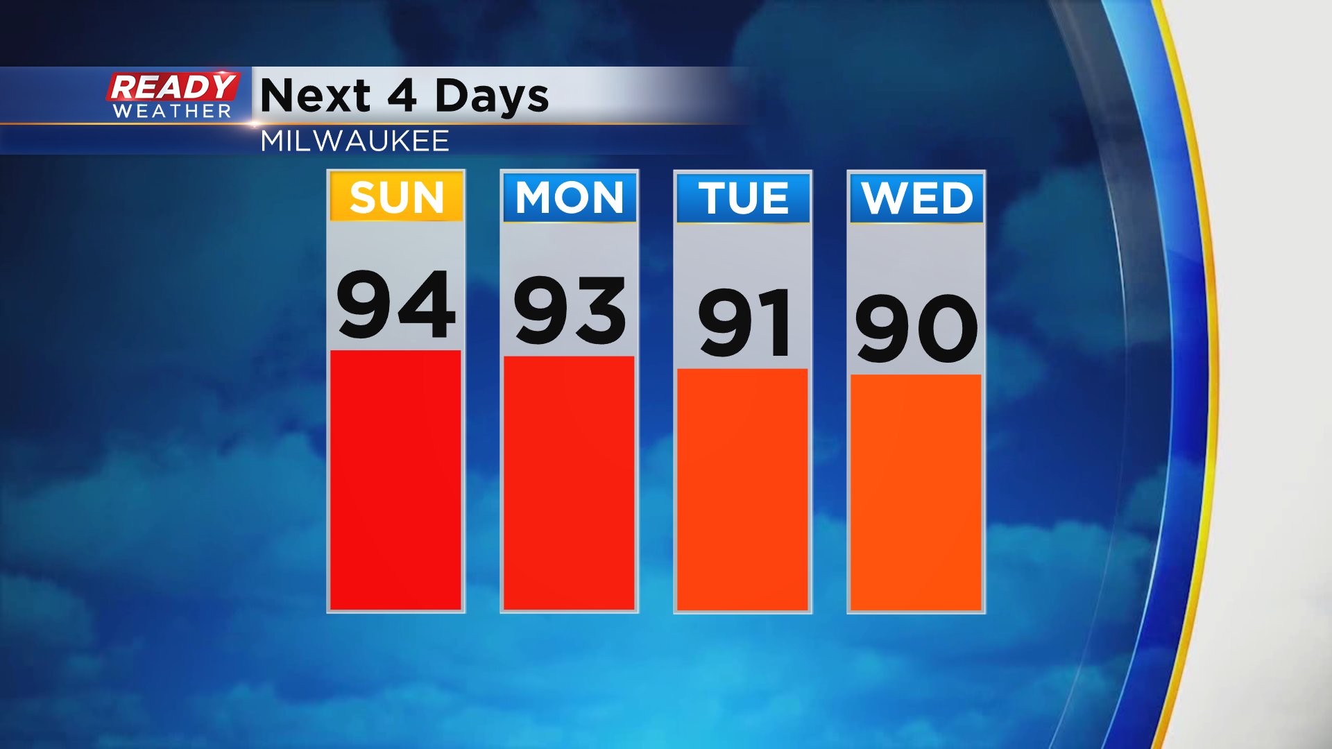
It was already our 11th day in the 90s this year, and it won't be our last. Temps will climb well into the 90s again Sunday and Monday and will make a run at 90° Tuesday and Wednesday.
Although the heat will continue into the beginning of the week, we'll have a break from the humidity on Sunday, and it won't be too bad on Monday.
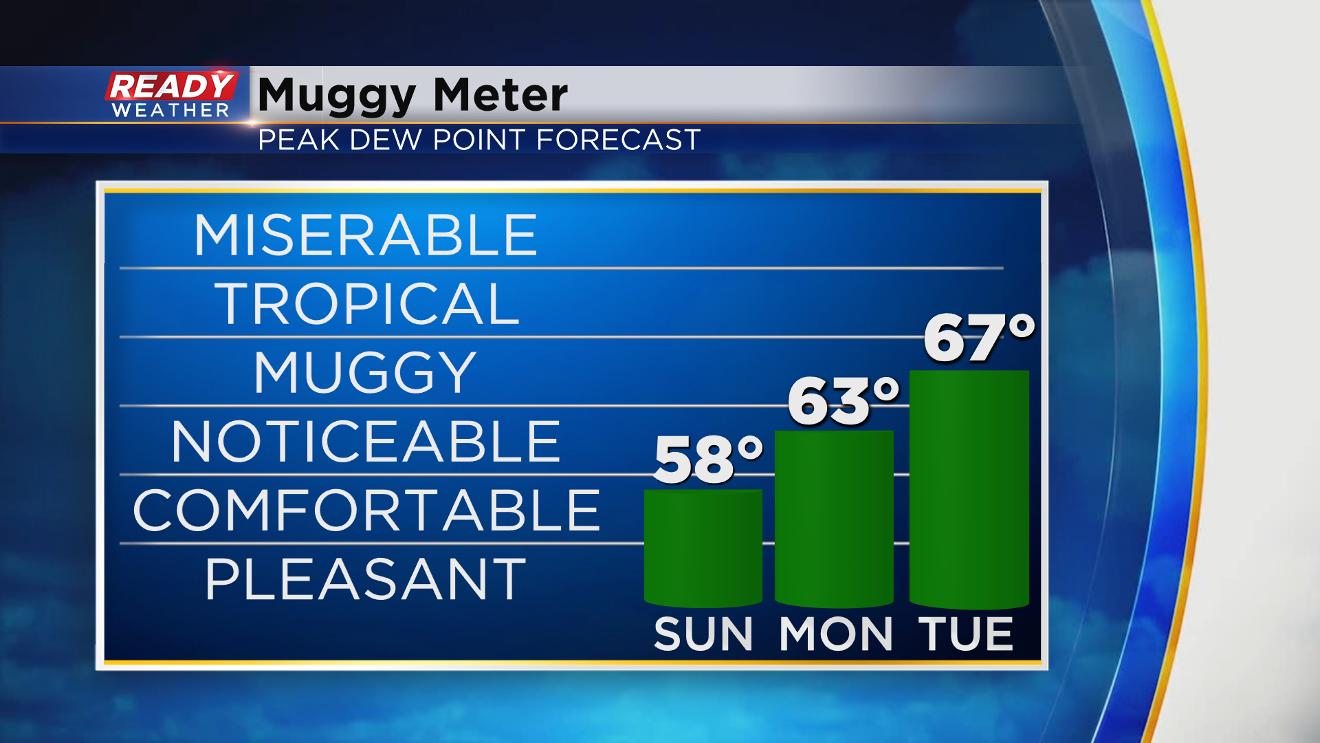
Unfortunately, the muggy air moves back in Tuesday and Wednesday, along with storm chances. Chance will be isolated on Tuesday and confined to areas north of 94, but everyone will likely see rain and storms later Wednesday into Thursday morning as the cold front moves through. Download the CBS 58 Ready Weather App to see how fall temps will fall behind the cold front.