


A little here and there. That's been the snow theme this month across our area. To date, we've picked up just over ten inches of snow for the city of Milwaukee. We should be closer the 13.4" to date, leaving us with a deficit of 3.3" this January. After what looked like a promising start with almost five inches of the white stuff to kick off the month, it's been ho hum ever since.
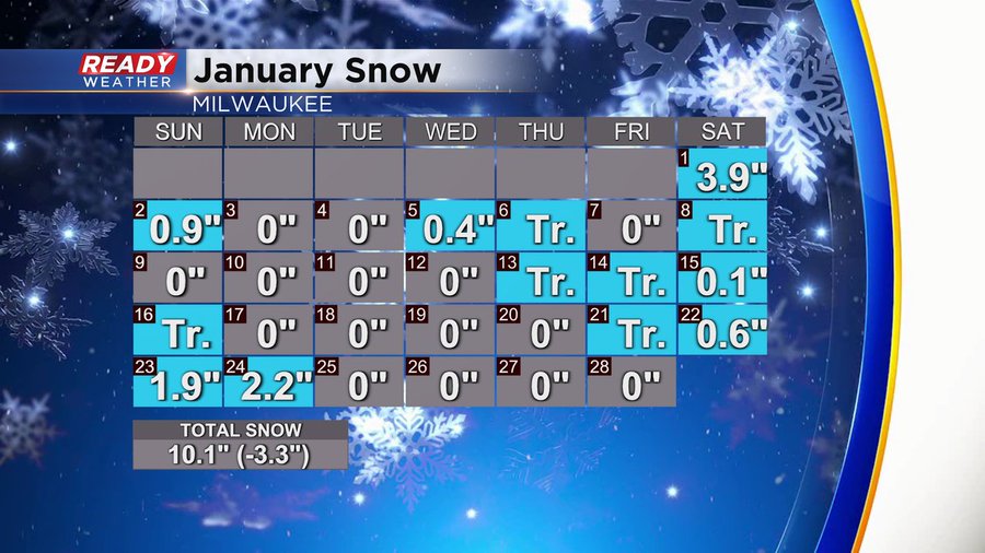
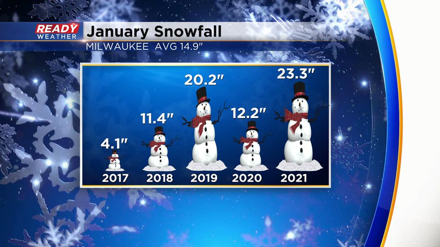
Did you know that January, on average, is our snowiest month of the year?! Total monthly snowfall is 14.9" And while we've had less snowfall than average this month, we've had drier years. Check out January snow for Milwaukee the last five years.
We will close out the month lower than normal, but not too far off. Then, as we kick off February, we'll be watching a big snow maker skirt up the southern Great Lakes and Ohio River valley. At this point models are starting to take the track south, leaving us with lighter amounts. However, it's still a solid four days away and a lot can change with each new model run. We'll continue to monitor this potential snowfall in the coming days, stay tuned for updates on air and online!
Until then, enjoy your weekend.
I'm meteorologist Rebecca Schuld