Saturday Night Update: Winter Storm Warnings cancelled, snow totals top out just under a foot


Updated: 9:48 p.m. January 19, 2019
The National Weather Service has cancelled the remaining winter storm warnings early for Milwaukee, Racine and Kenosha Counties.
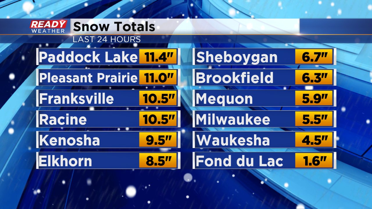
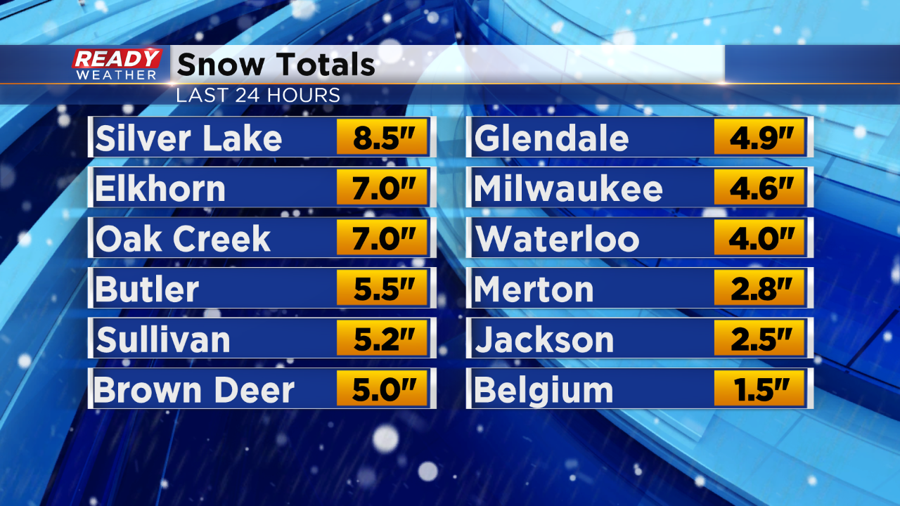
Milwaukee's snow total has stayed at 5.5" which is enough to be one of the biggest snowfalls over the past two winters.
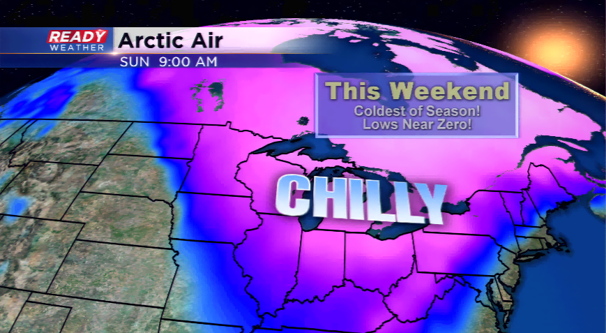
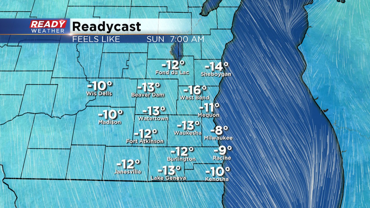
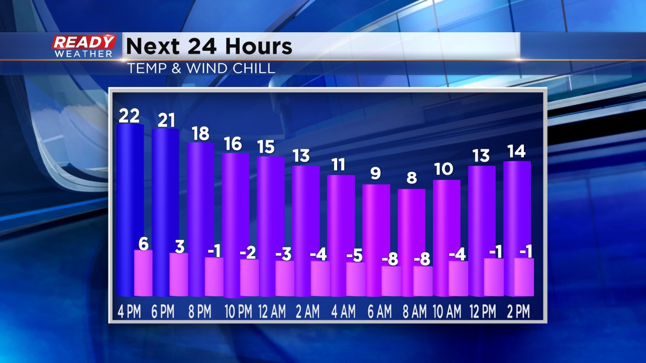
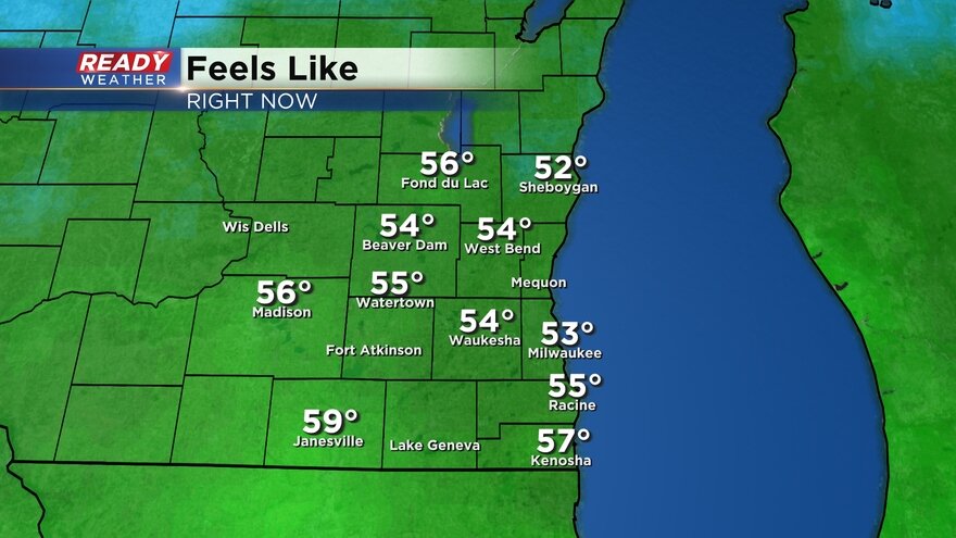
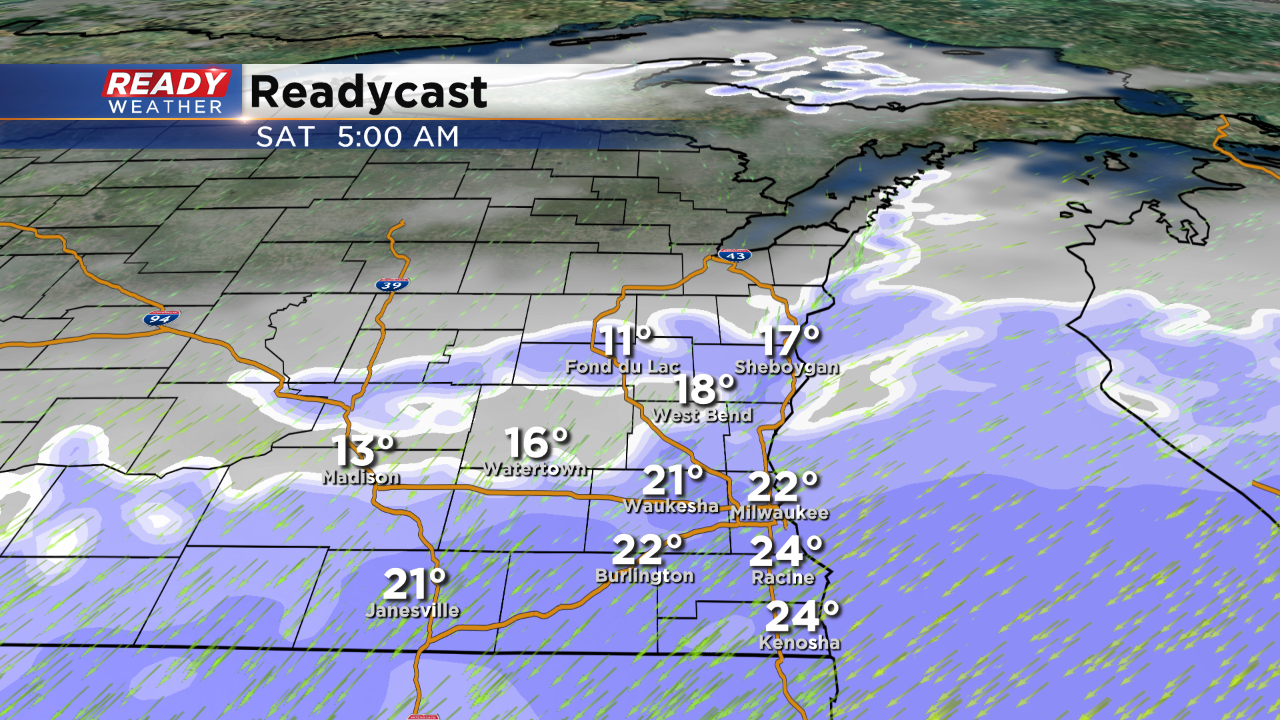
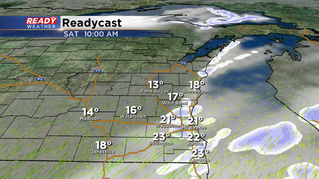
Wind chills by Sunday morning will be about -15° to -5° for everyone.
------
Updated: 6:14 p.m. January 19, 2019
The winter weather advisory for Sheboygan and Ozaukee Counties has been allowed to expire as the lake effect snow band has moved mainly towards southern Milwaukee County into Racine and Kenosha Counties. The Winter storm warning there will last until midnight tonight with another inch or two of snow possible for some.
------
Updated: 5:19 p.m. January 19, 2019
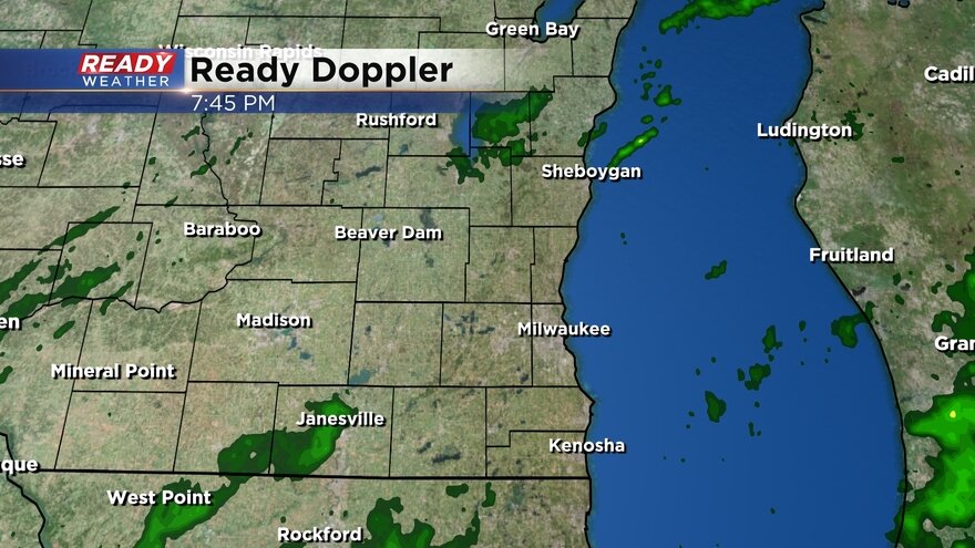
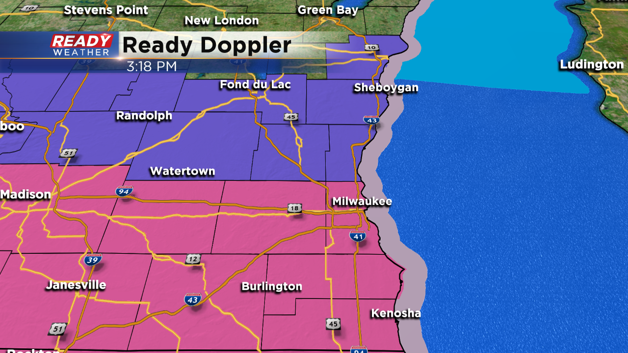
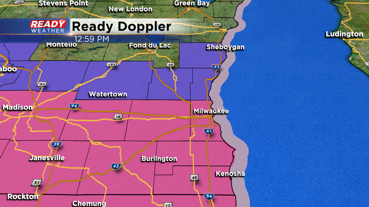
The band of lake effect snow has slowly moved to the south now impacting areas around and south of Milwaukee and starting to move towards Racine and Kenosha Counties.
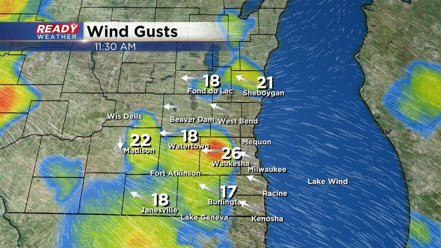
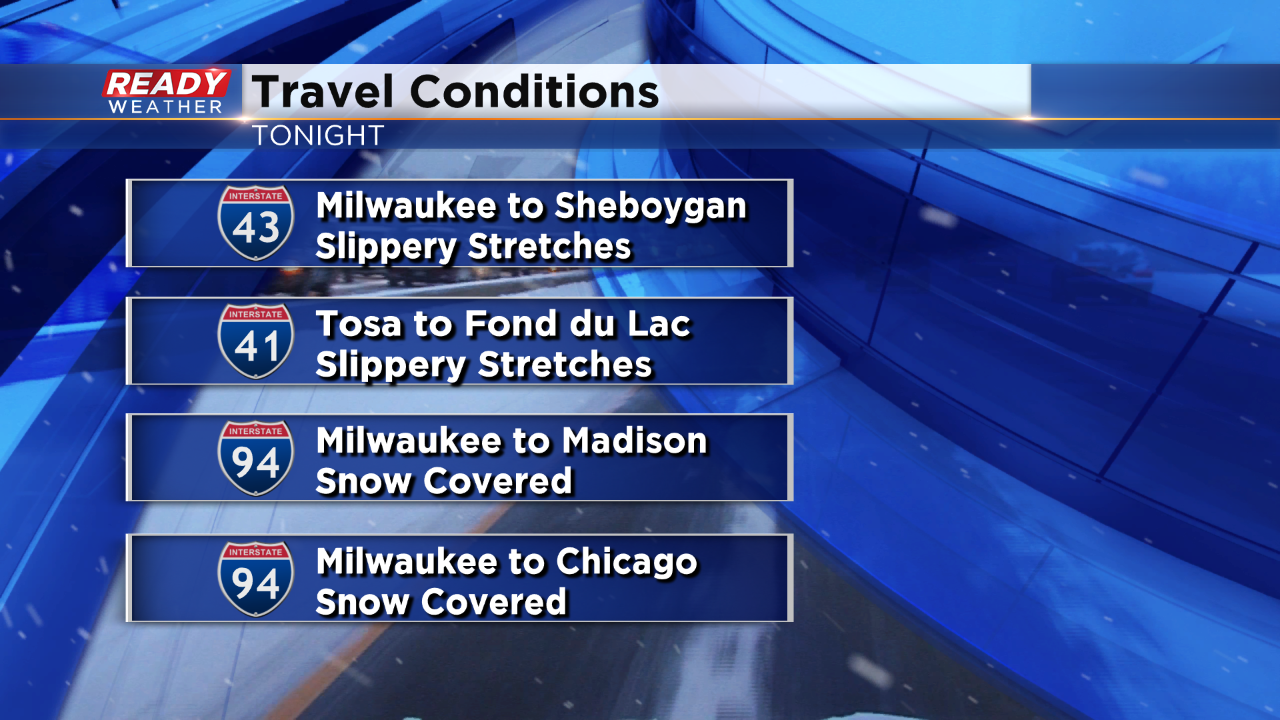
Blowing and drifting snow is making cleanup more difficult and the wind won't let up any time soon. Breezy conditions are expected through most of Sunday.
------
Updated: 2:48 p.m. January 19, 2019
Lake effect snow is still moving in to our lakeside communities, mainly in Ozaukee and Kenosha Counties this afternoon but expected to transition into Racine and Kenosha this evening. Another inch or two of additional snow is possible.
Snow totals are still coming in and Racine and Kenosha Counties where a combination of heavy snow bands from the main system and lake effect/enhancement has driven totals close to a foot. Totals decrease as you get farther northwest with most of southeast Wisconsin picking up between 4-8".
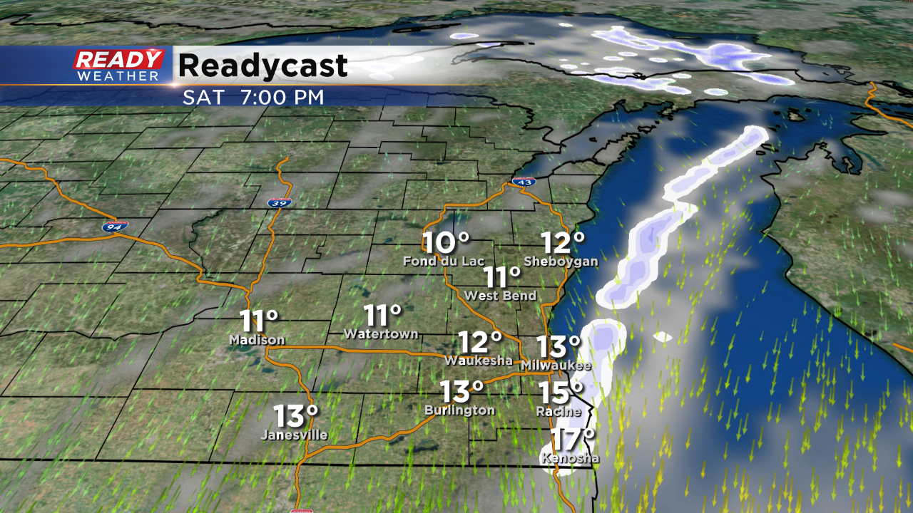
Although lake effect snow is still a threat our focus is shifting towards the second punch - cold air. Lows are expected to reach the single digits Sunday morning with wind chills as cold as -10° thanks to a breeze gusting above 20 mph at times.
------
Updated: 11:26 a.m. January 19, 2019
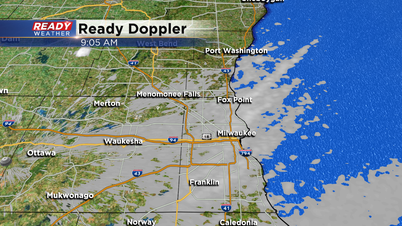
Light lake flurries and light snow are still showing up in parts of Ozaukee, Milwaukee, Racine and Kenosha Counties. These areas could still pick up minor accumulation throughout the rest of the afternoon.
Here's the latest radar image:
Snow totals continue to come in and show that parts of Walworth and Kenosha Counties near the Illinois border saw as much as 10" of snow. Northern spots only picked up a couple of inches with most of southeast Wisconsin seeing between 4-8".
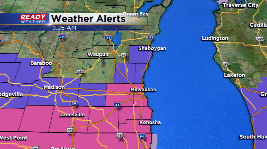
The advisories and warnings for Sheboygan, Washington, Waukesha and Walworth County are expected to expire at noon today with warnings lingering until midnight for Milwaukee, Racine and Kenosha Counties.
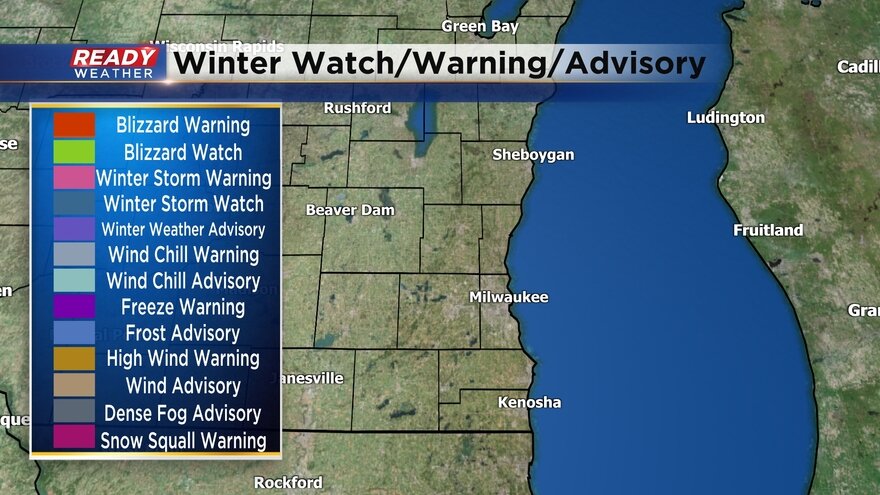
Here's the latest warnings and advisories map:
In addition to the snow, wind is strong with gusts approaching 30 mph in spots as temperatures plummet. Air temps are already in the teens for inland locations meaning wind chills are already sub-zero. Expect it to get even colder with lows in the single digits for some Sunday morning and highs only in the teens and much colder with the wind chill.
Here's the current wind chill map:
------
10 AM Update:
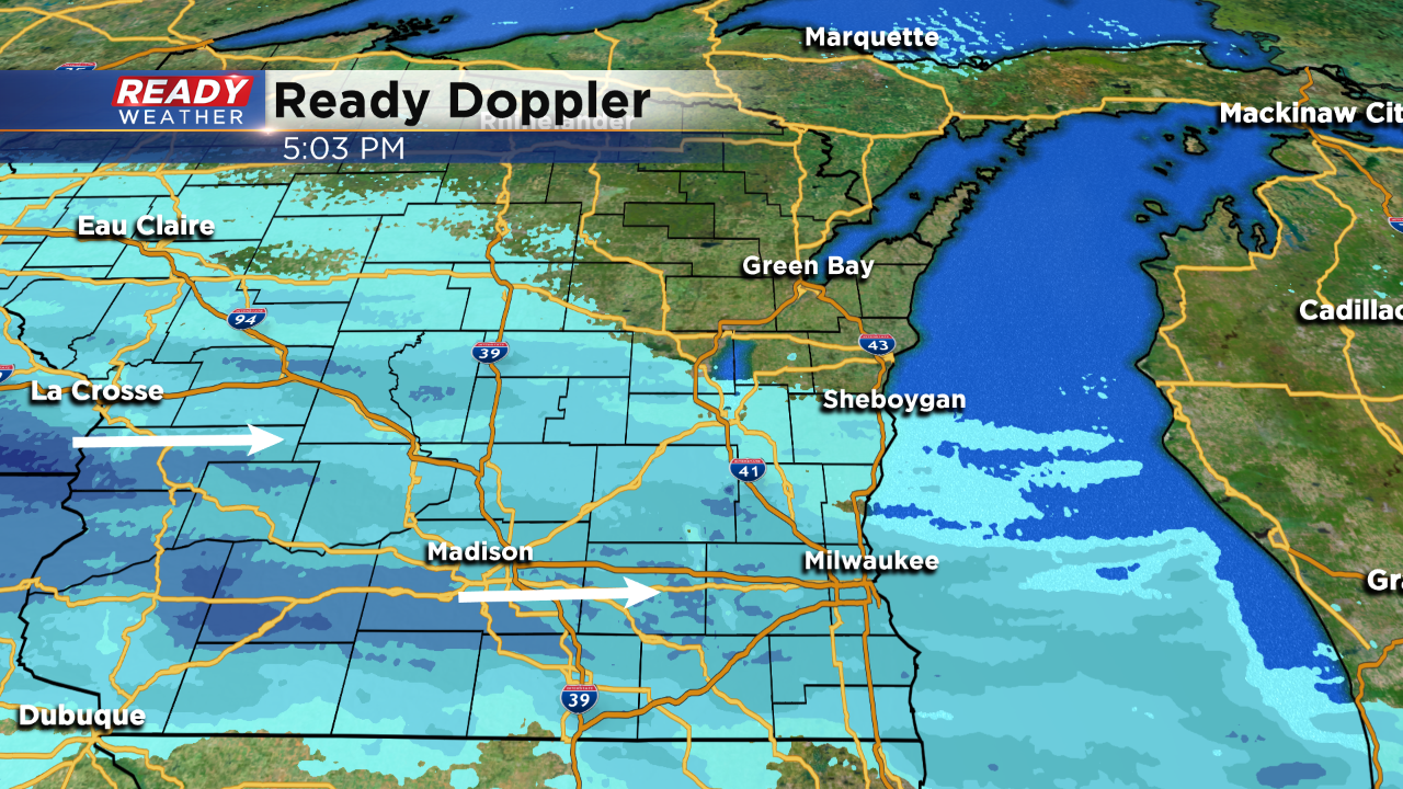
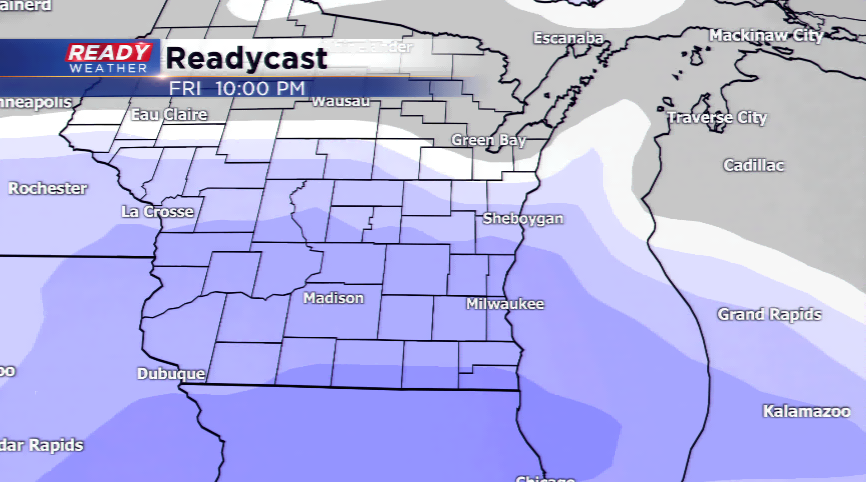
You can see the lake effect bands setting up on radar. Not much will change for the afternoon.
With a persistent northeast wind and relatively warmer lake temperatures, expect light lake effect snow to persist through the afternoon and early evening. Additional accumulation would likely be around an inch. An additional band later this evening could provide another inch.
______________________________________________________________________________________________________________
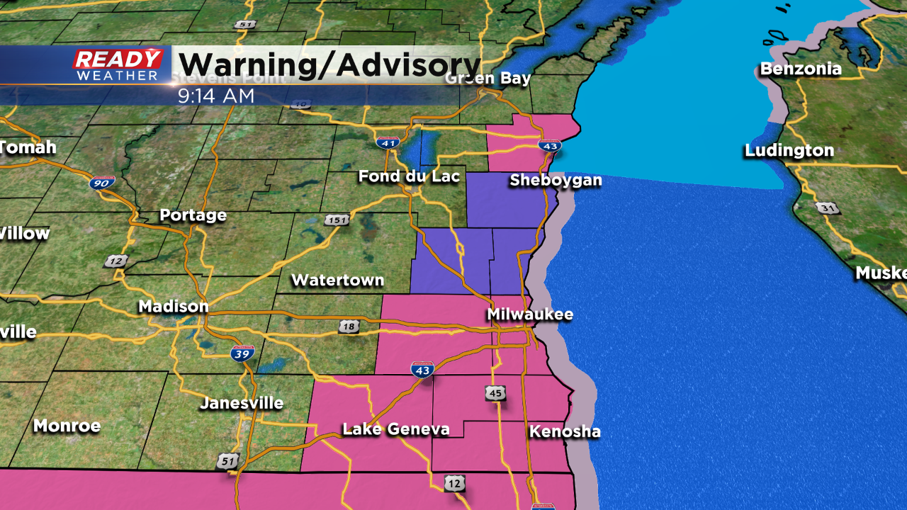
The NWS Milwaukee has trimmed back some of the advisories and warnings. It's possible more will be dropped prior to their expiration.
9 AM Update:
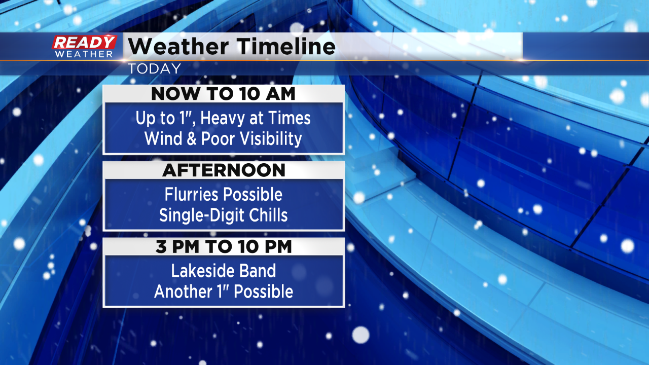
The trend over the last hour has been for the lingering snow to decrease in intensity. Snow showers along and south of 94 will likely persist through 11 am; however, significant accumulation is not expected. Another 0.5" of snow is possible.
Roads are snow covered and slick. We don't expect much of a change there.
Light snow or flurries is expected to continue this afternoon. Wind chills will hover close to 0 in many spots.
8:00 AM Update:
A lake enhanced snow band will continue to move south across the area over the next 2 hours. Most of the measurable snow will be done by 10 am. Light snow or flurries will remain possible through the afternoon with little accumulation.
7:30 AM
Here are some of the snow reports that have come in overnight. A lake effect band that's moving through Waukesha and Milwaukee county right now could quickly produce a inch of snow with low visibility!
______________________________________________________________________________________________________________
6 AM Update:
The advisory and the warning continues this morning. Snowfall reports across the warning area have ranged from 3" to 8" with the highest totals in Walworth and Kenosha counties.
The snow will continue to weaken and move out by 10 am. Another band of lake effect snow is possible late this afternoon and evening.
An additional half an inch to 1" is possible through 10 am. The best chance for closer to an inch will be 94 and south!
______________________________________________________________________________________________________________
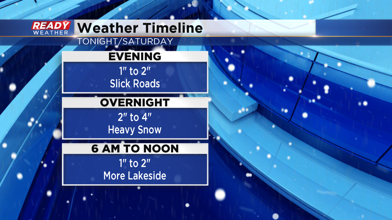
Many areas overnight will pick up an additional 2" to 4" of snow. Some higher totals are possible across portions of Racine, Kenosha, and Walworth counties.
An additional 1" to 2" is expected from 6 am till 10 am; however, the snow will really shrink in intensity and coverage by the late morning.
Late Saturday afternoon into the evening a lake effect band is forecast to develop that will slide south across our lakefront areas. Additional accumulation from Milwaukee to Kenosha is possible. If that band develops it could produce another 1" to 2".
_____________________________________________________________________________________________________________
10 PM Update:
Temperatures in the upper teens and lower 20s are ideal for slick roads. Snow has easily accumulated and has caused many accidents. Use caution with travel.
Snow totals across Kenosha, Racine, and Walworth counties range from 1" to 3" already. Waukesha and Milwaukee county have received between 1" to 2".
7 PM Update:
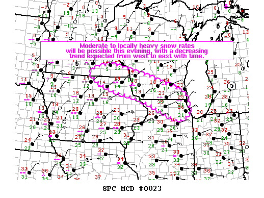
The SPC is watching the southern parts of our area for a intensifying snow band to produce more like 1" rates of snow per hour. The snow areawide should pick up by midnight. At this point there are no real changes to the going forecast!
5 PM Update:
Light to moderate snow continues to fall across the area. Look out to the west and you will see more intense radar returns. This indicates heavier snowfall that will move east by midnight.
The heaviest of the snow will fall between 10 pm and 4 am across southeastern Wisconsin!
One change...Fond du Lac has been added to the advisory. Everything else remains the same.
______________________________________________________________________________________________________________
3 PM Update
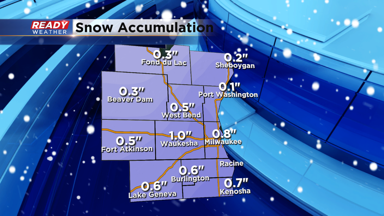
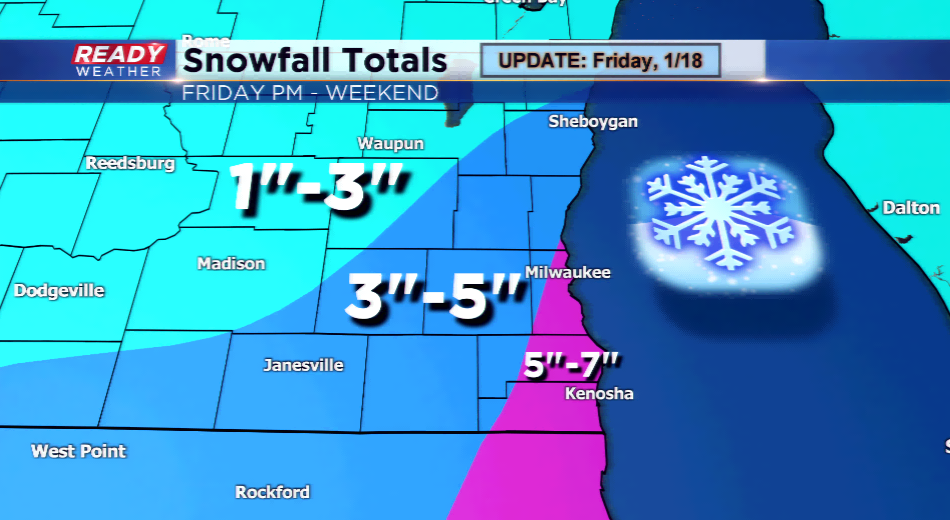
No changes with the timing of the snow. We still expect it to arrive between 3 PM and 6 PM. Here's a breakdown of the snow accumulation. A lake effect band is possible for most of Saturday. That band would likely impact eastern parts of Milwaukee, Kenosha, and Racine counties. If it doesn't move several more inches could fall within the band.
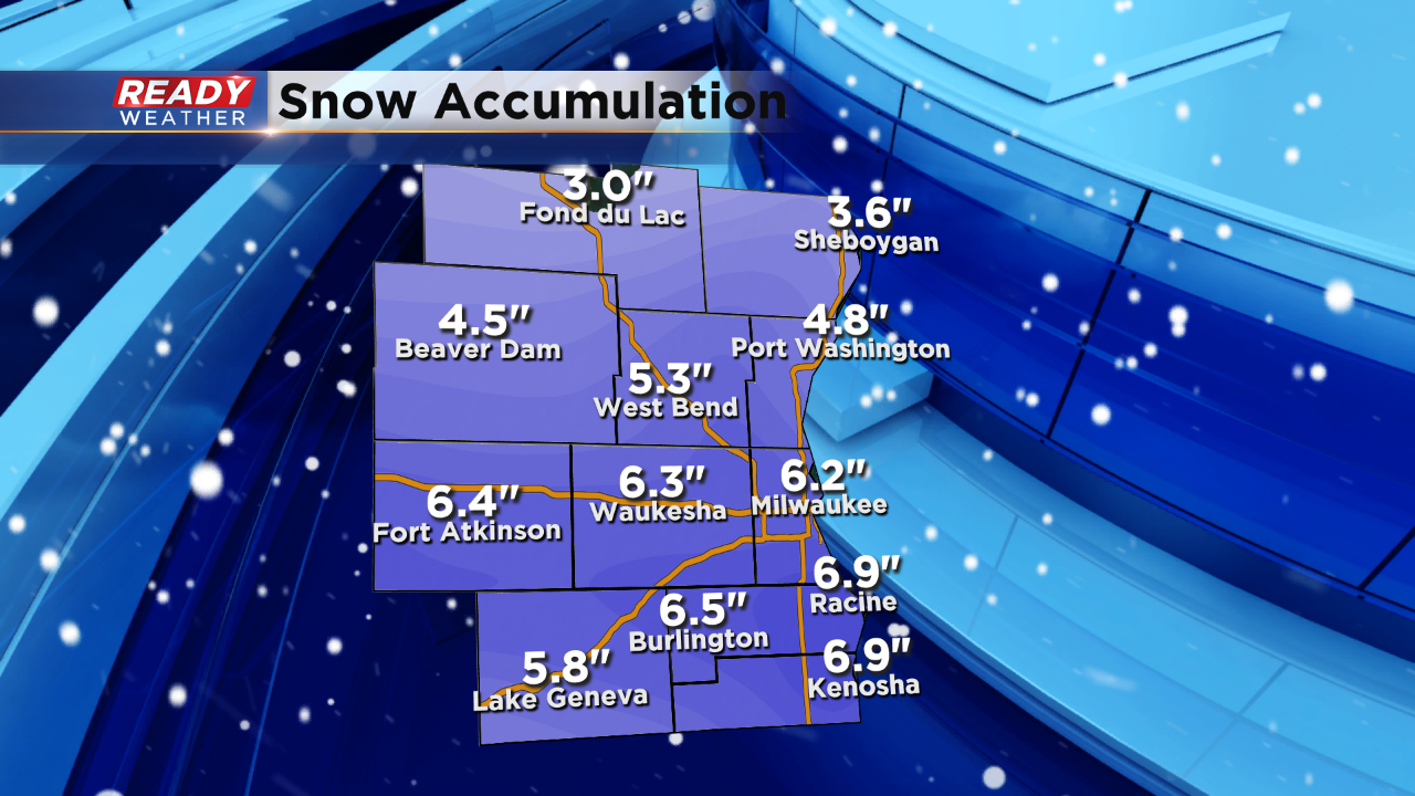
This is a fairly good representation of the snowfall totals from north to south. Racine and Kenosha have the highest chances of being over 7 inches!
______________________________________________________________________________________________________________
1 PM Update:
The NWS has extended the winter storm warnings into Jefferson county. Additional advisories in purple have been added as well. Dodge county was added from last night.
The snow will start to move in late this afternoon and into the evening. Temperatures in the 20s will allow snow to quickly accumulate and create slick conditions on the roads.
______________________________________________________________________________________________________________
A Winter Storm Warning is in effect for the metro starting at 6 pm this evening until noon Saturday. It includes Milwaukee, Waukesha, Walworth, Racine, and Kenosha Counties. Snowfall totals in these areas could range between 4”-7”. Also, a Winter Weather Advisory has been posted for Jefferson, Washington, Ozaukee, and Sheboygan – expect a little less for snowfall between 1” and as high as 5” near the lakefront in these areas.
Snow will spread across the area from west to east around a strengthening area of low pressure today. This storm could bring gusty winds, slick conditions, heavy snowfall, and on the backside of the storm, lake effect snow and cold. The wildcard in this system will be the lake effect, which could send those totals higher. Anyone considering traveling over the next 24-36 hours will expect deteriorating conditions and nasty roads. Gusty winds invade the area by daybreak tomorrow, and this will usher in a chance for blowing and drifting.
Cold air is sent down from Canada as an Arctic blast will follow this storm. Lows will fall down near zero for Monday morning; highs will plummet into the teens on Sunday.