Heavy rain Monday transitions to light snow Tuesday morning
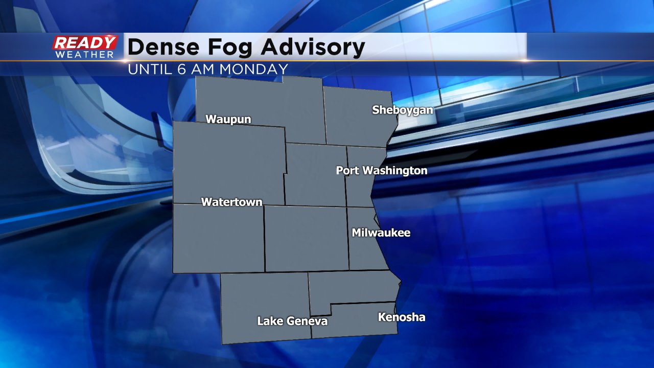
The gloominess of Sunday isn't going anywhere. Dense fog will continue to remain Sunday night and most of Monday. A dense fog advisory has been issued for all of southeast Wisconsin until 6 AM Monday morning. Visibility of a few hundred feet has been reported all across the viewing area.
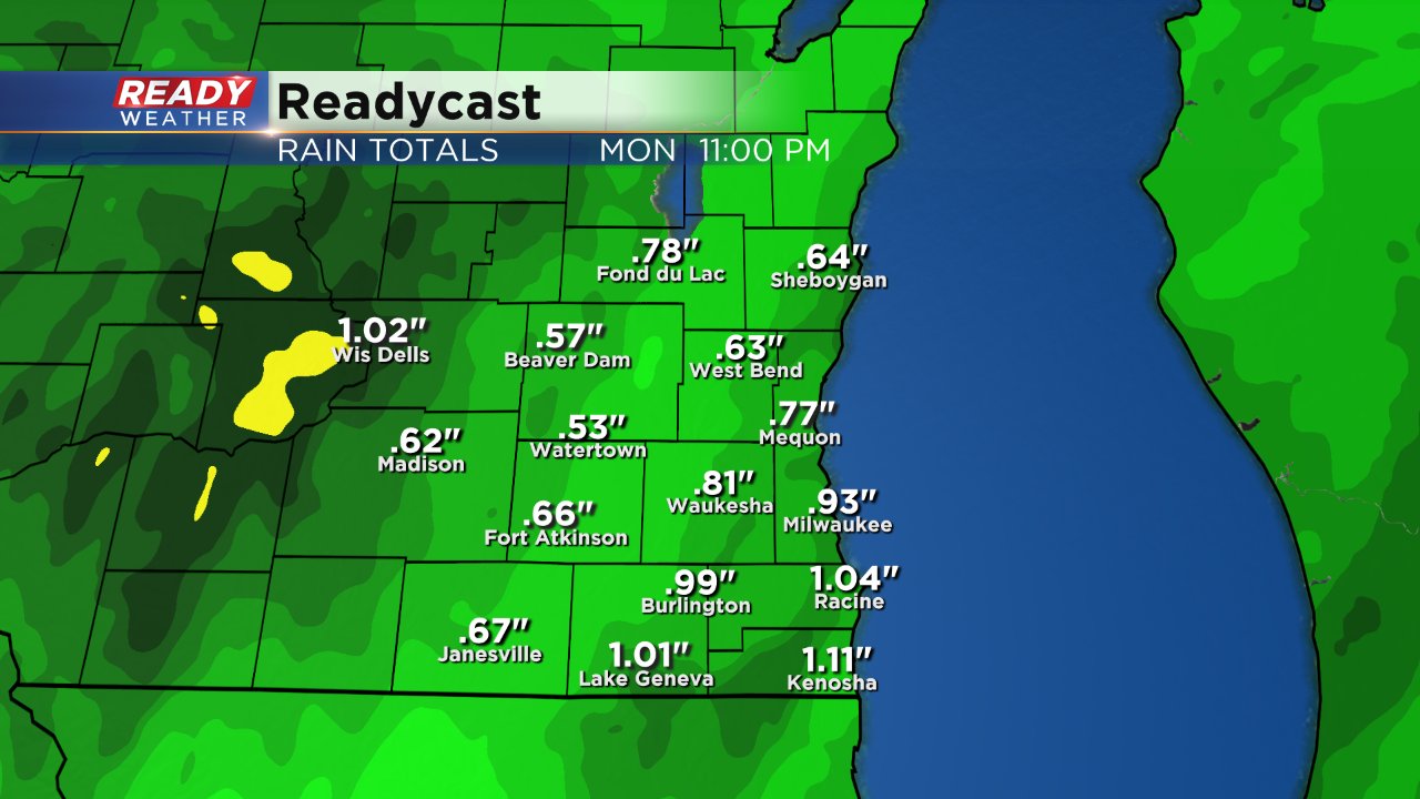
Drizzle and mist from Sunday will transition into rain showers Sunday evening with heavy rain arriving by Monday morning. The Monday morning commute will likely be wet with moderate to heavy rain falling at times. Although not likely, a few rumbles of thunder will be possible.
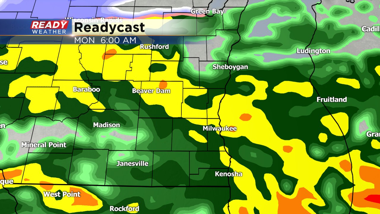
Rain becomes more scattered Monday afternoon and evening. By the time rain starts to transition to snow up to 1" of heavy rain will have fallen melting any remaining snow across the area.
Rain will transition to snow Monday night, mainly after midnight and last through Tuesday morning. The Tuesday morning commute could be slick with a wet snow falling across most of the area. A few inches of snow is expected locally with most picking up a half inch to 2" of snow.
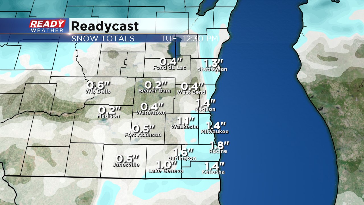
Snow totals will increase dramatically the farther north and west you go. Parts of Minnesota and northern Wisconsin could see over a foot of snow with a foot and a half not out of the question. Blizzard conditions are also expected in SW Minnesota.
Download the CBS 58 Ready Weather app to track the fog Sunday night, heavy rain on Monday and snow Tuesday morning.
